
becoming cosmopolitan citizen-architects
IV. Reimagining The Future Of Terrain Vague In A Former Military Base | Martyna Griffiths


---------------
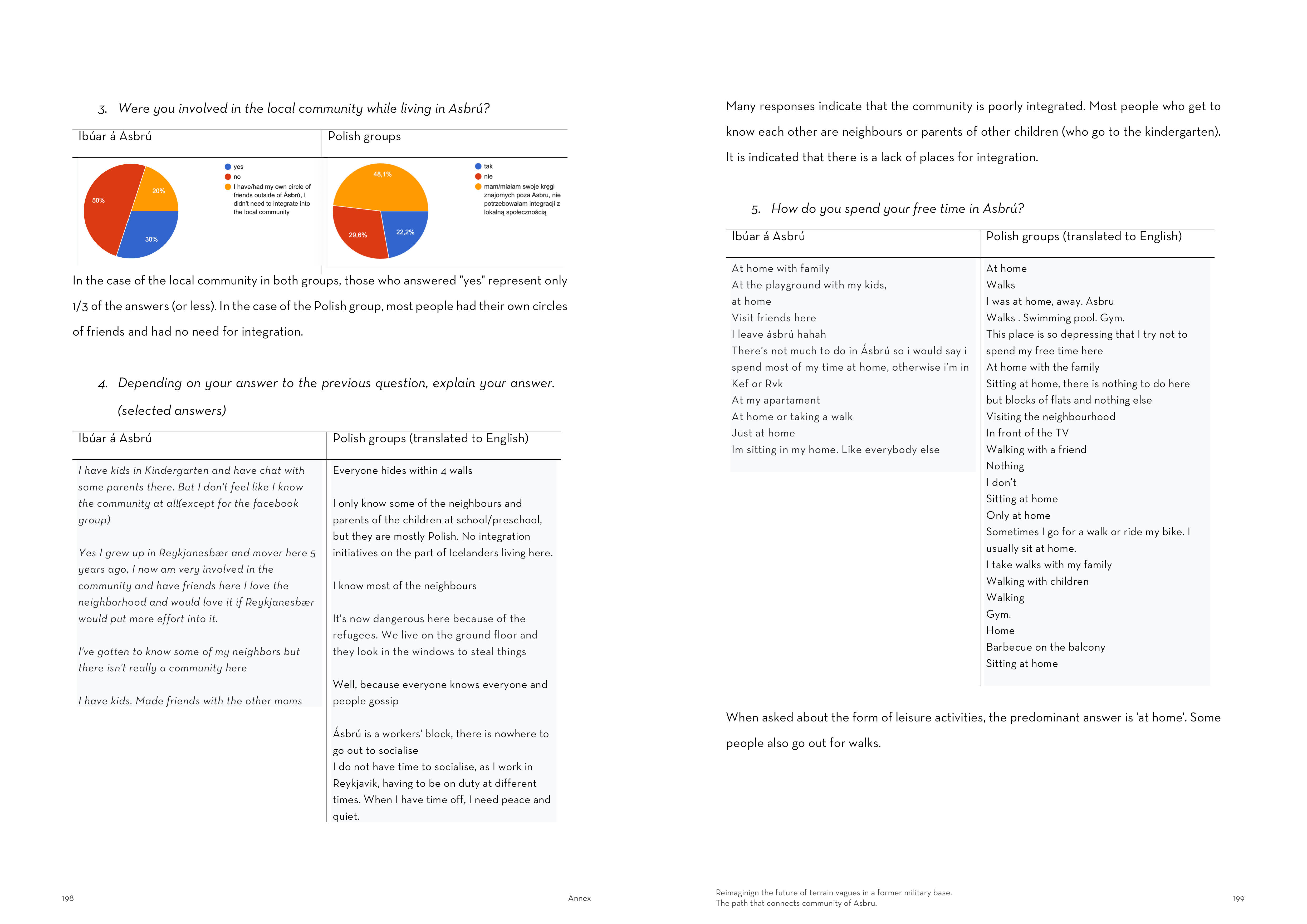
FALL SEMESTER


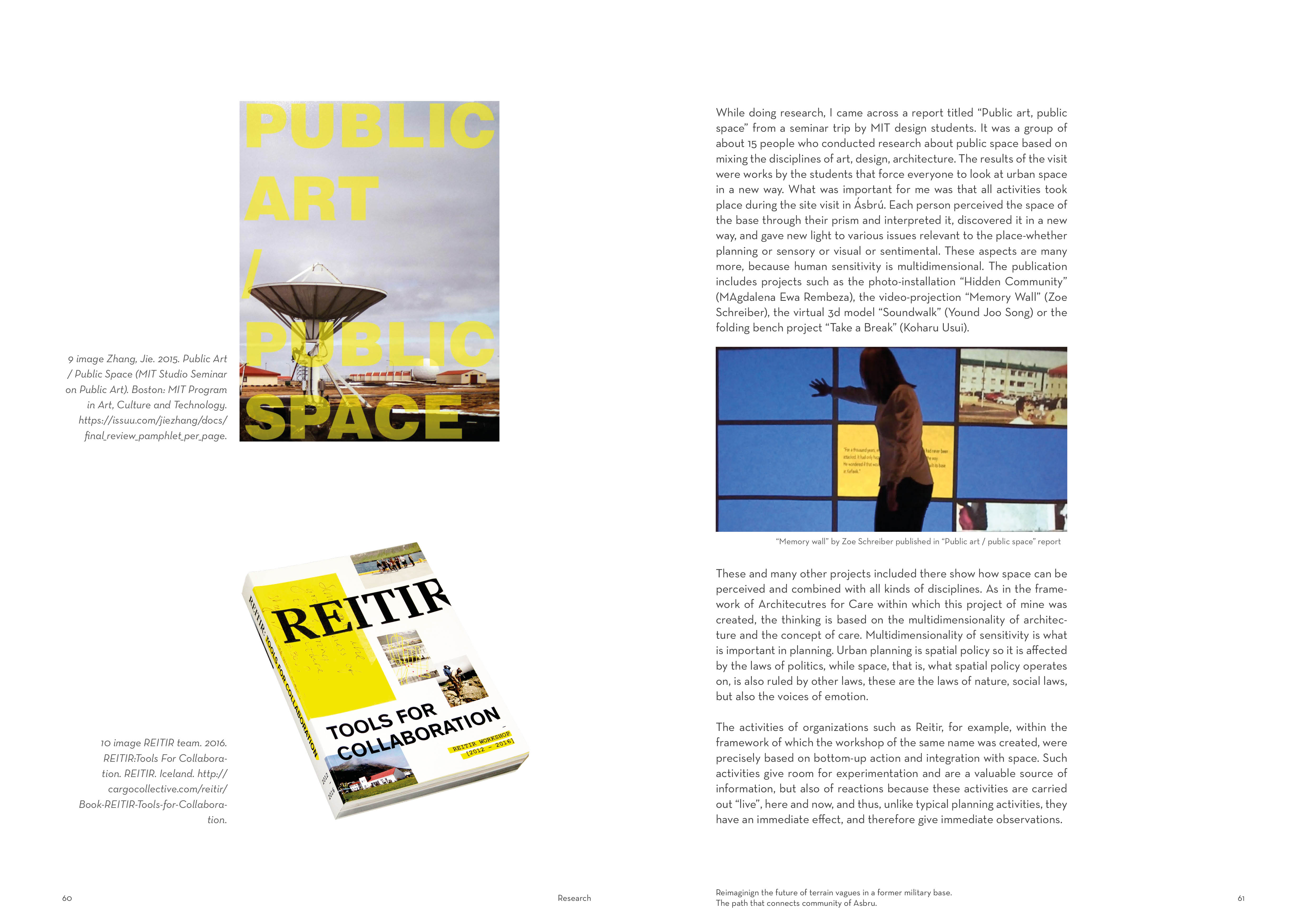
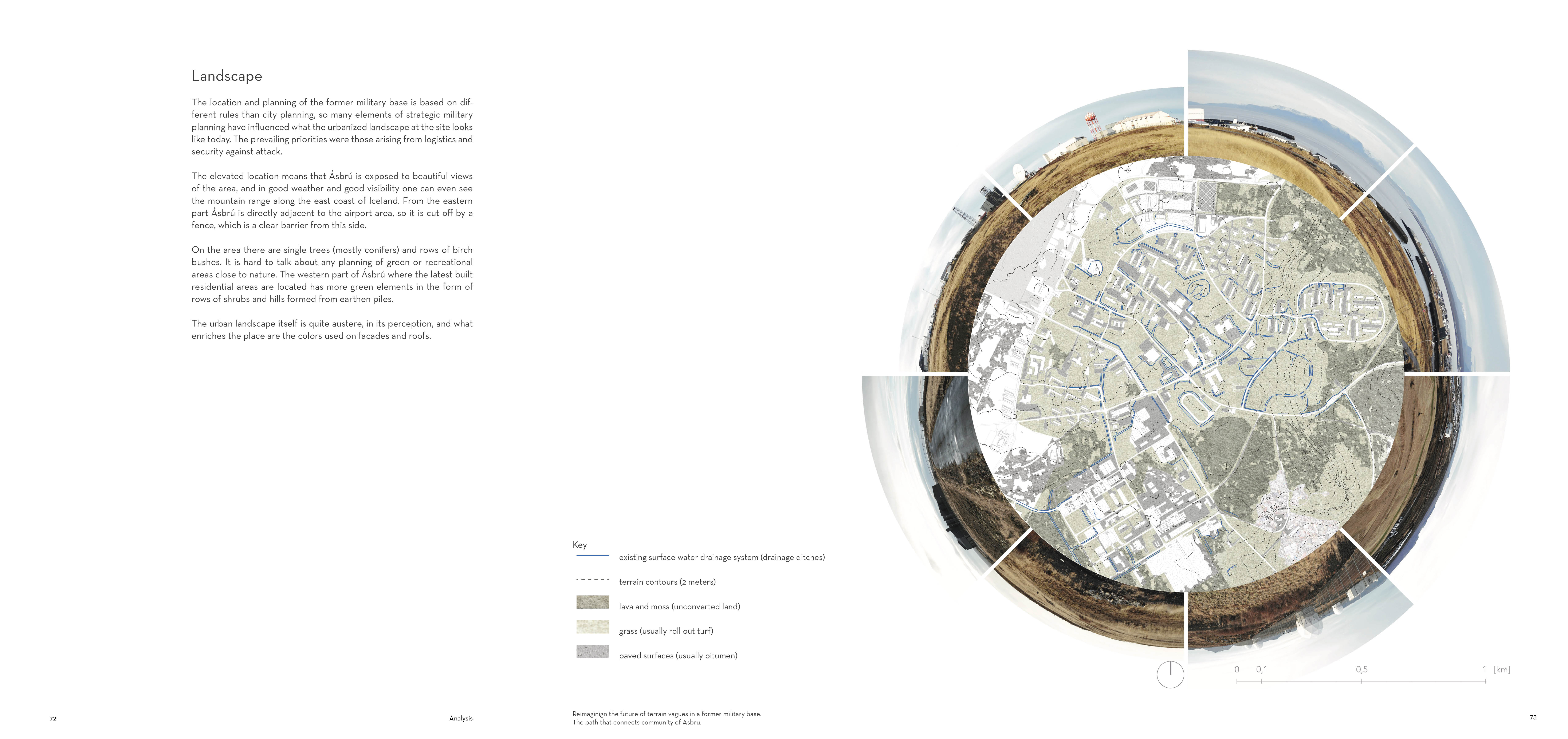
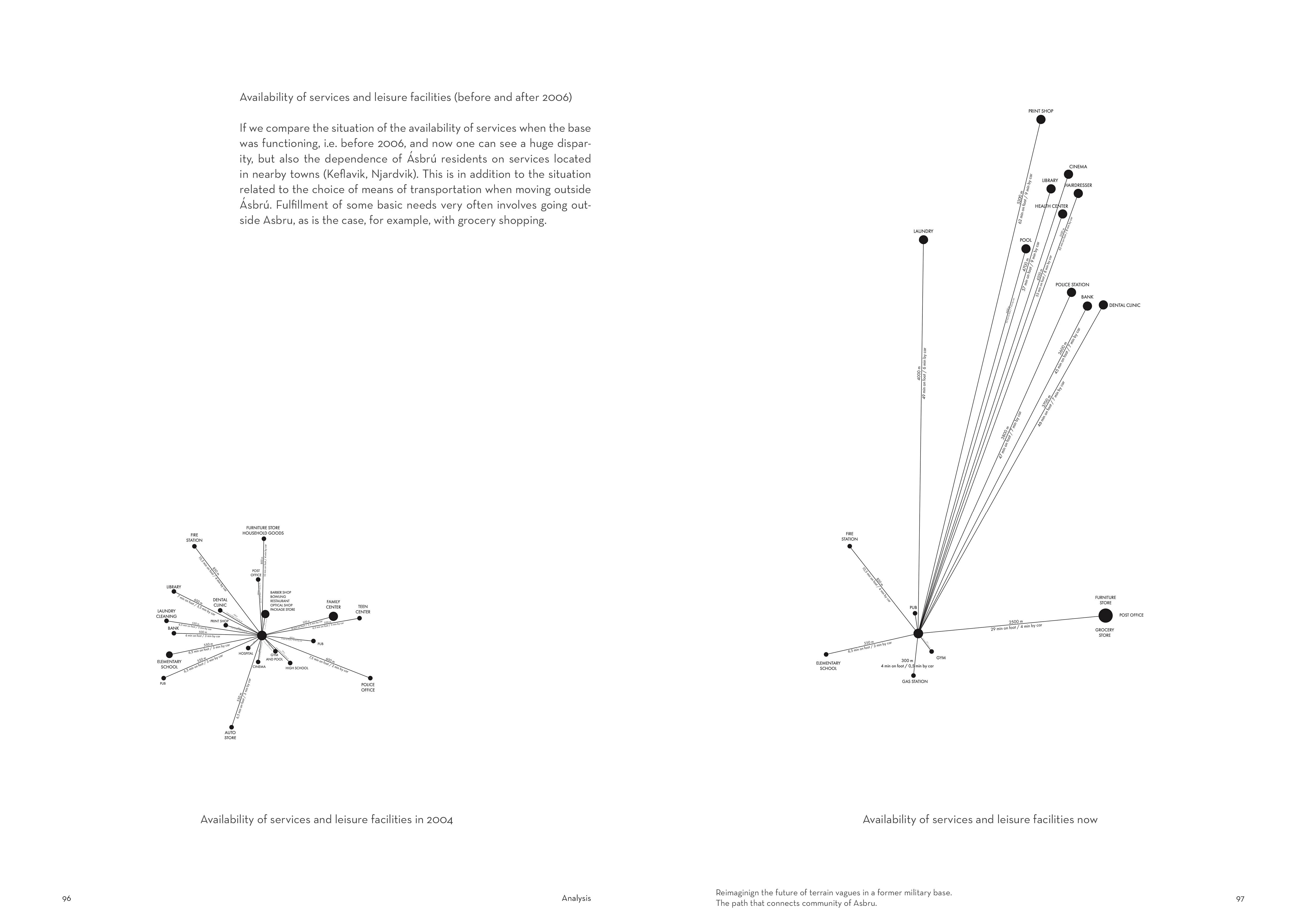
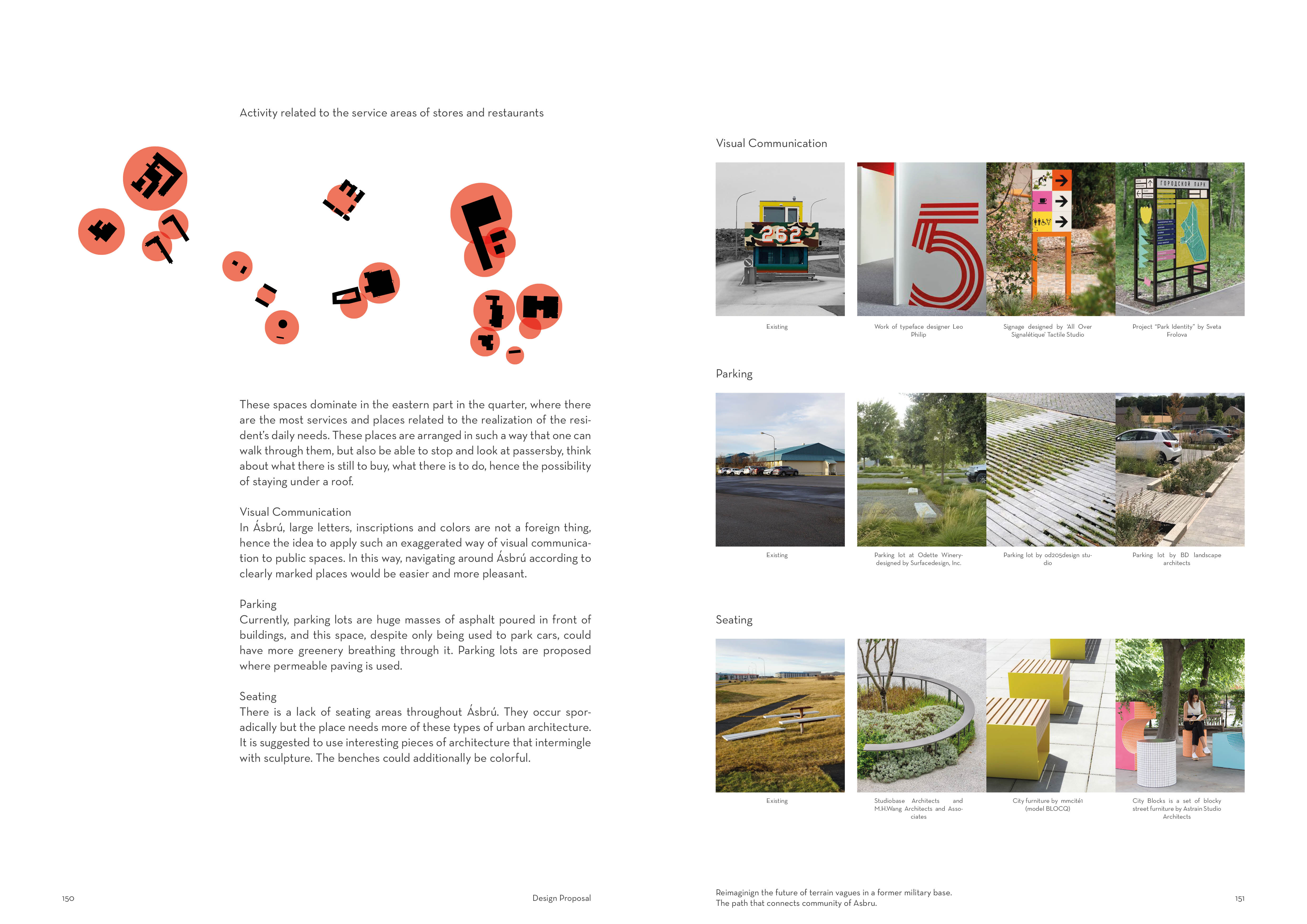
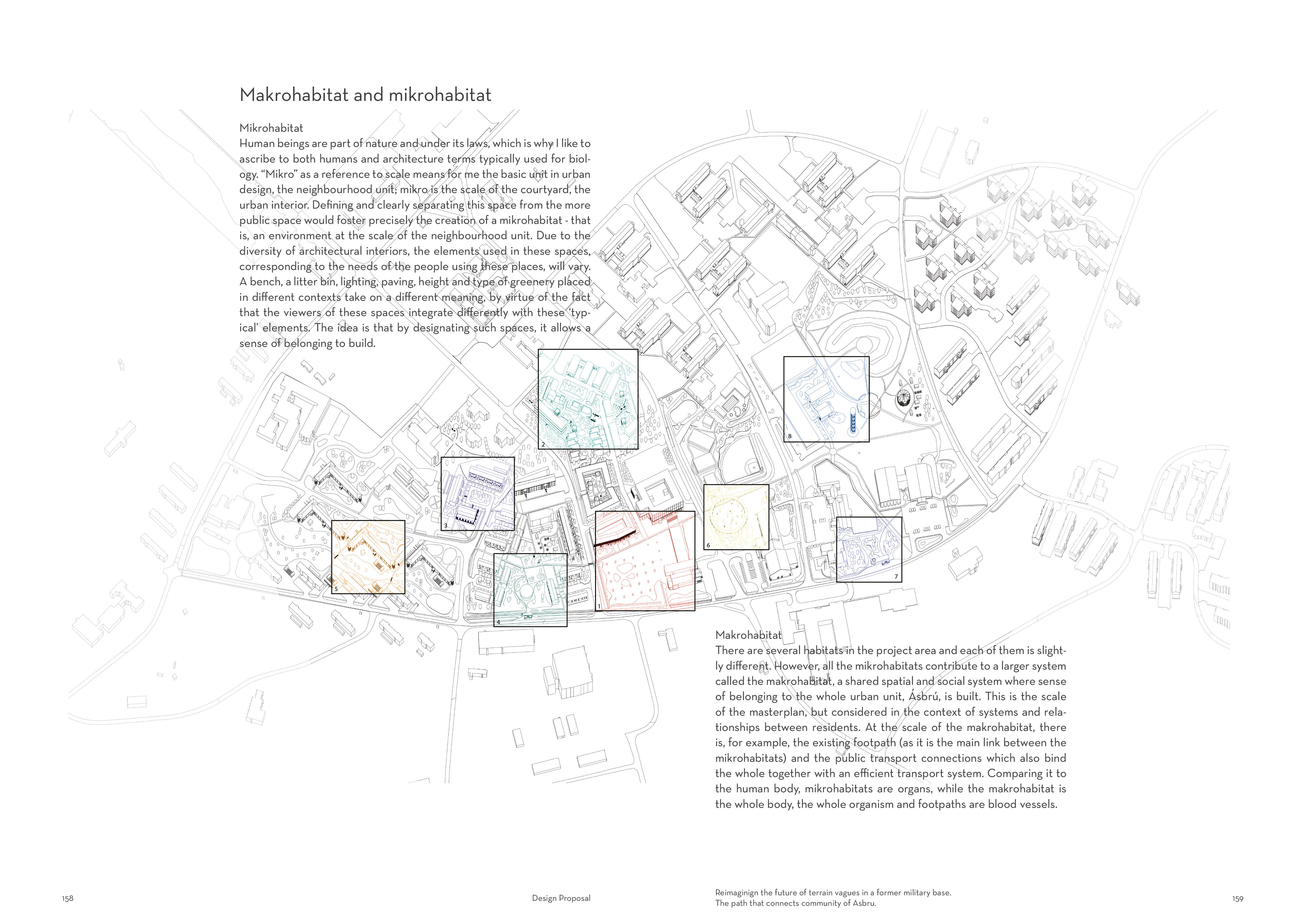
Introduction
My name is Martyna Griffiths and I’m currently an exchange student that had been accepted by the LHI to finish my MA diploma in Iceland. I’ve finished my BA in Poland and the moment I made this achievement I faced myself in truth and found that after these 4 years of architectural education I could consciously say "I know what I don't know". So, this is where my journey with architecture really began, and now I'm in Iceland, and I'm truly amazed at what the country is with its nature, but also how many possibilities there are with what's already there.

Some time ago I came across this sketch which was made by the 3-year-old son of two artists from Poland. This sketch became my manifesto of architecture. I strongly believe that what we create and build are not just walls and ceilings, they are life-giving or life-resistant structures. I believe that every person, while living, organizes their environment. By taking away their basic rights and deciding how they live without being sensitive and listening to them, we become resistant to basic needs for expression and take away people's awareness and ability to create their spaces. Architecture is about people, not buildings.
The beginning...
During the first weeks of a collective research I was observing the area of Reykjanes peninsula through my emotions and senses. I’ve never been here so I was and still am like a sponge, I take everything in.
I believe that becomein a cosmopolitan citizen architect is among other things, trust in intuition and that it, combined with a search for the good, supported by critical thinking can lead to places where the tools provided by architecture can make the world a better place in a small way.
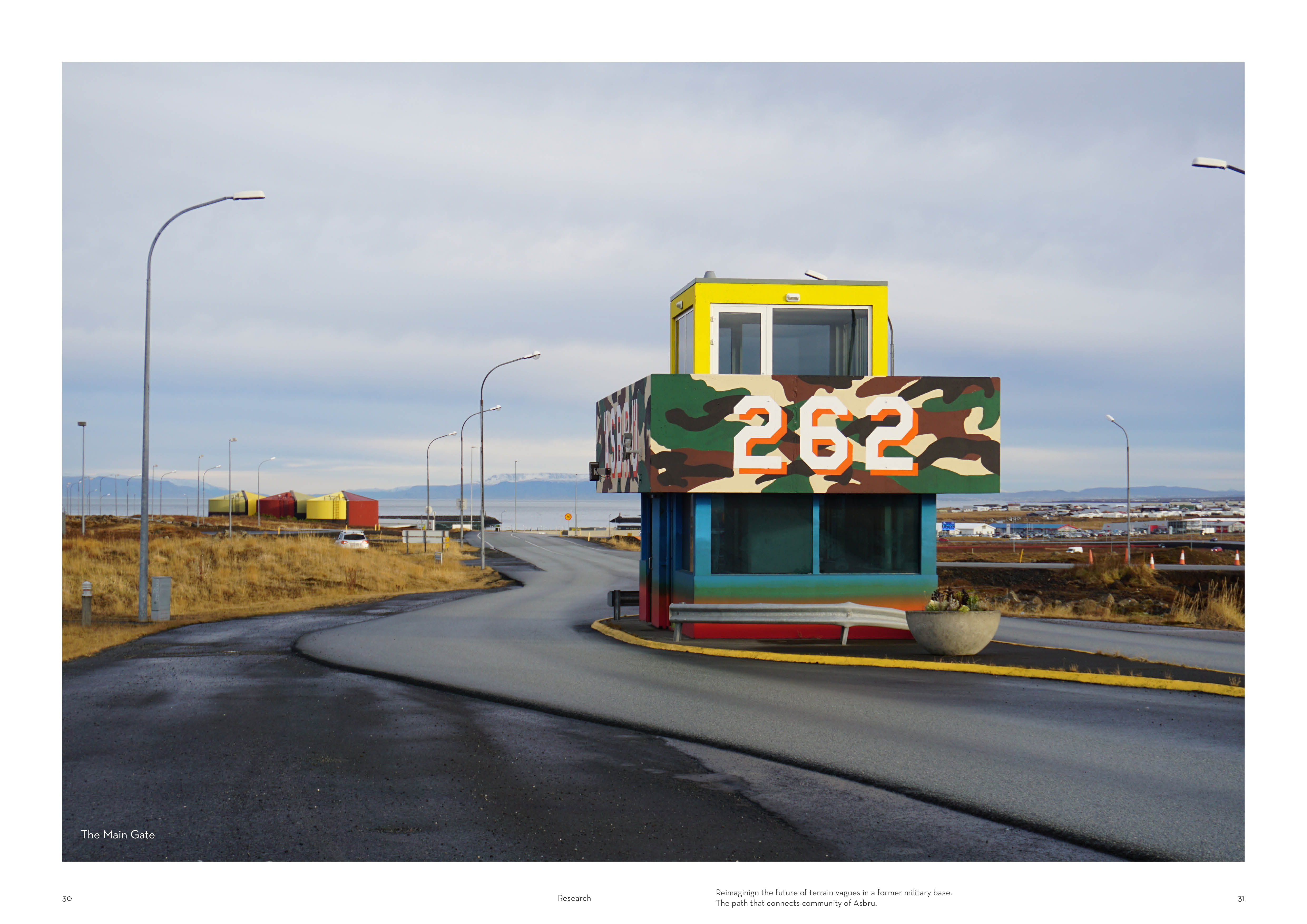
Ásbrú caught my attention, I noticed that there was a lot of potential there, I didn't really know what the place is or was. However, I knew it could be a starting point for my research.
I decided to investigate more and find out what the problem might be based on four Matters of care that resulted from the collective research.
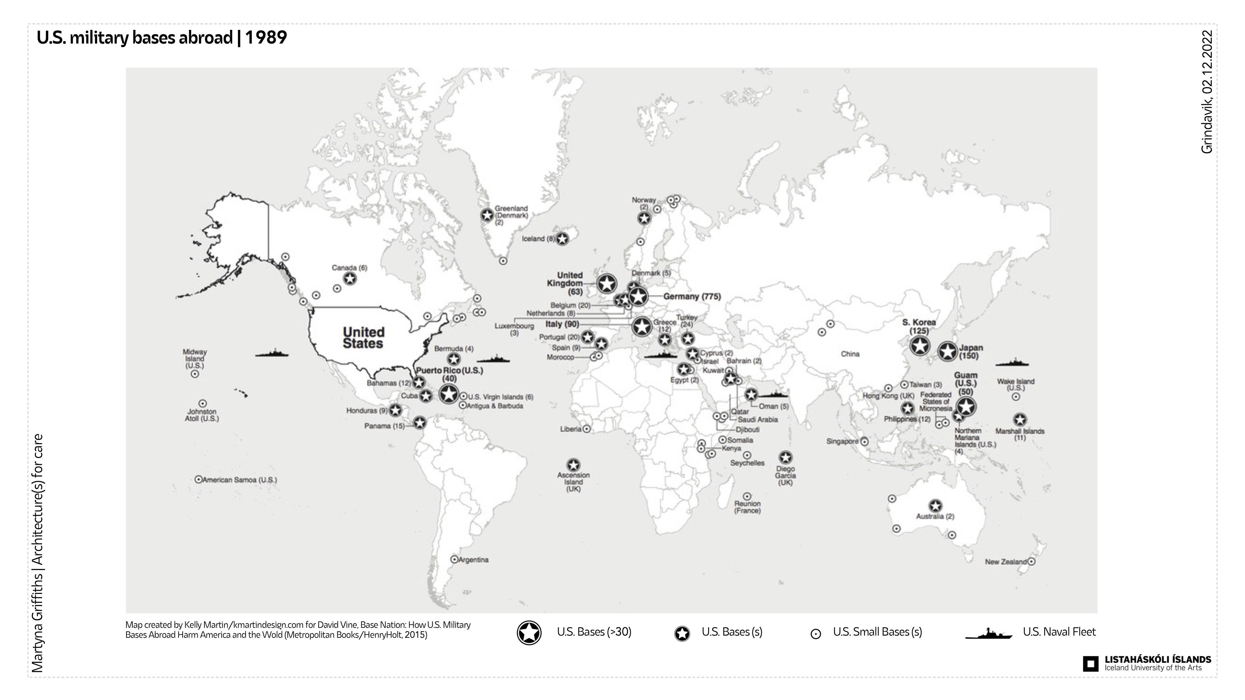
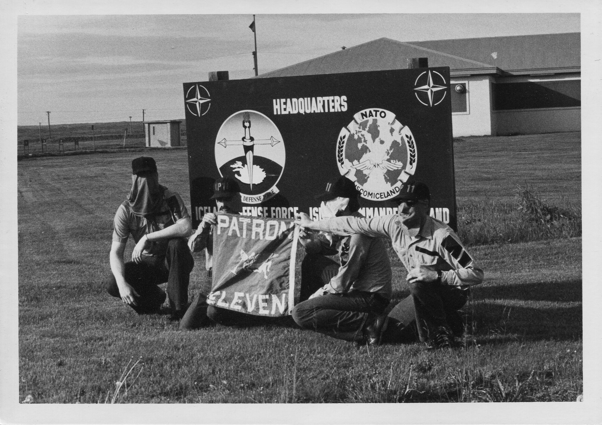
U.S. military bases
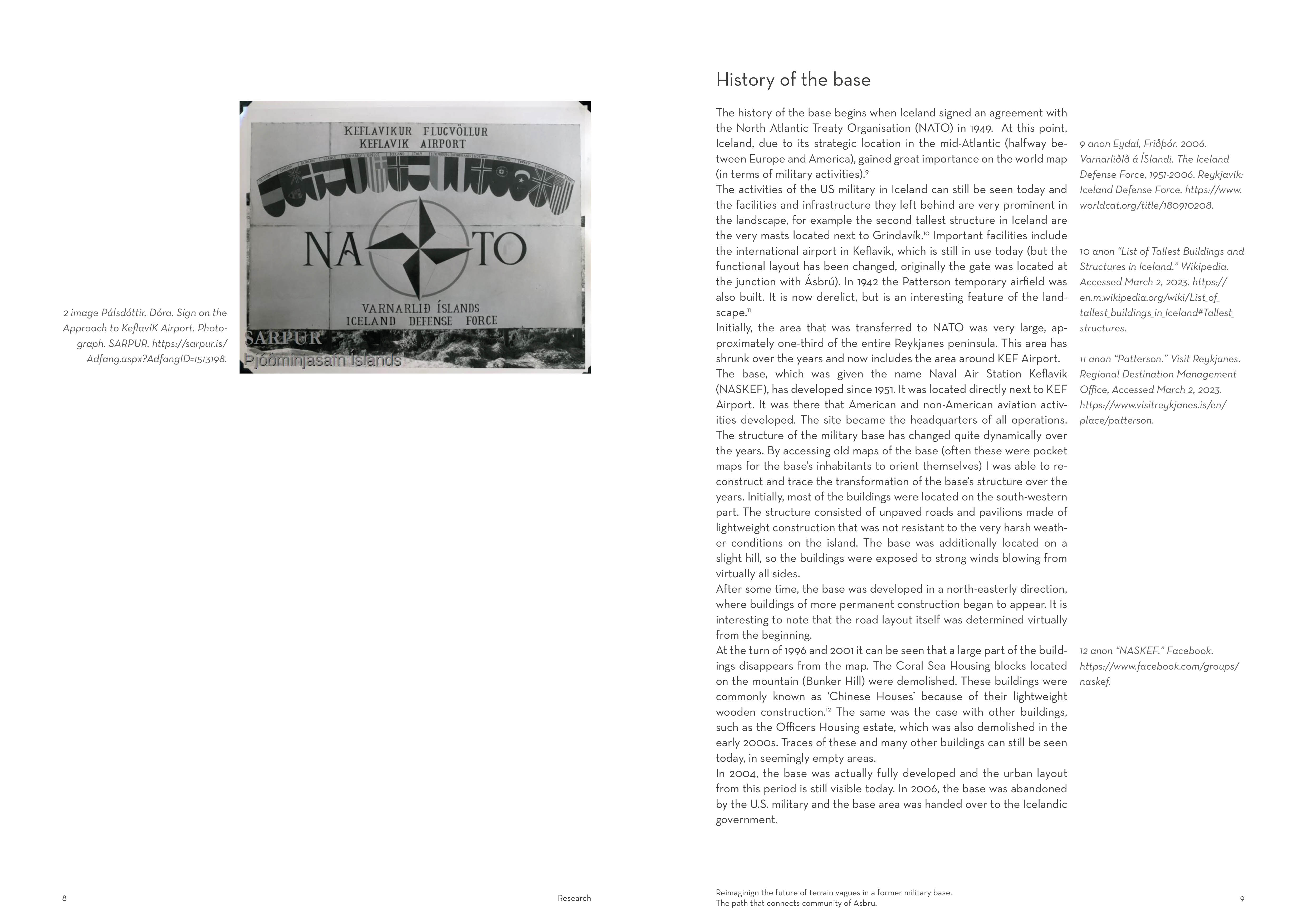
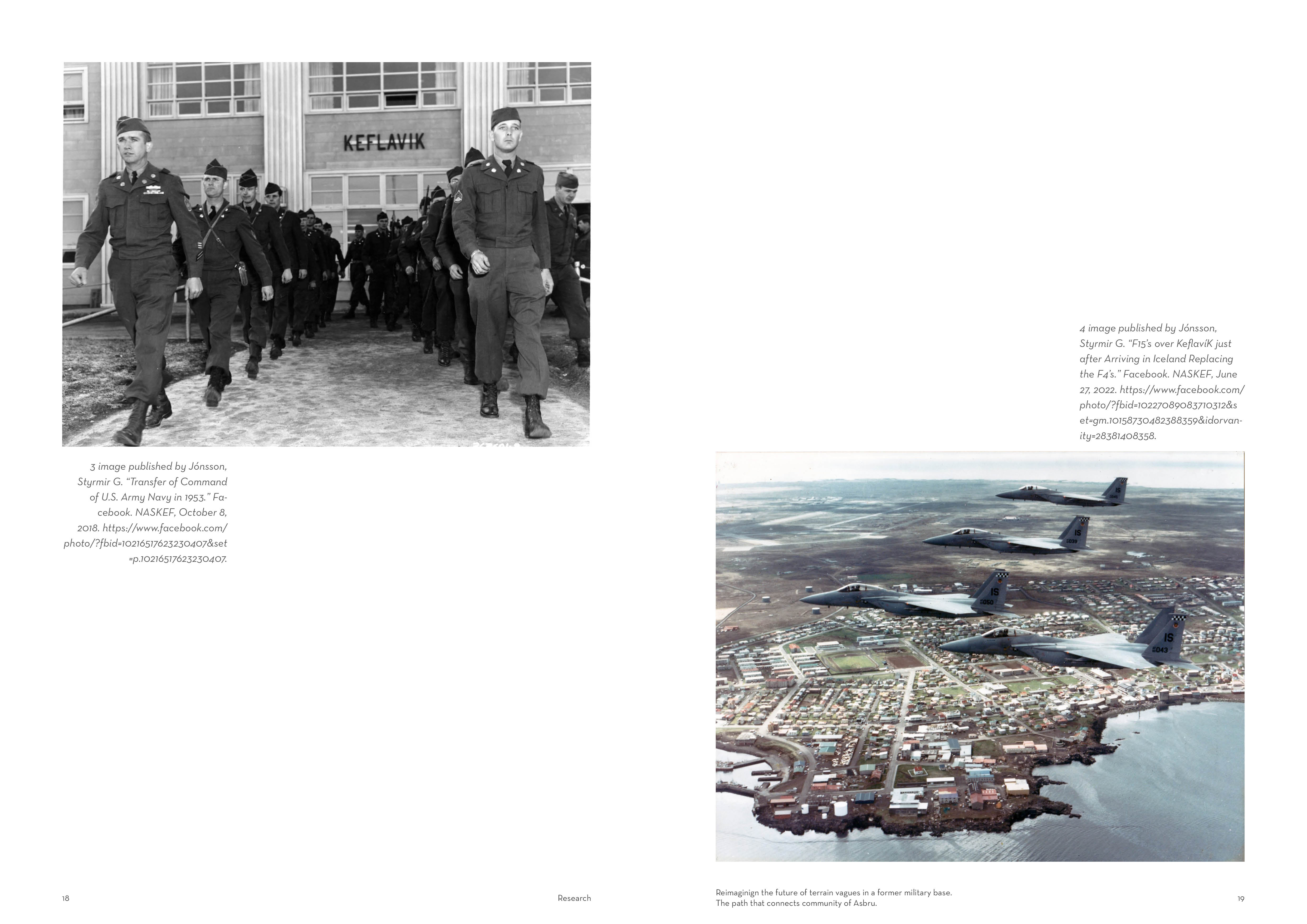
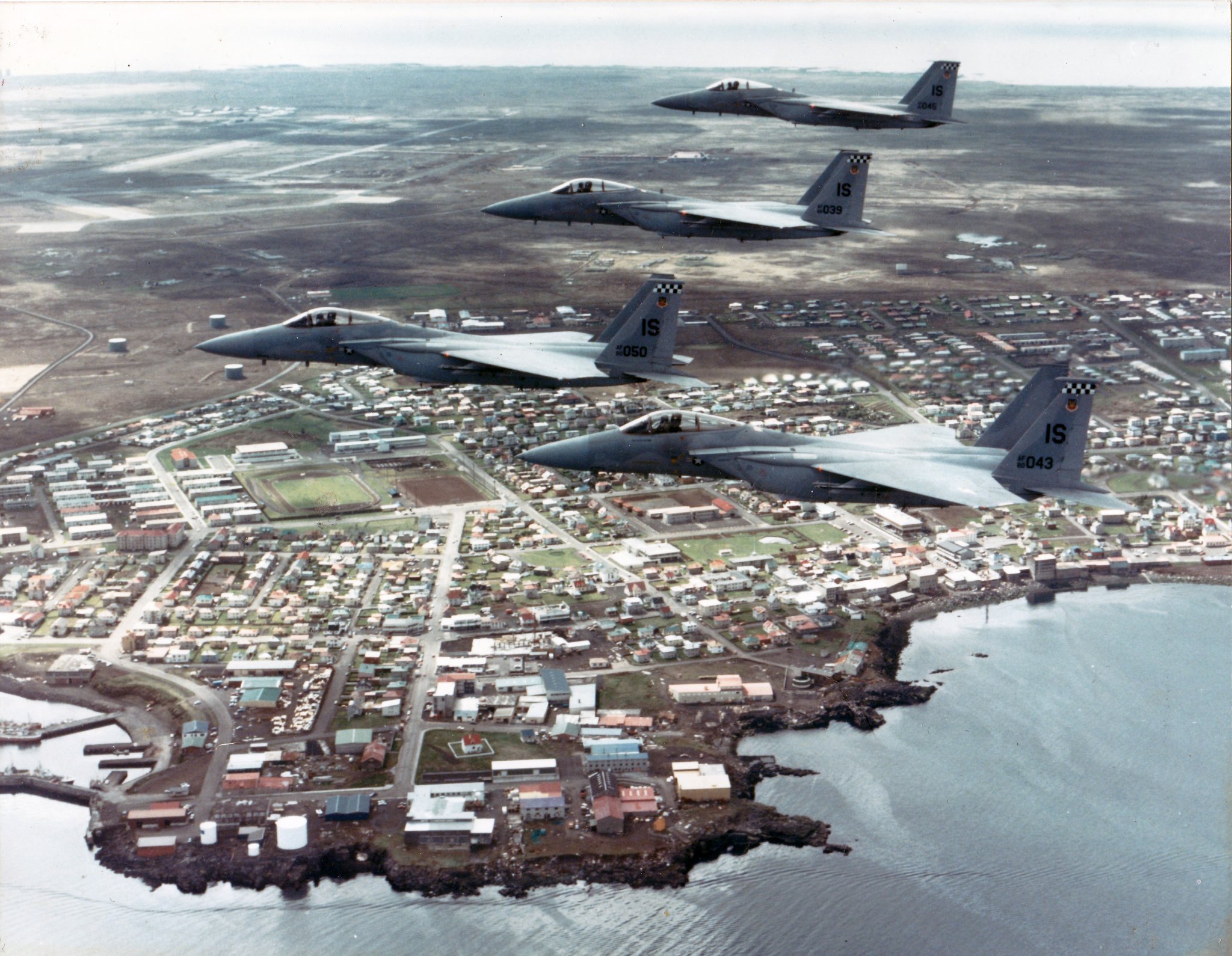
The history of Asbru, or rather Naval Air Station Keflavik (or NASKEF in short) dates back to when the world was absorbed in conflit in the 1940s. Iceland played an important role in both the Second World War and the Cold War period because of the strategic location in the North Atlantic.
In 1946 it was decided to terminate the United State’s responsibility for the defense of Iceland, but with the right for the United States to maintain Keflavik International Airport as an air transit base in support of occupational forces in Europe. In 1949 Iceland became a charter member of NATO.
A year later the following unstable international political situation the US and Iceland agreed that the defence of Iceland came under the auspices of NATO. The returning US military forces were named the Iceland Defense Force. Over the next five decades, until 2006, the Defense Force played an important and significant role in the security of the North Atlantic.

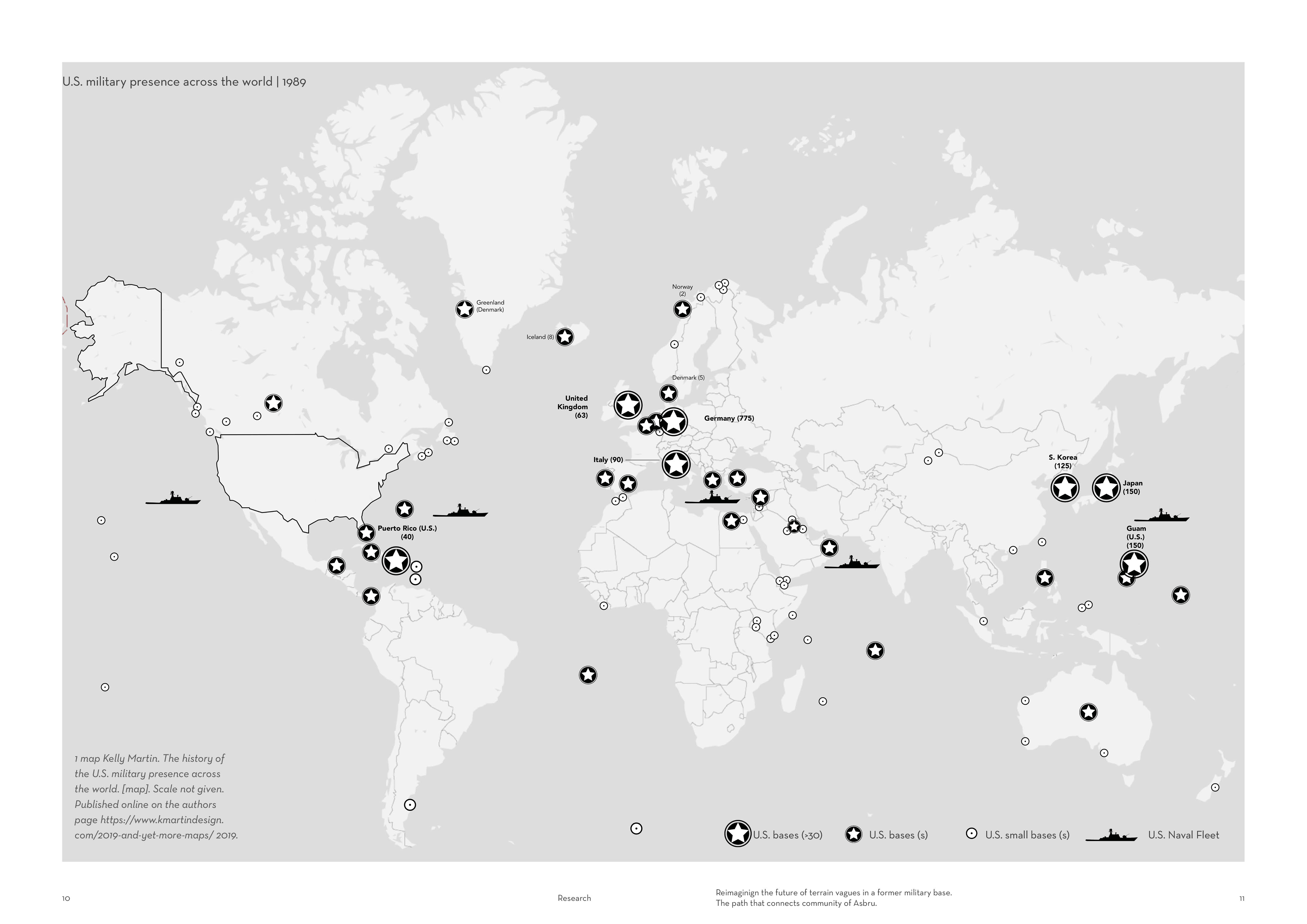
Remnants of WWII bases can be found in Iceland, but those created as part of Iceland's cooperation with NATO often stand out most prominently in the landscape, e.g. one of the masts near Grindavik measures more than 300 meters and ranks as the second tallest structure in the entire country. This shows that traces of U.S. military activity are distinctive in shaping Iceland's landscape.
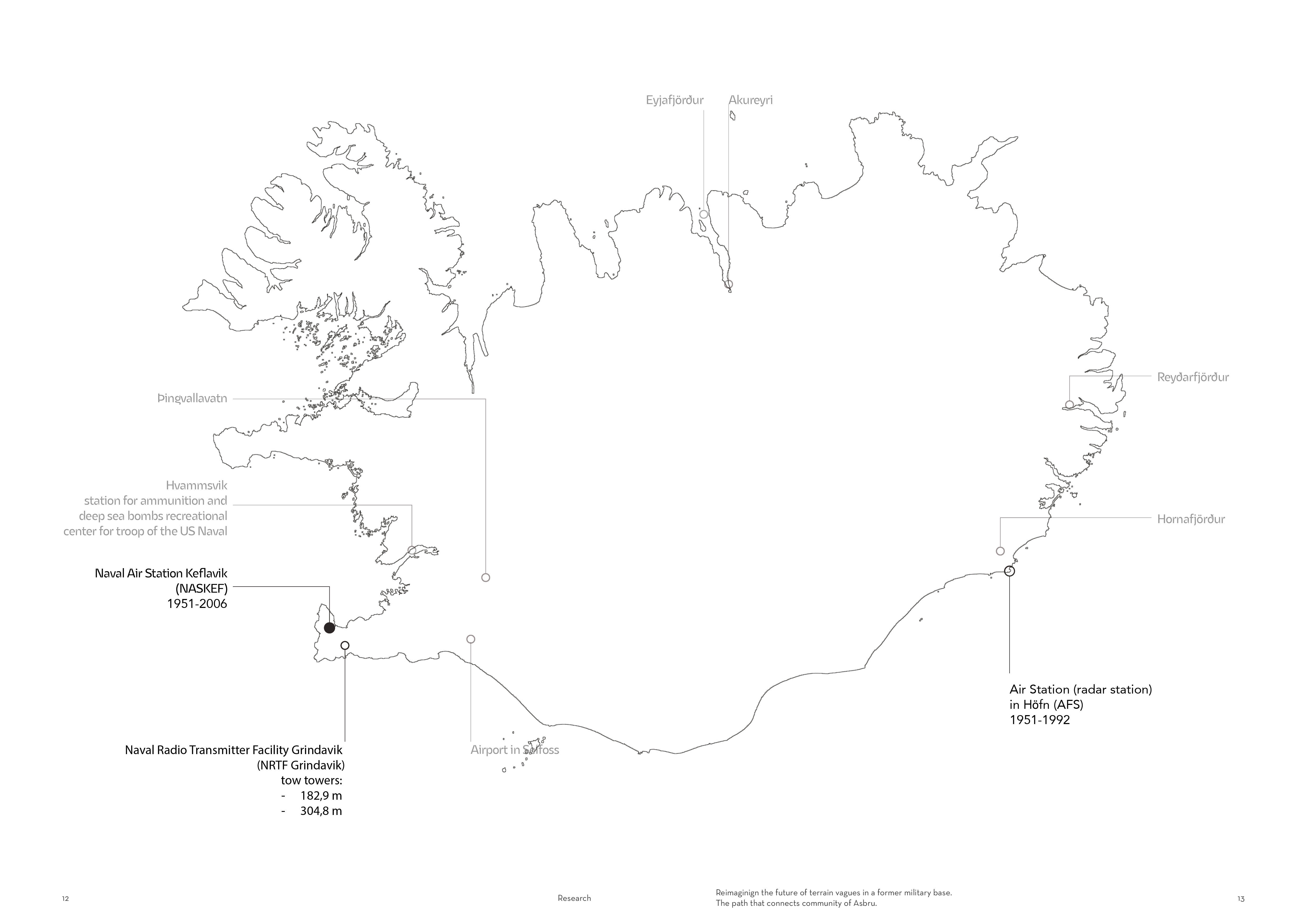
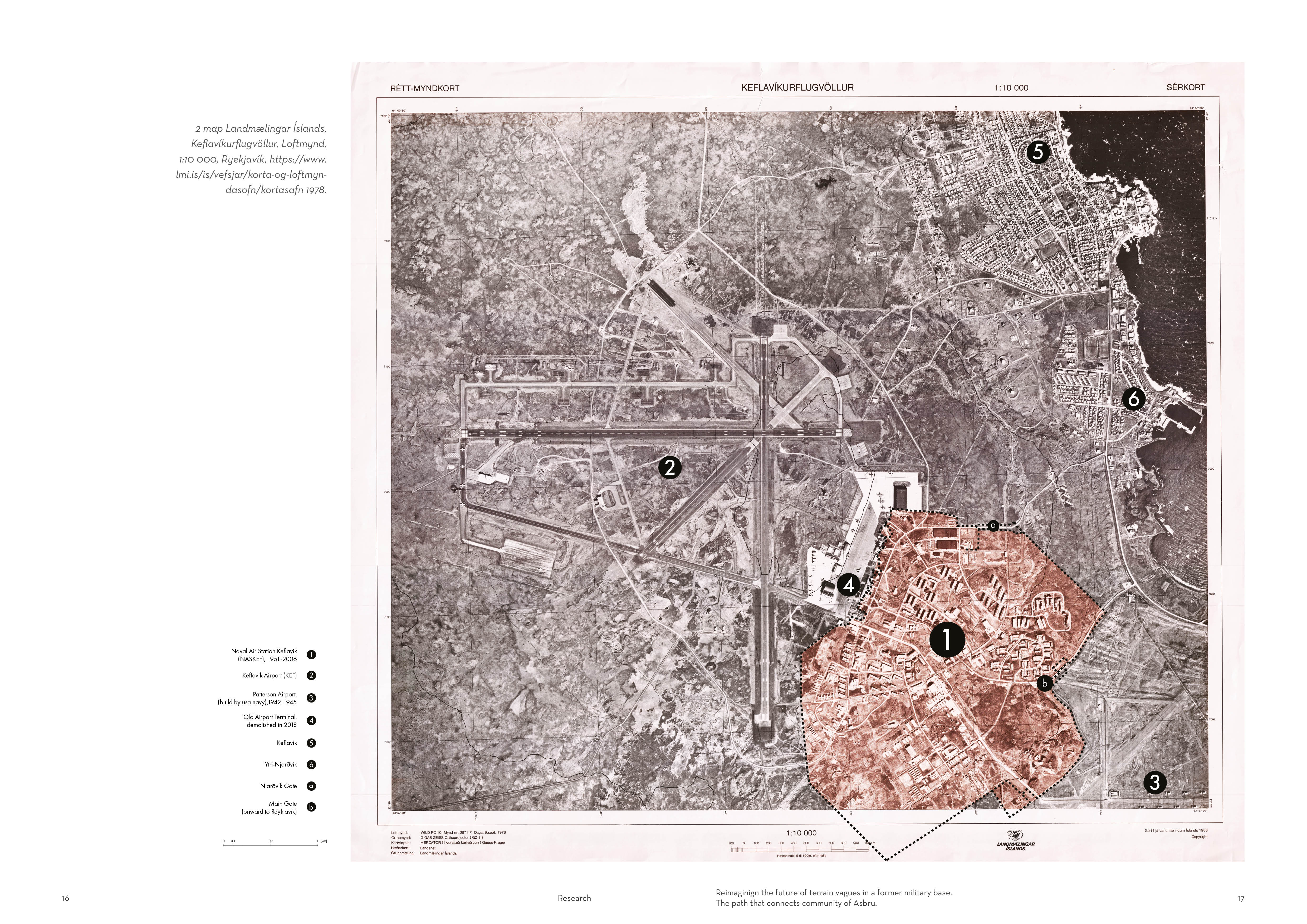
The main base was located on the Reykjanes peninsula and since 1951 for over the next five decades, until 2006, the Defense Force played an important and significant role in the security of the North Atlantic.
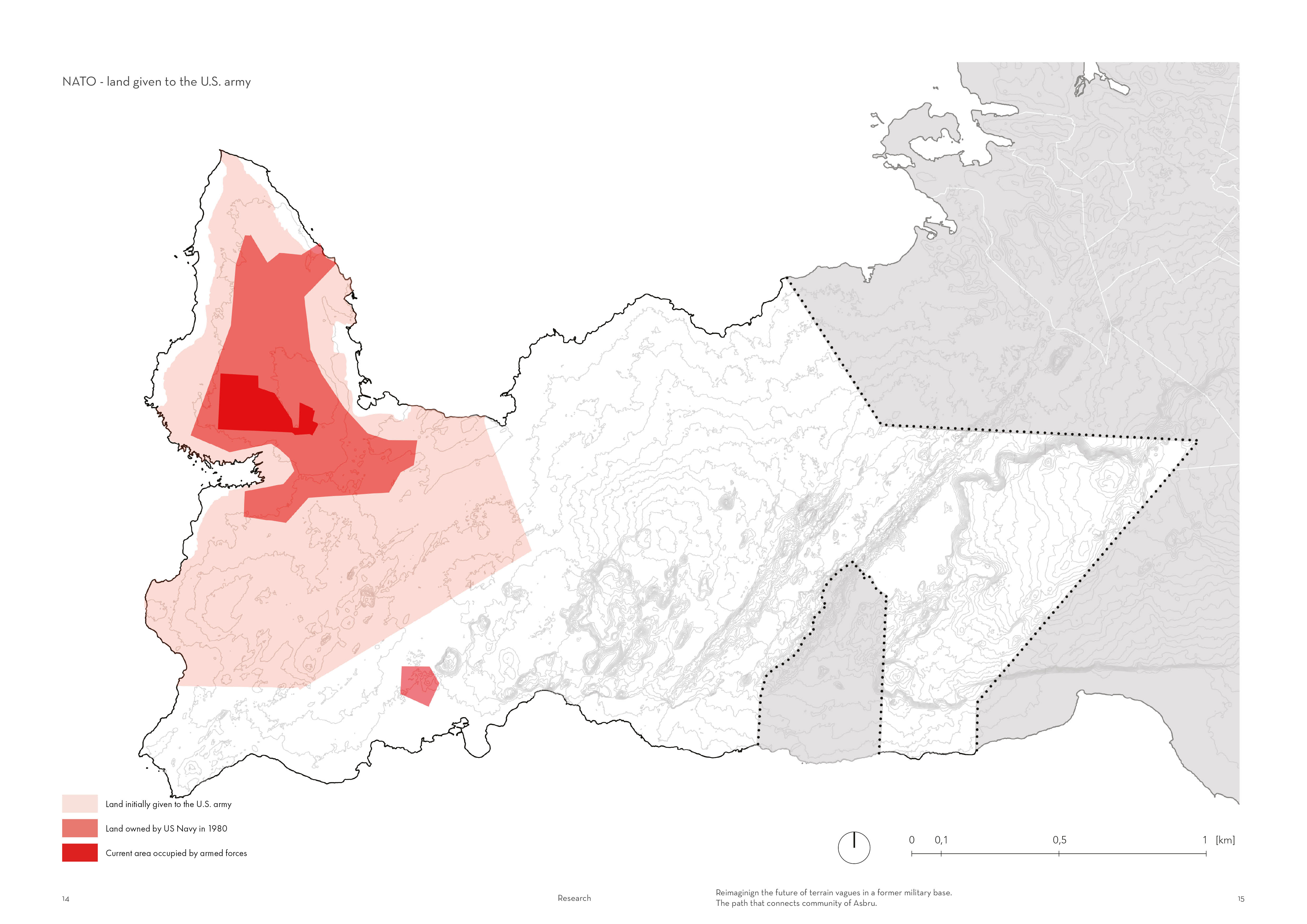
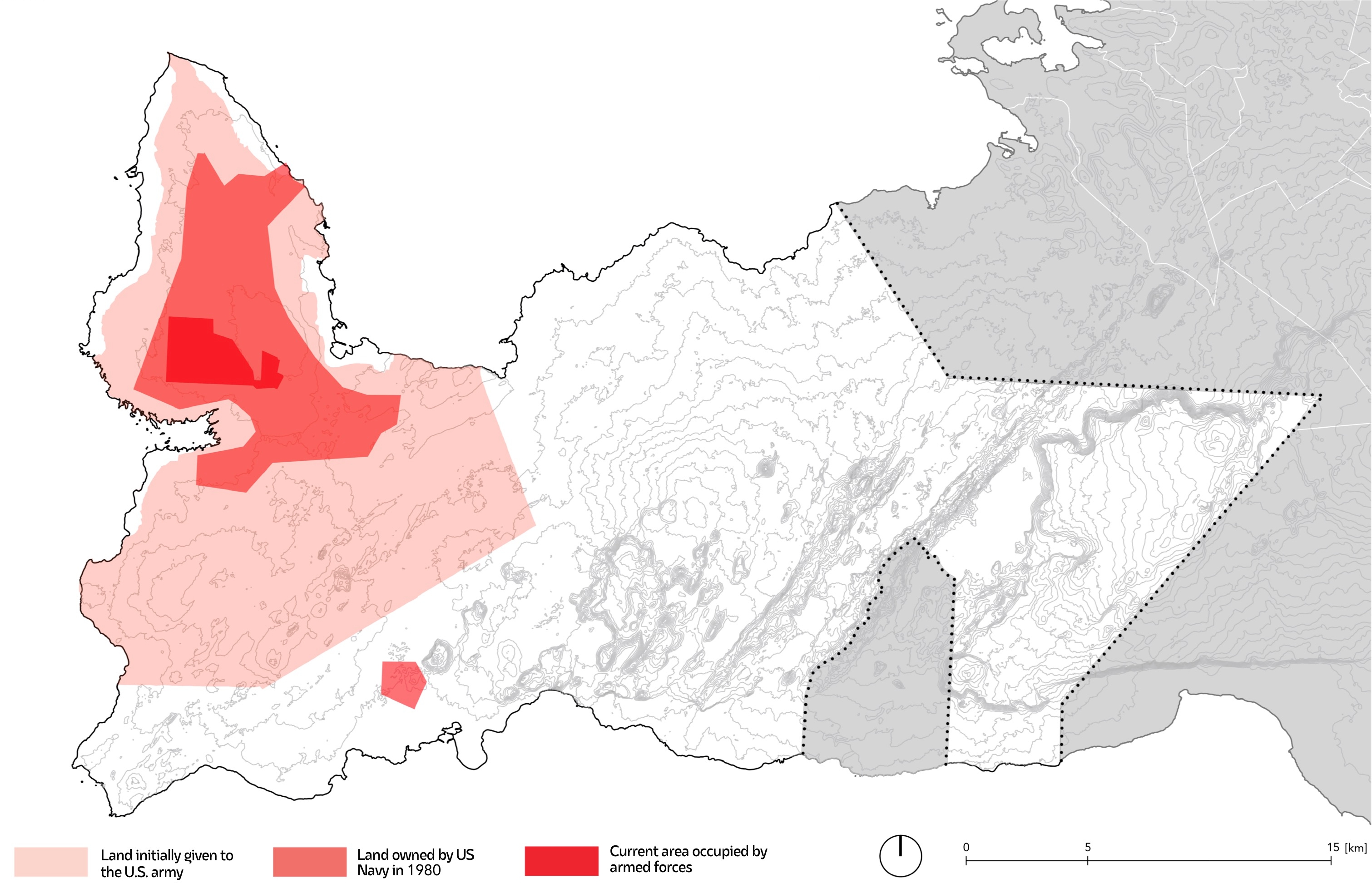
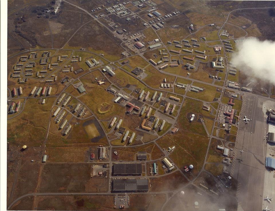
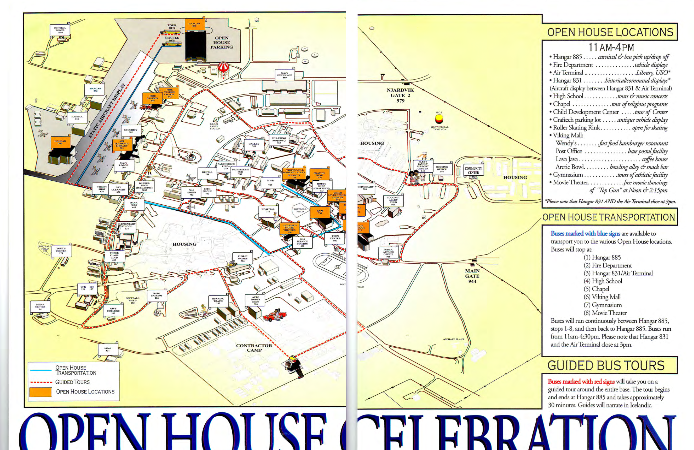
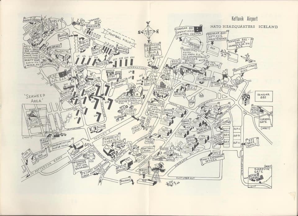
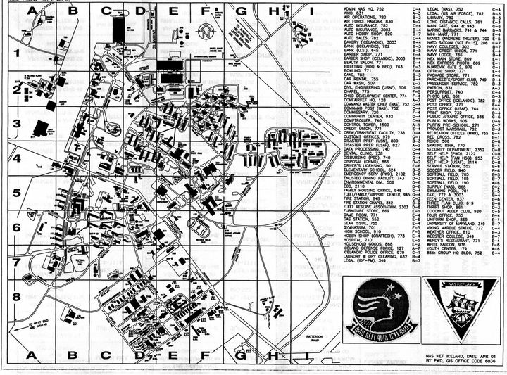
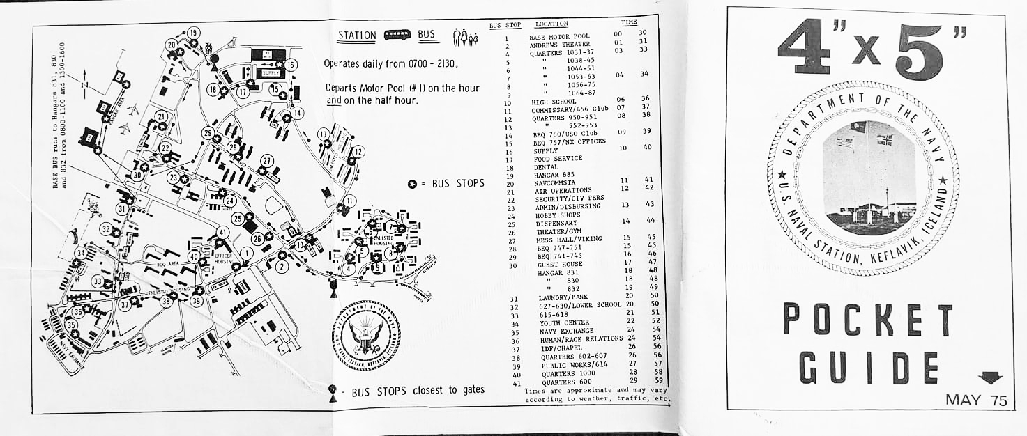
Here you can see how much space has been given to the U.S. army. Initially, more than a quarter of the peninsula was given away. Over time, the terriory of the base has shrunk, and now only the Keflavik airport area remains under control.
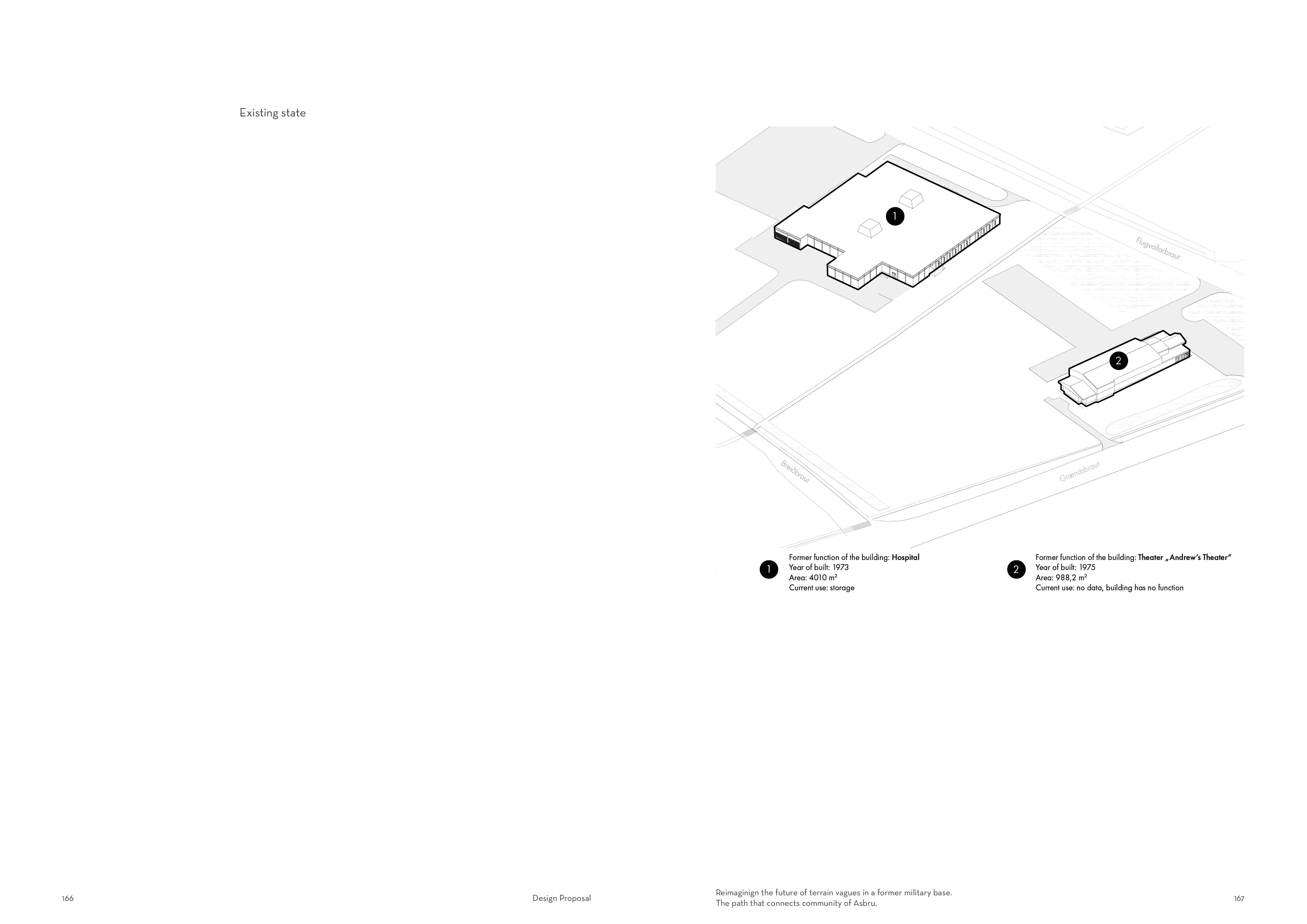
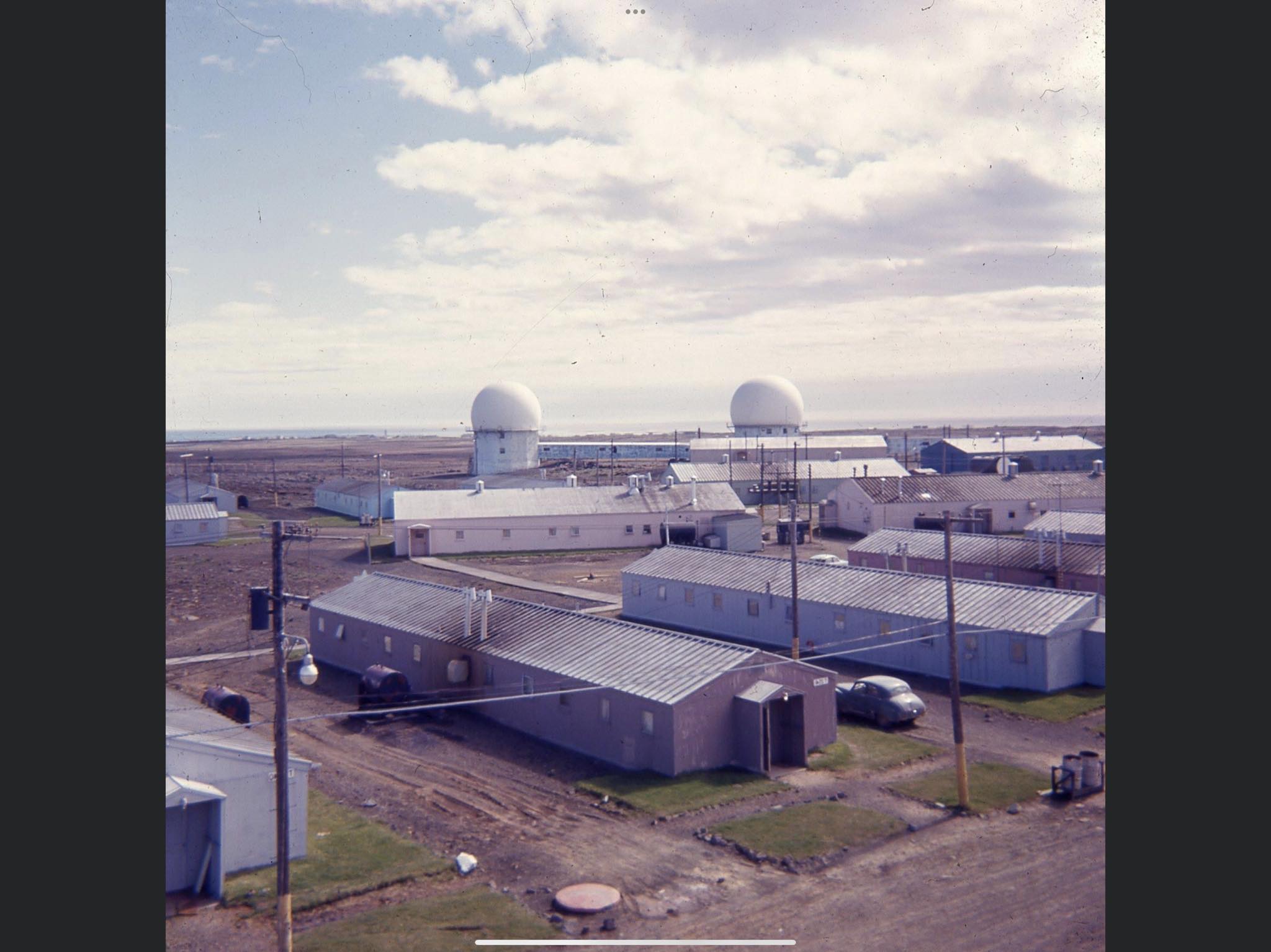
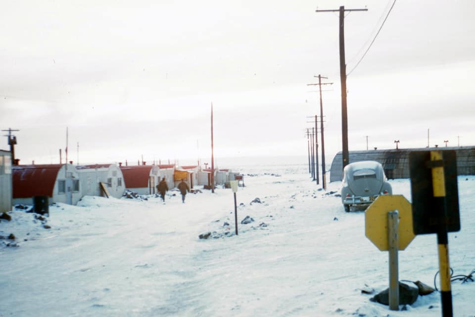
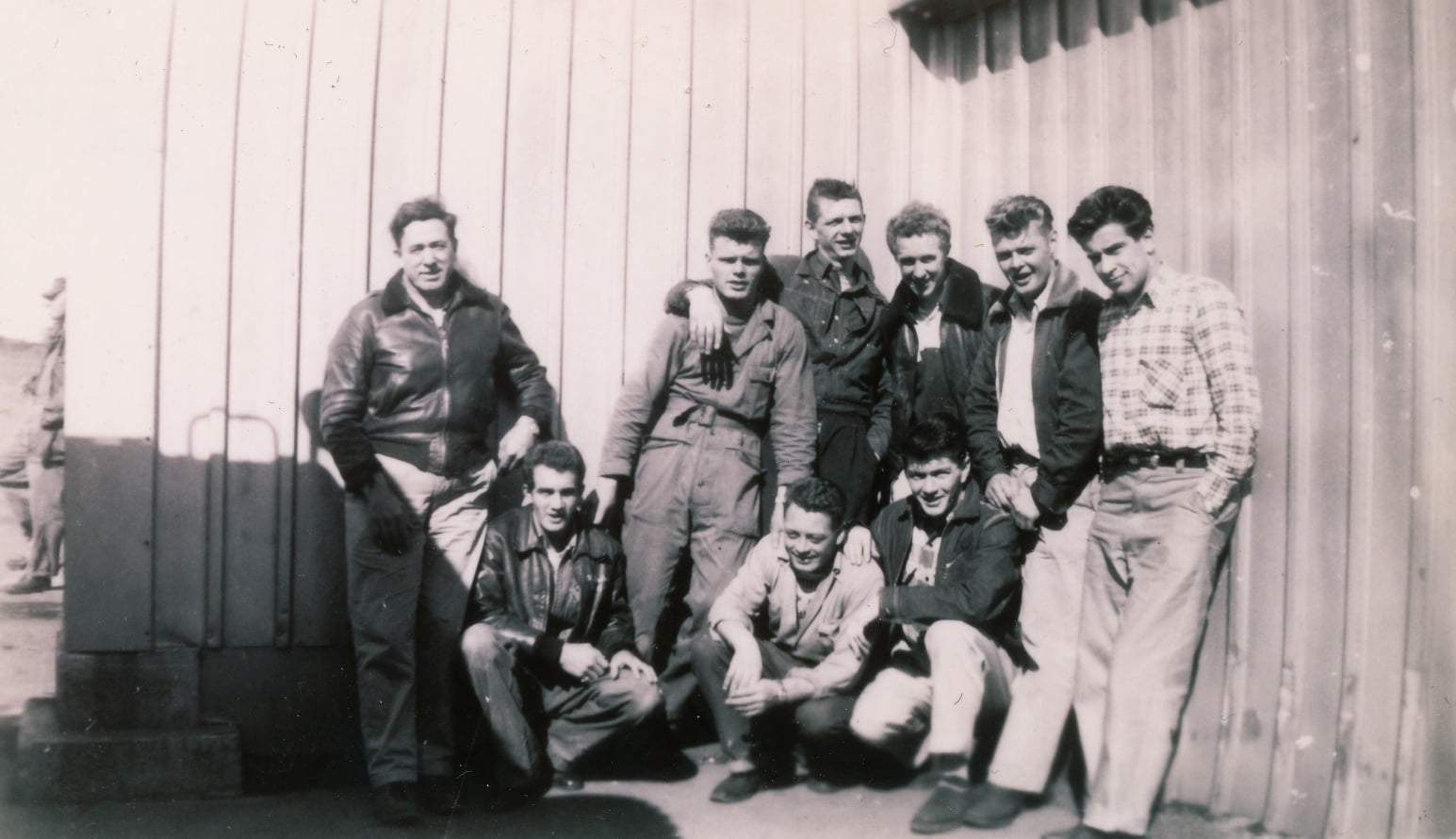
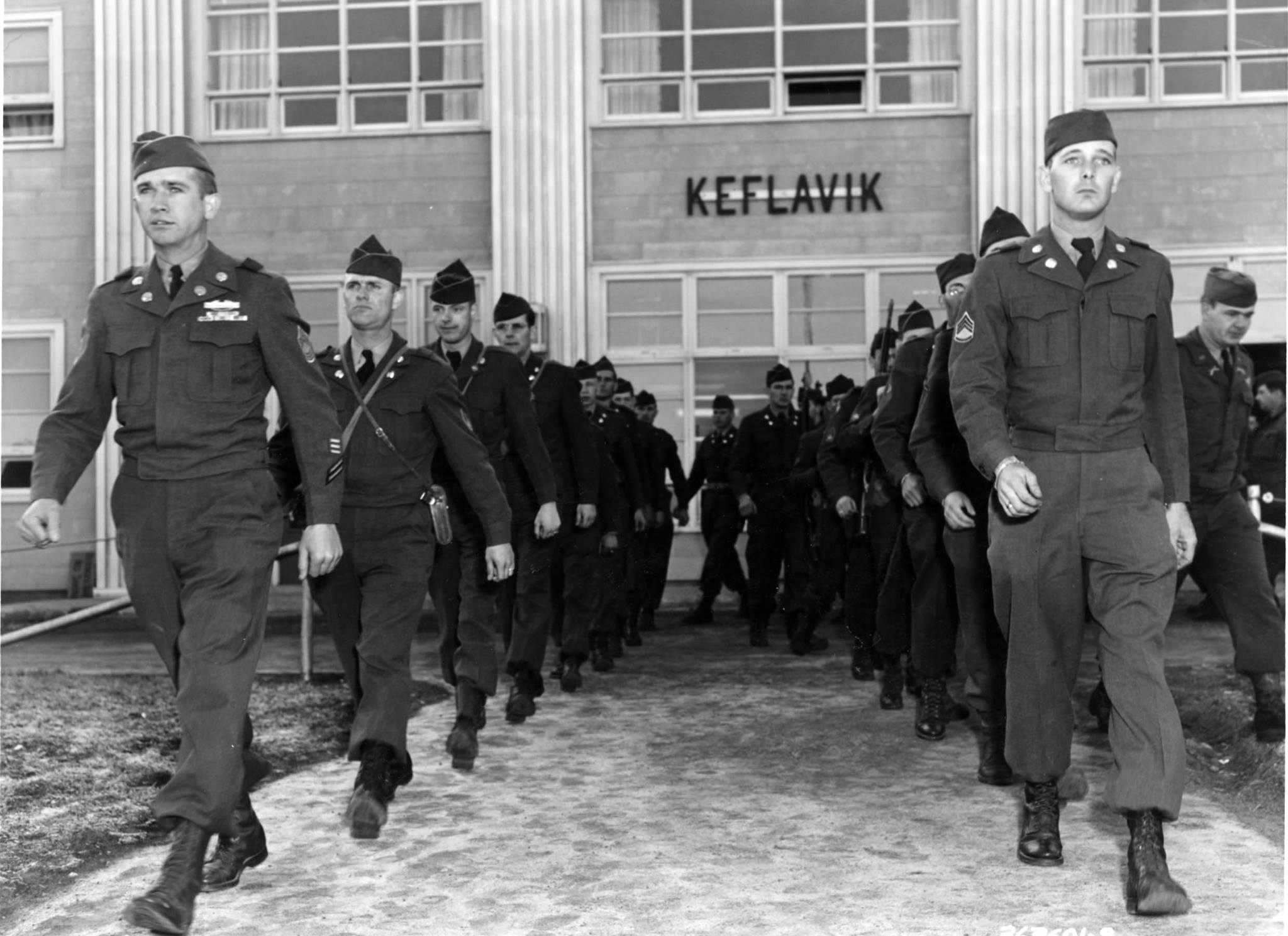
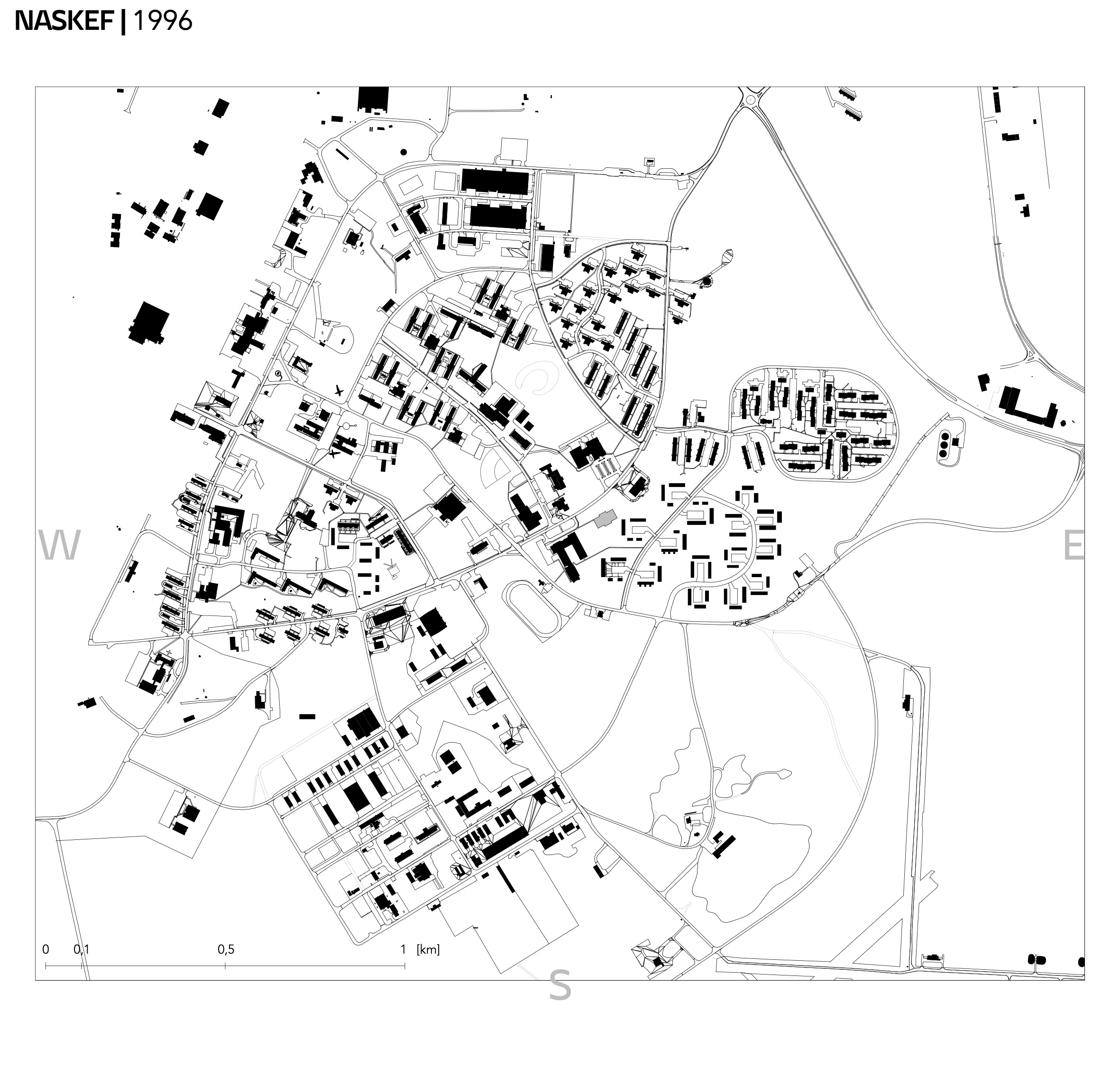
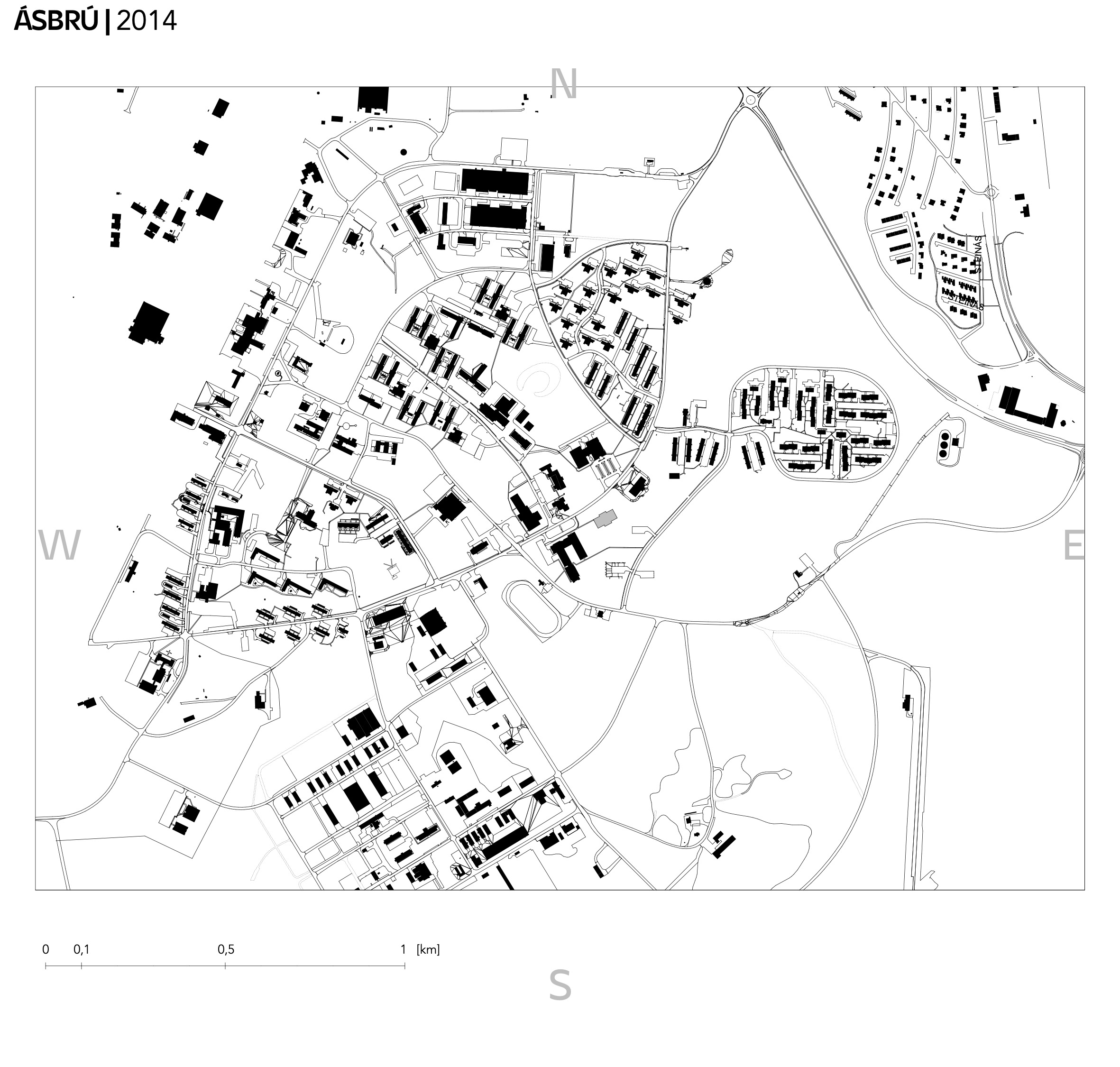
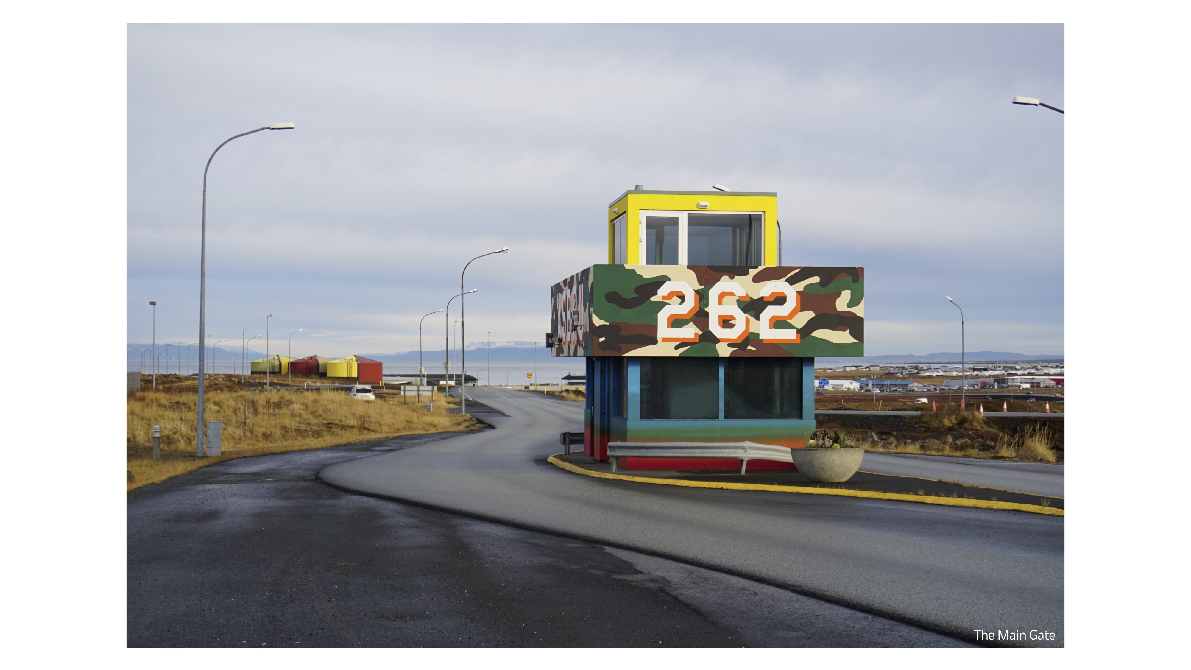
Photos

History of the base (NASKEF -
Ásbrú)
By analyzing materials from various sources (most were found on the NASKEF FB group) such as pocket maps distributed to soldiers living on the base, photos from aircraft, private photographs and videos, I was able to reconstruct how the layout of the base has changed since its establishment.

At first, it developed mainly in the southwestern part, formed by temporary bunkers that were not protected from winds and harsh weather conditions.
The base gradually began to expand towards the coast (north). In fact, from the very beginning the street layout was already formed.
Turning to 1996 and 2001, it can be seen that a large part of the buildings disappeared from the map, which due to their light wooden construction took the name "the chainesse houses", and officially these were the buildings on Bunker Hill called coral sea housing. They were destroyed in the fall of 1996.
The trace of the establishment is still present today.
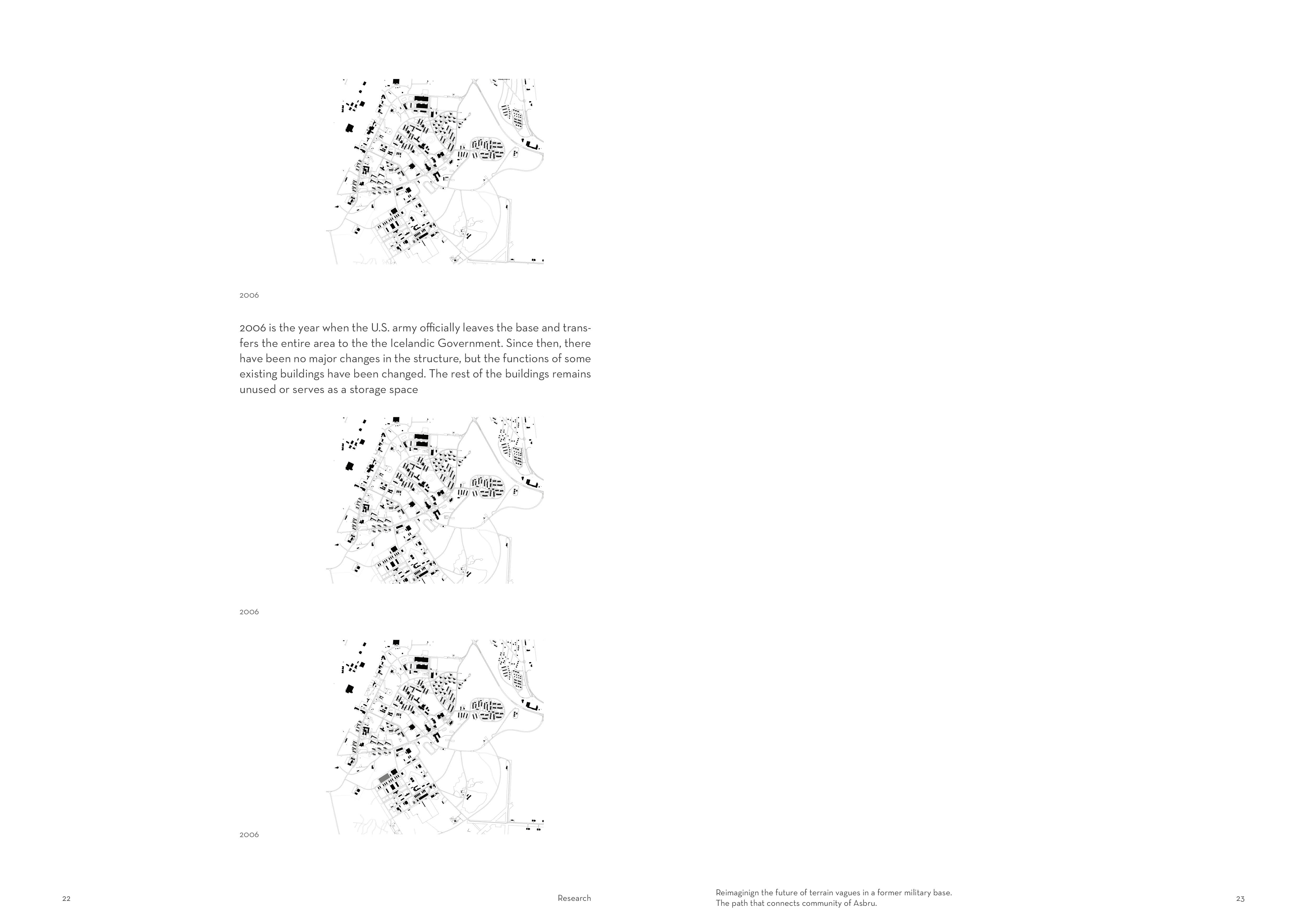
2006 is the year when the us army officially abandons the base and transfers the entire area to the Reykjanesbær municipality.
Since then, there have been no major changes in the structure, but the functions of some existing buildings have been changed.


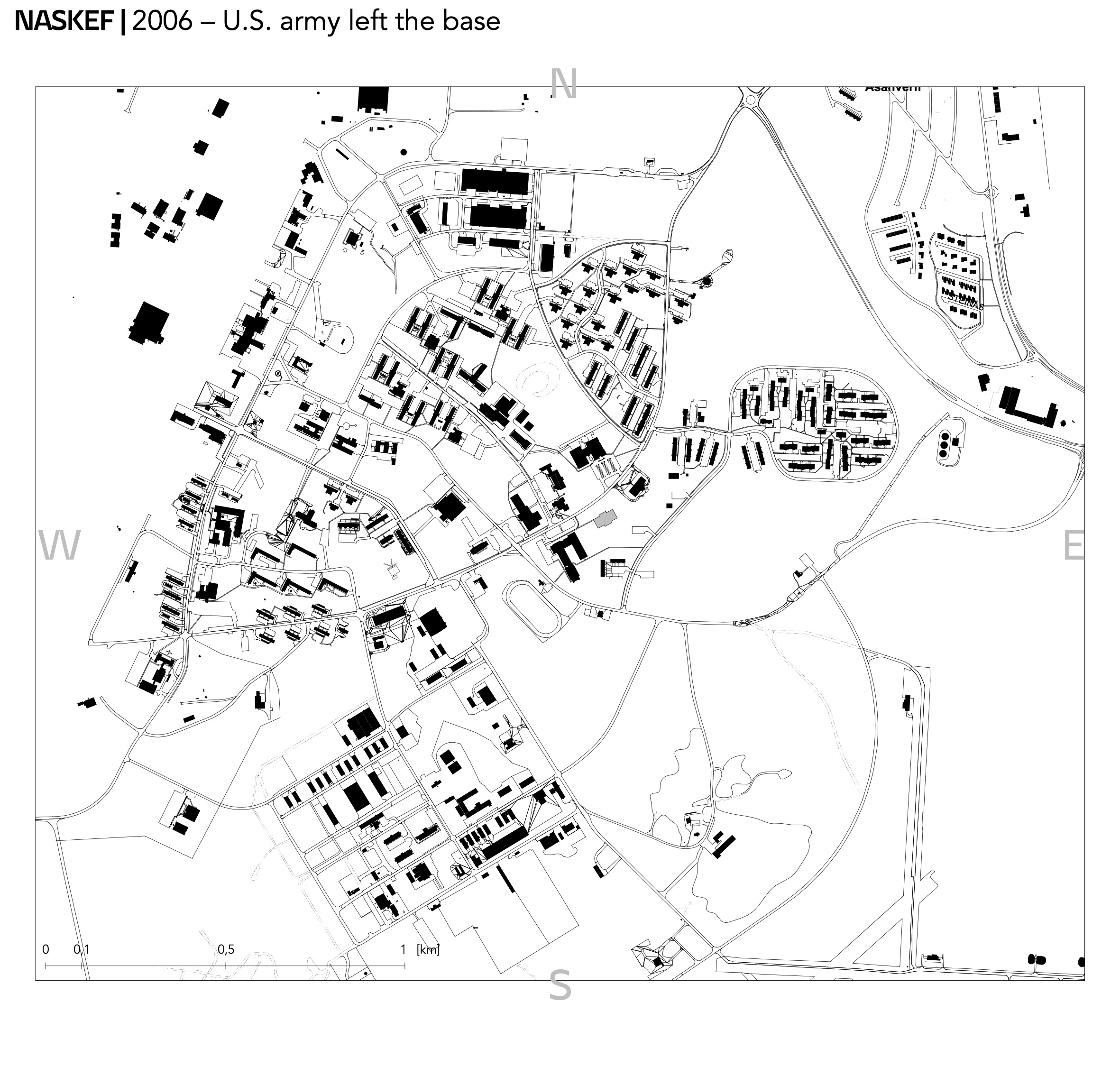

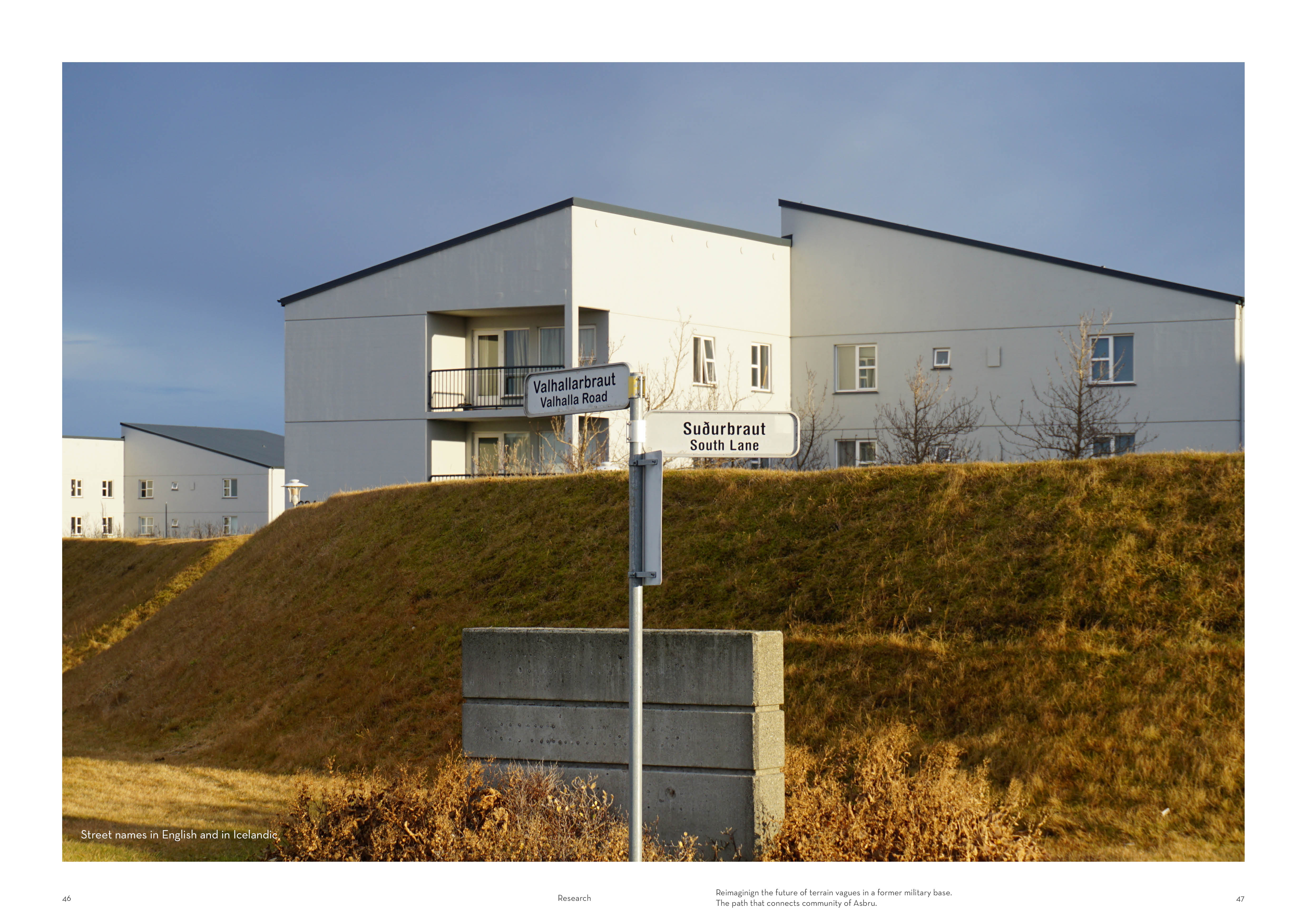
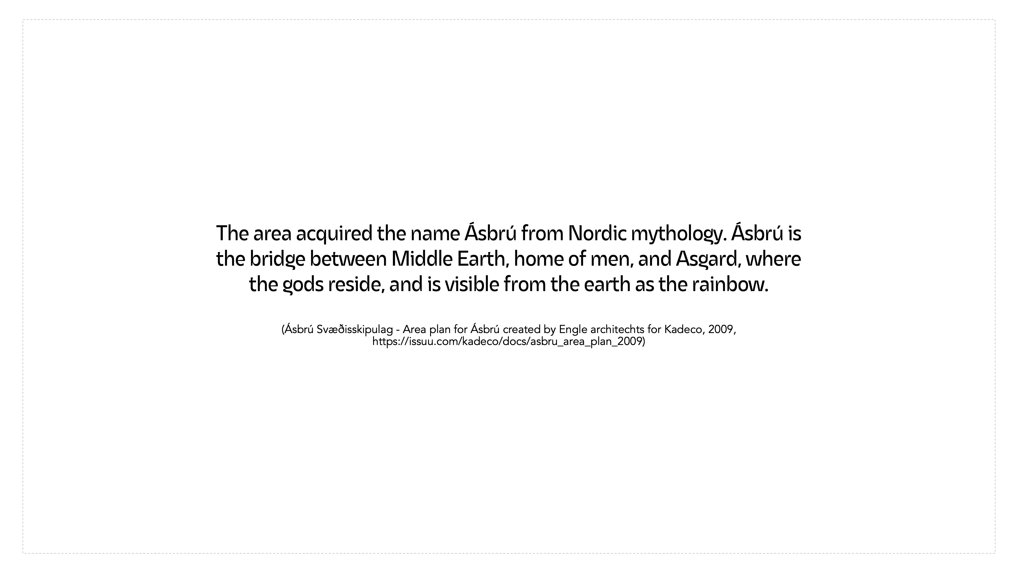
The transfer of the base also involved giving it a new name....
The
area acquired the name Ásbrú from Nordic mythology. Ásbrú is the bridge between
Middle Earth, home of men, and Asgard, where the gods reside, and is visible
from the earth as the rainbow.
(Ásbrú Svæðisskipulag - Area plan for Ásbrú created by Engle architechts for Kadeco, 2009, https://issuu.com/kadeco/docs/asbru_area_plan_2009)
(Ásbrú Svæðisskipulag - Area plan for Ásbrú created by Engle architechts for Kadeco, 2009, https://issuu.com/kadeco/docs/asbru_area_plan_2009)
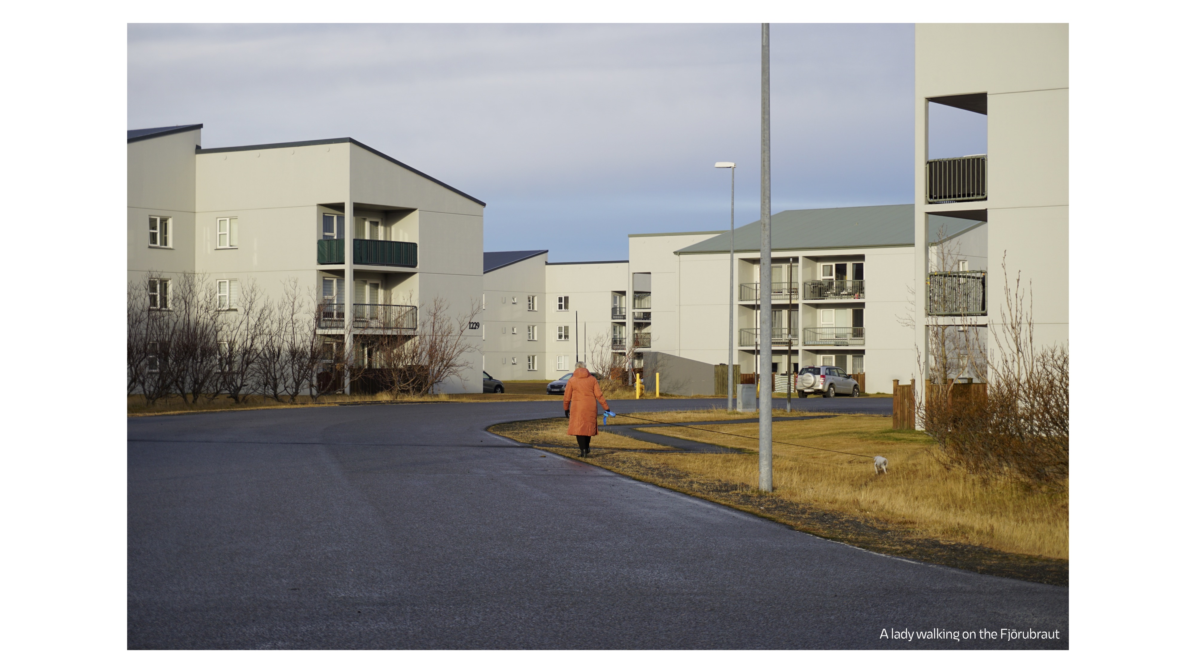


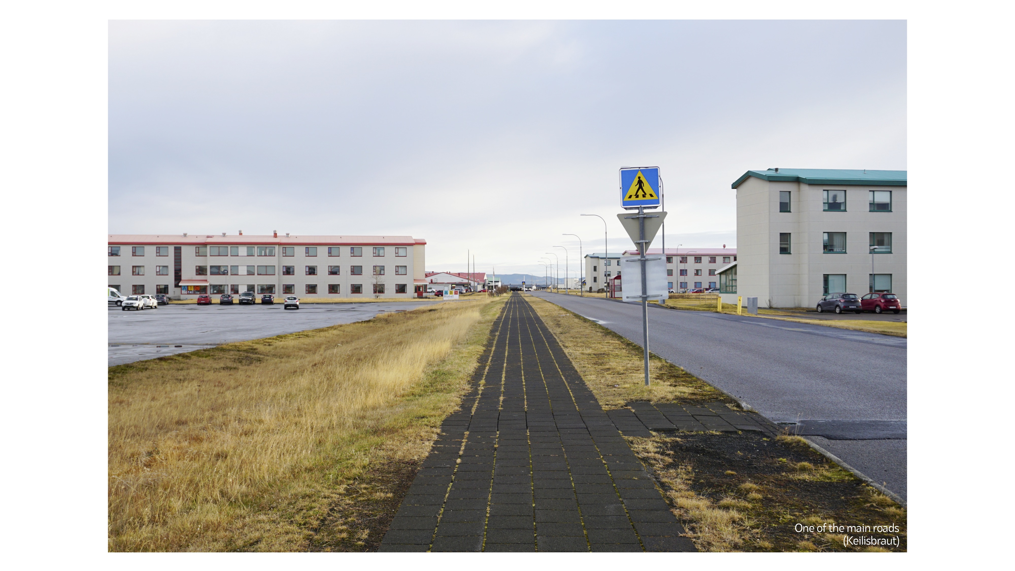


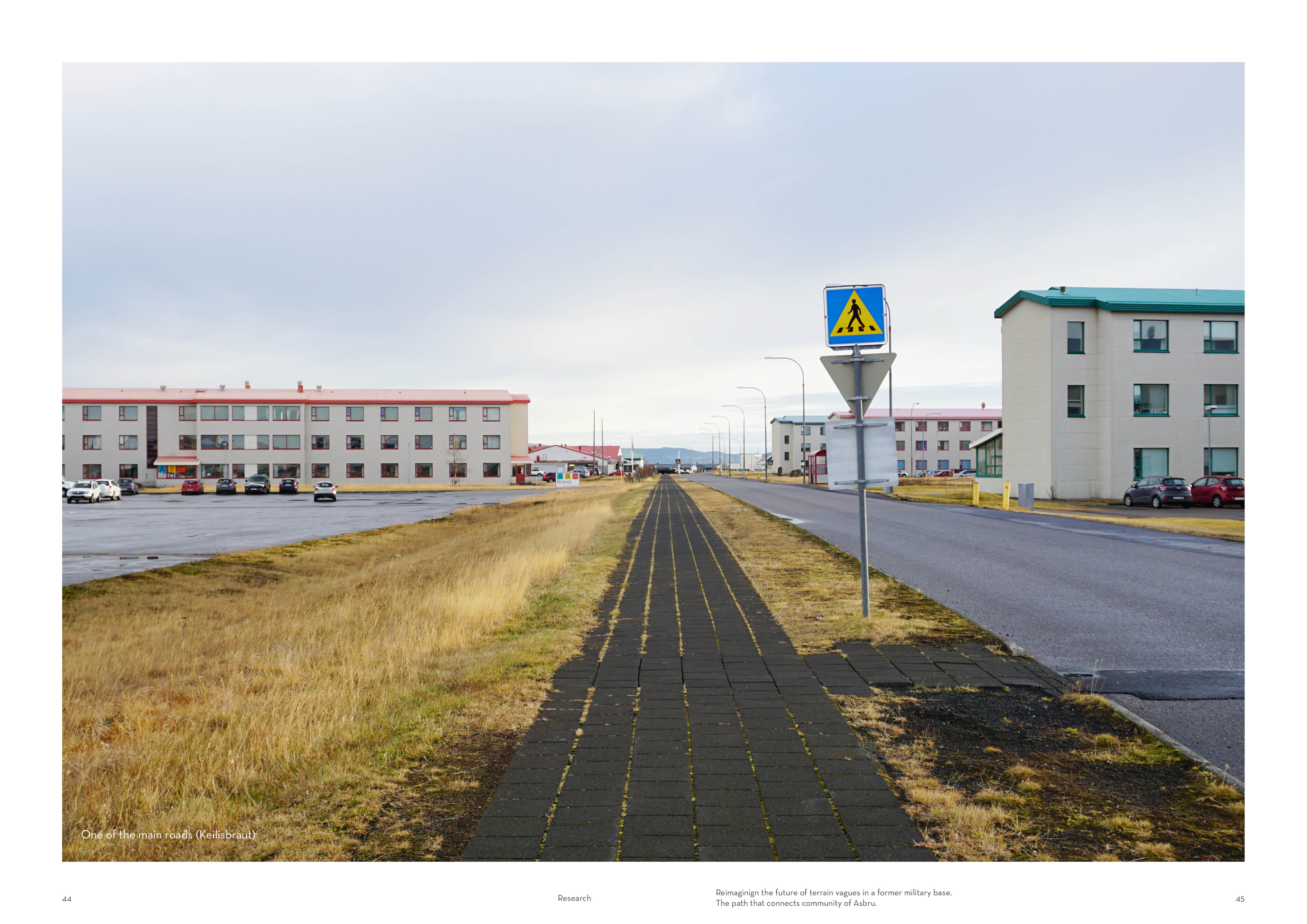
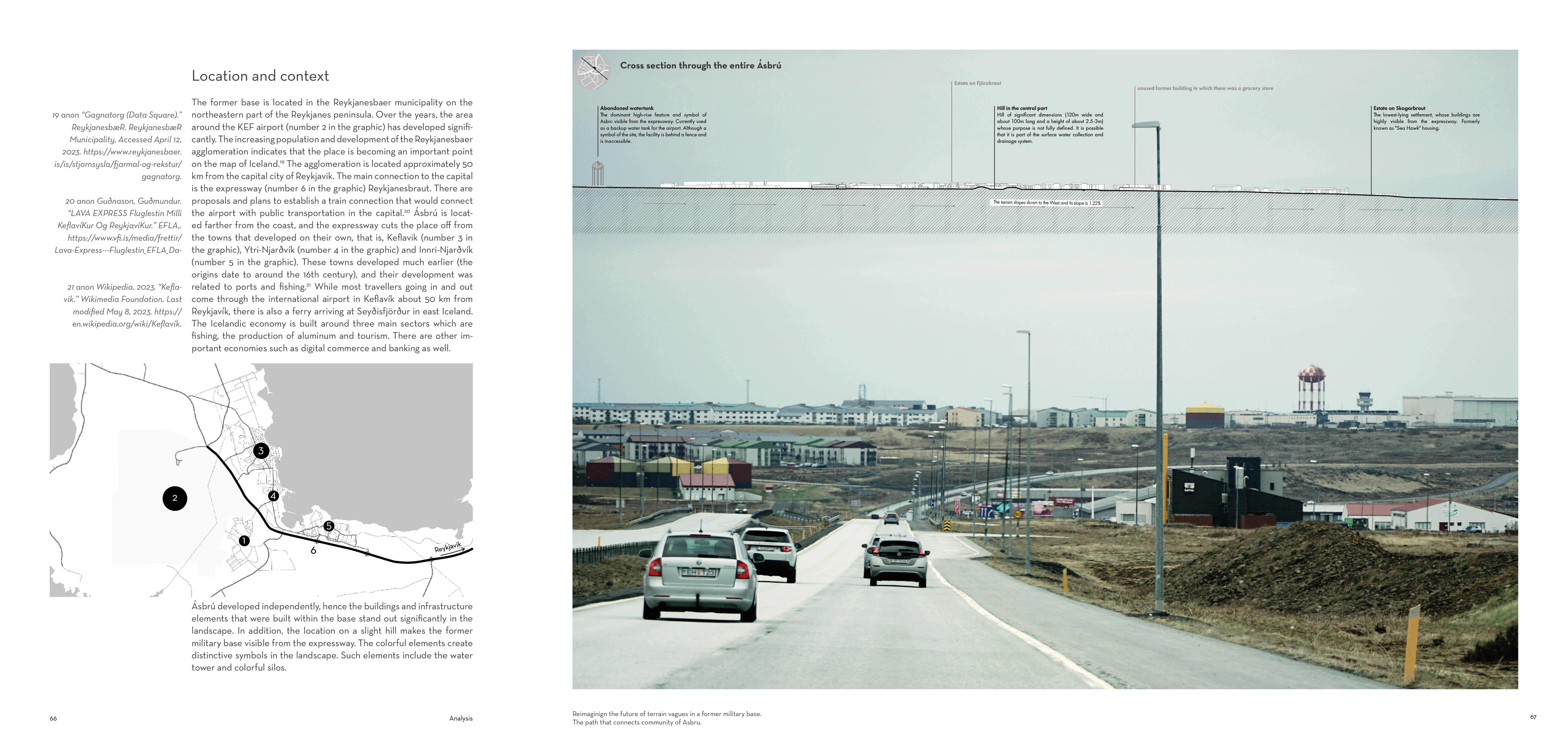
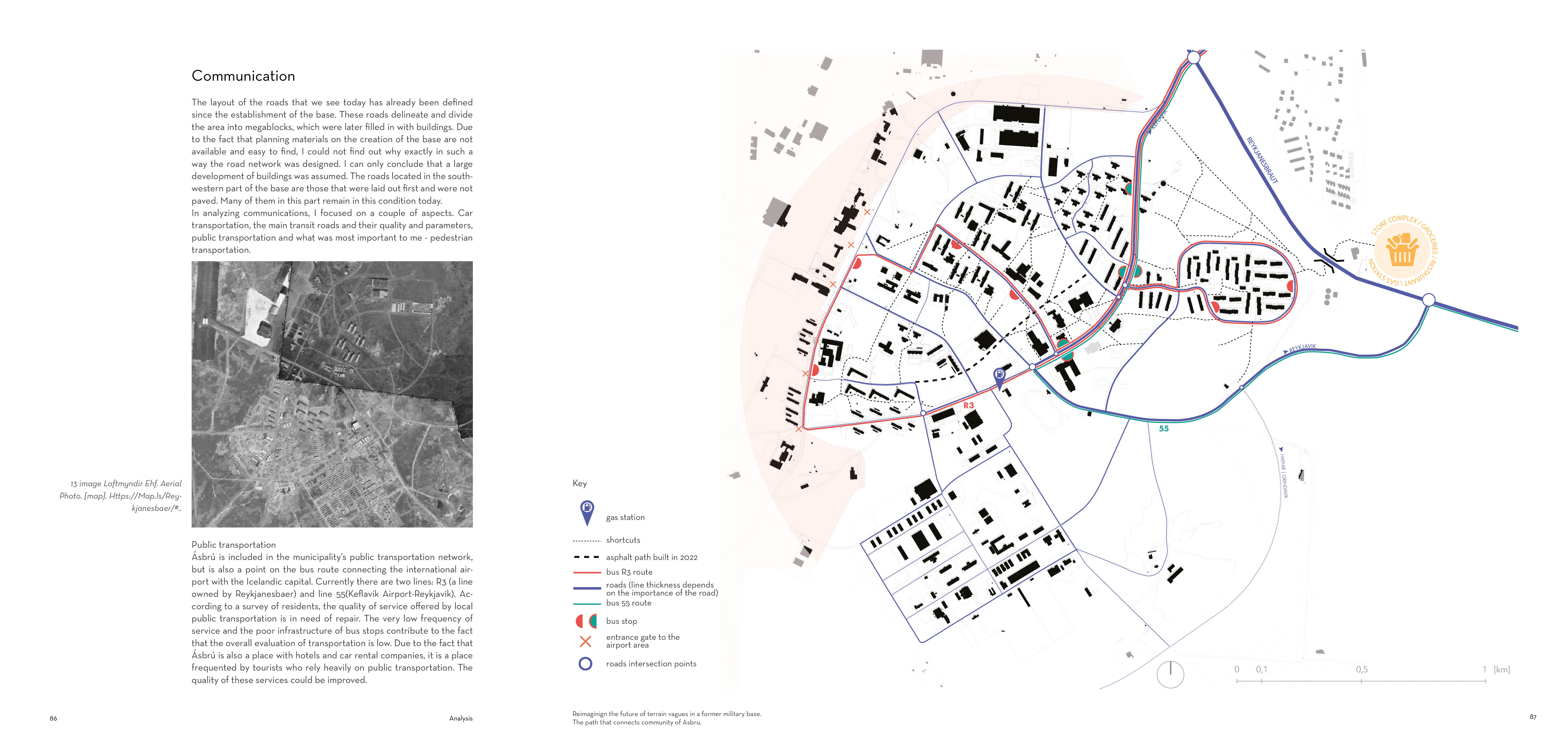
Zooming out a bit, this is what the area looks like. Ásbrú is located in the northwestern part of the peninsula. It was difficult to determine the boundaries from the east and area that is occupied, we can say that it is about 4.484101 square kilometers (including empty spaces around). The peninsula is crossed by a high-speed road Reykjanesbraut, so for this reason Ásbrú also remains cut off (in a sense) from Keflavik and Njarðvík, although these areas are interconnected because people living in Ásbrú shop outside it.
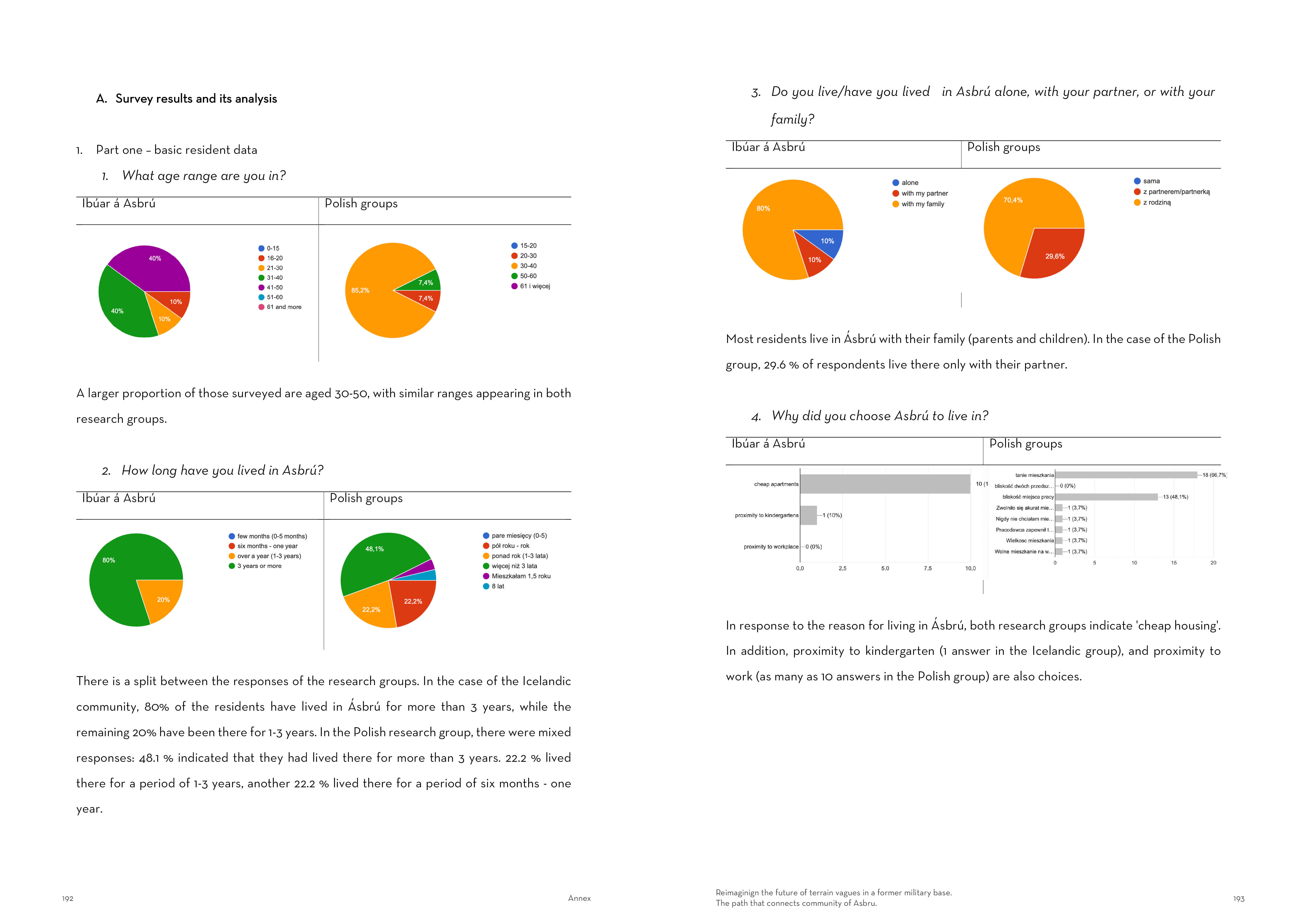
Initially the base was created for about 5,000-6,000 people. Today the area is home to about the same amout: 6,000 people.

Mapping
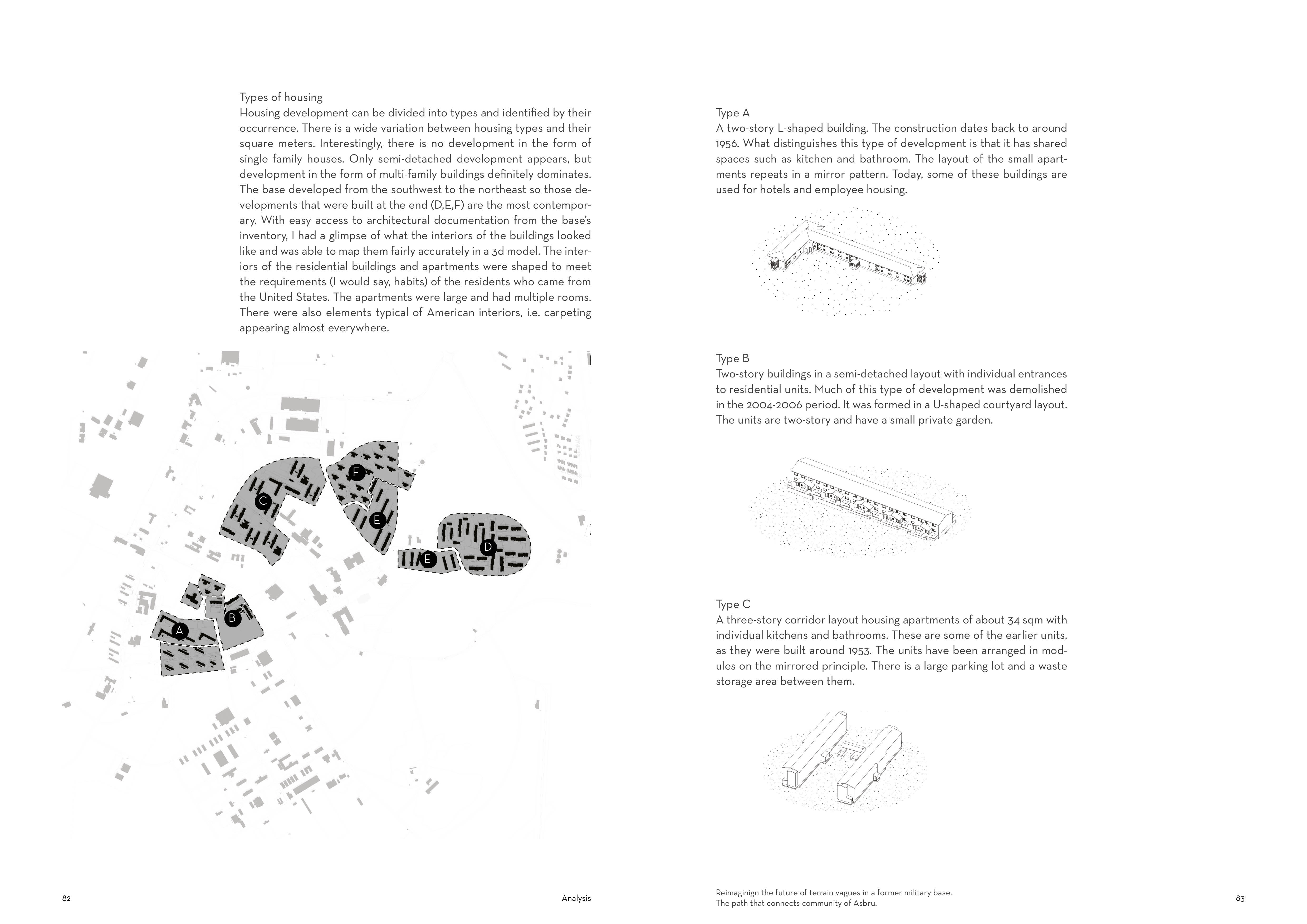
1. Surfaces
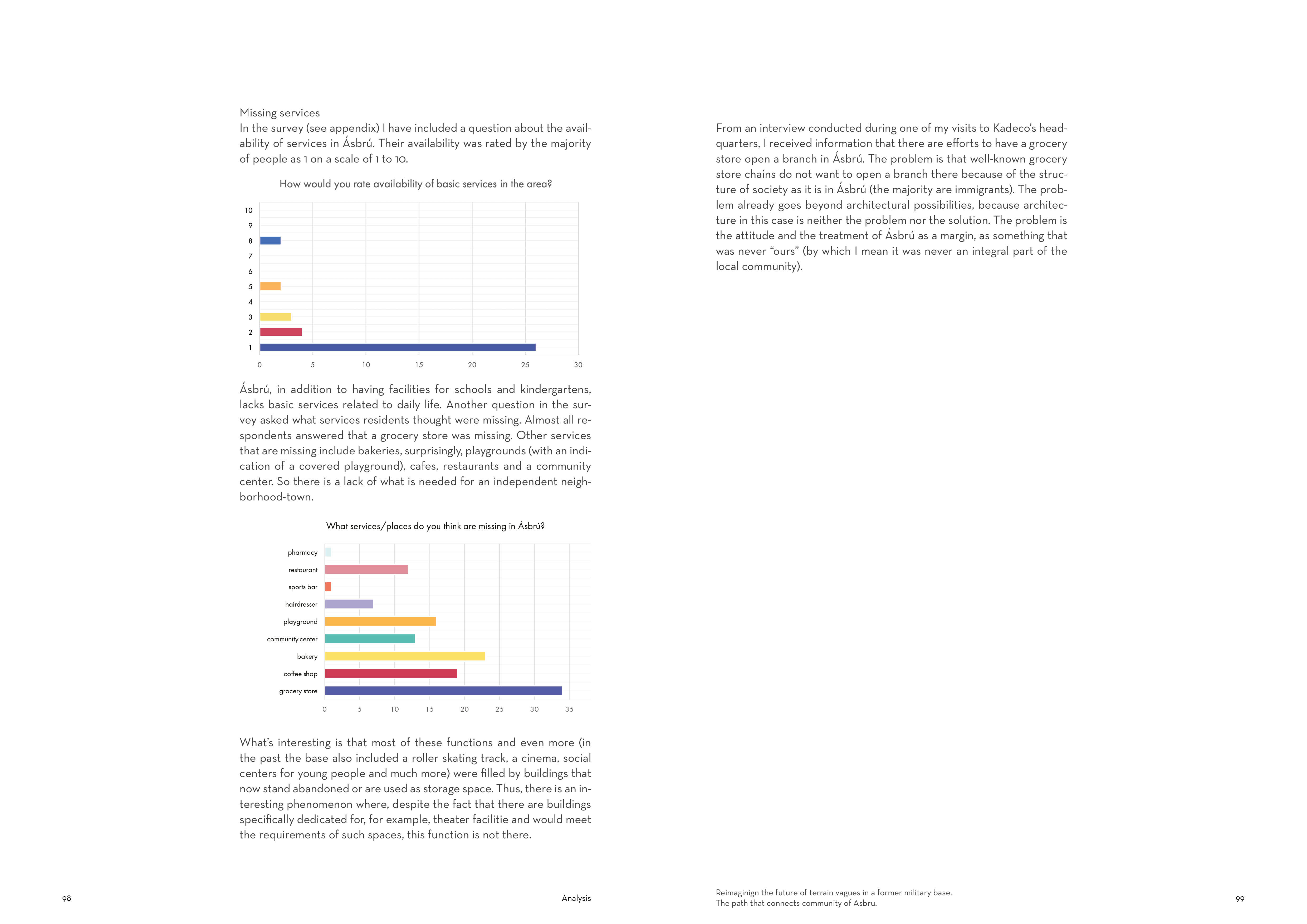
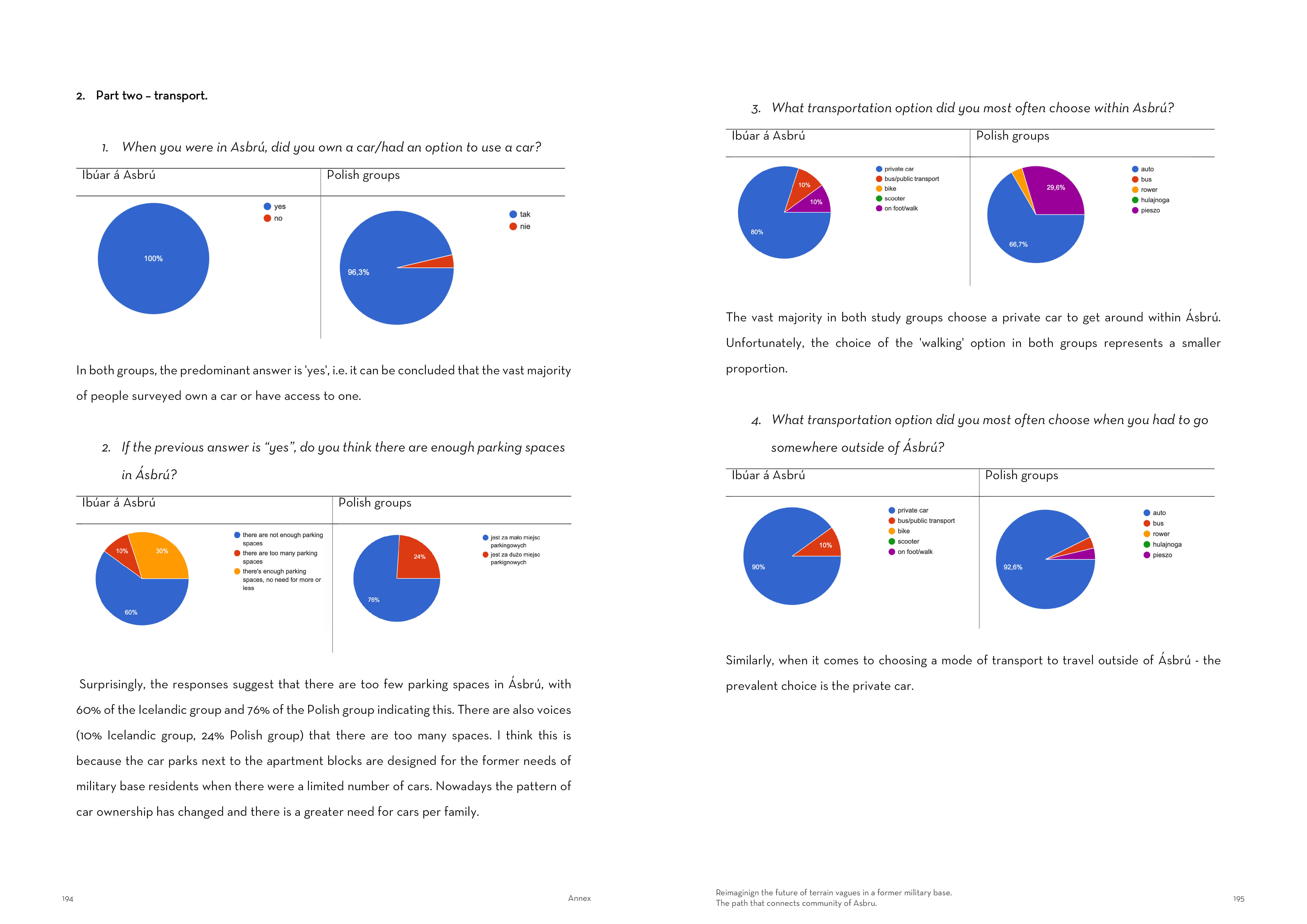
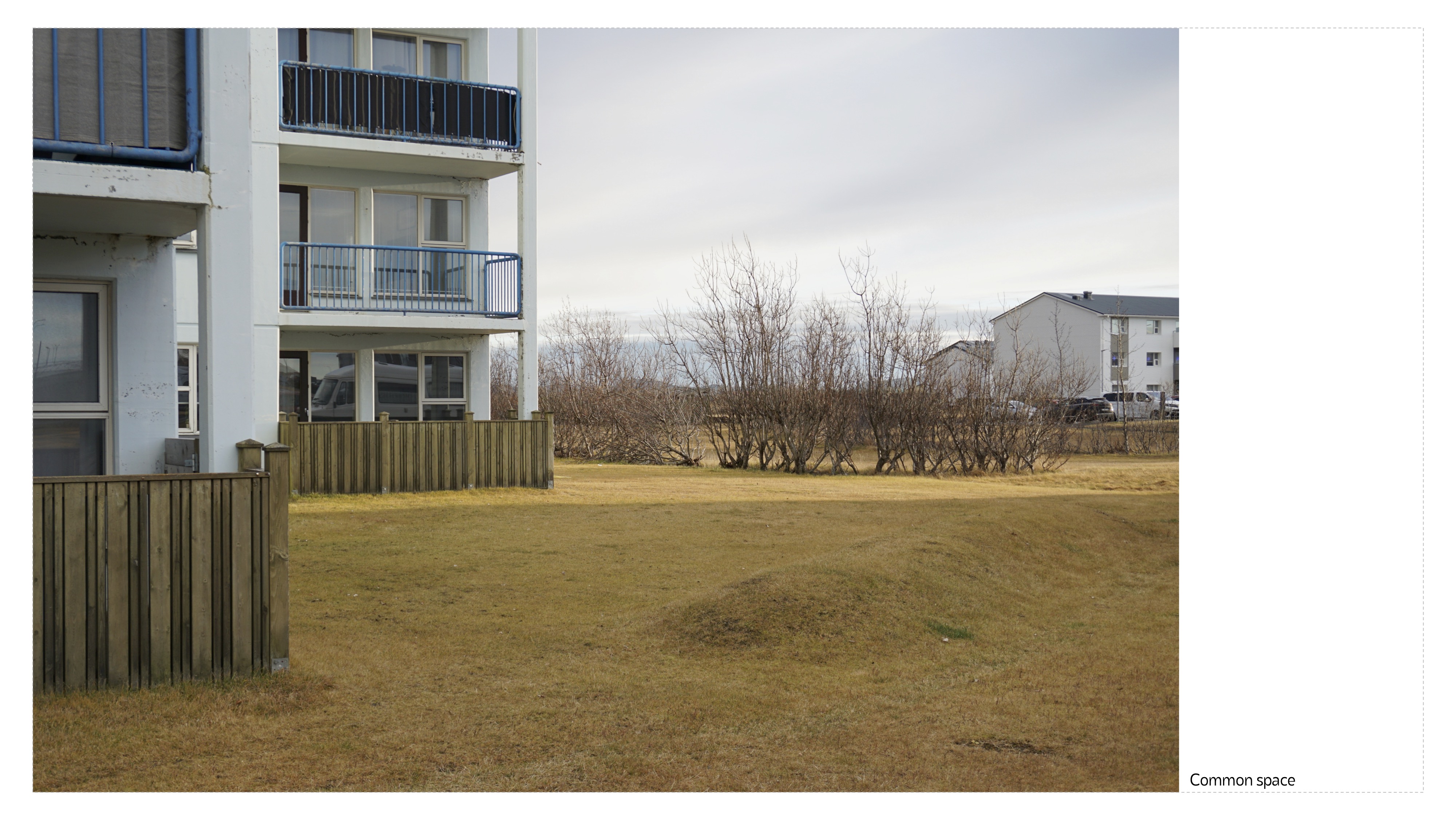
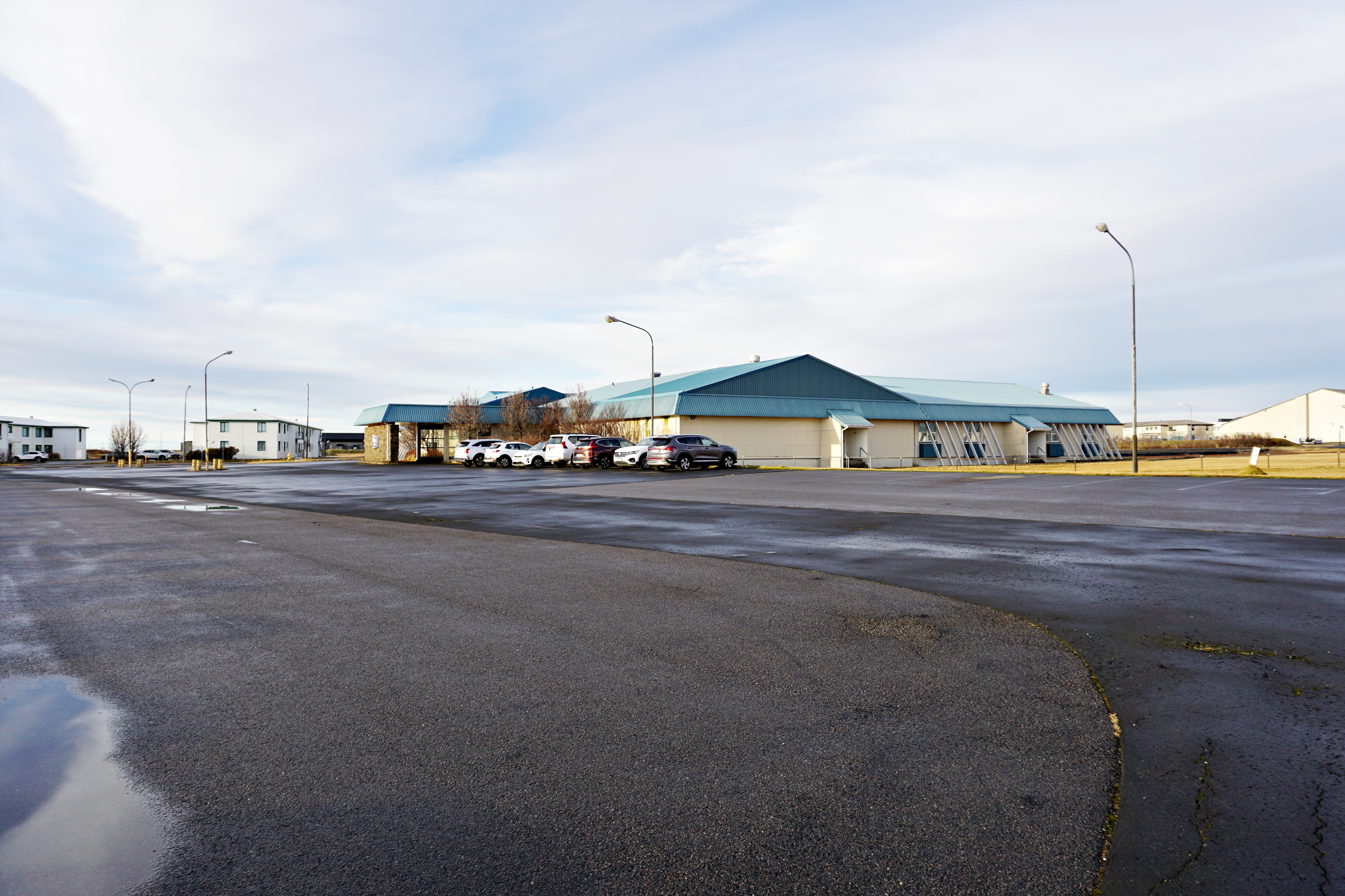
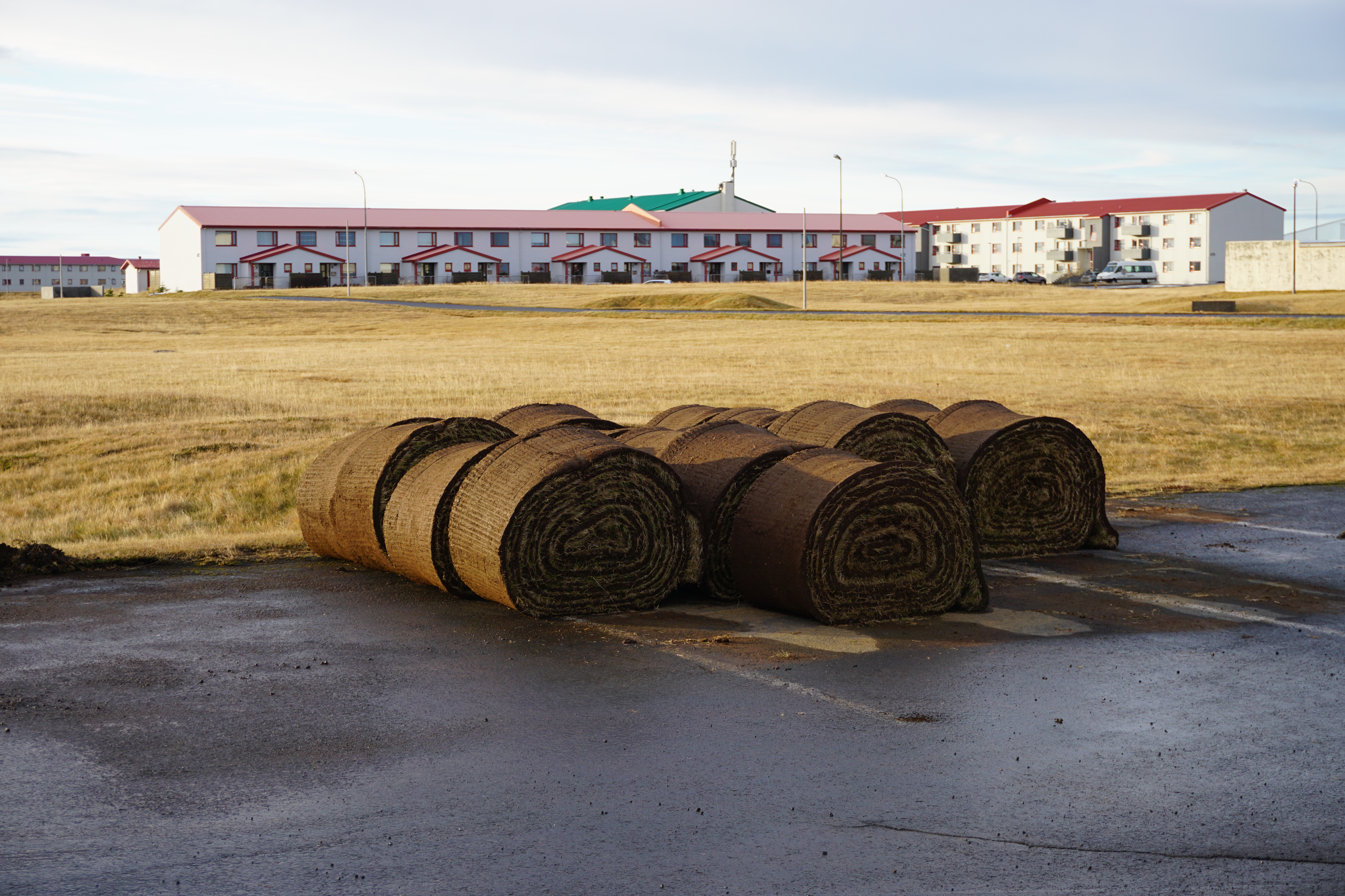
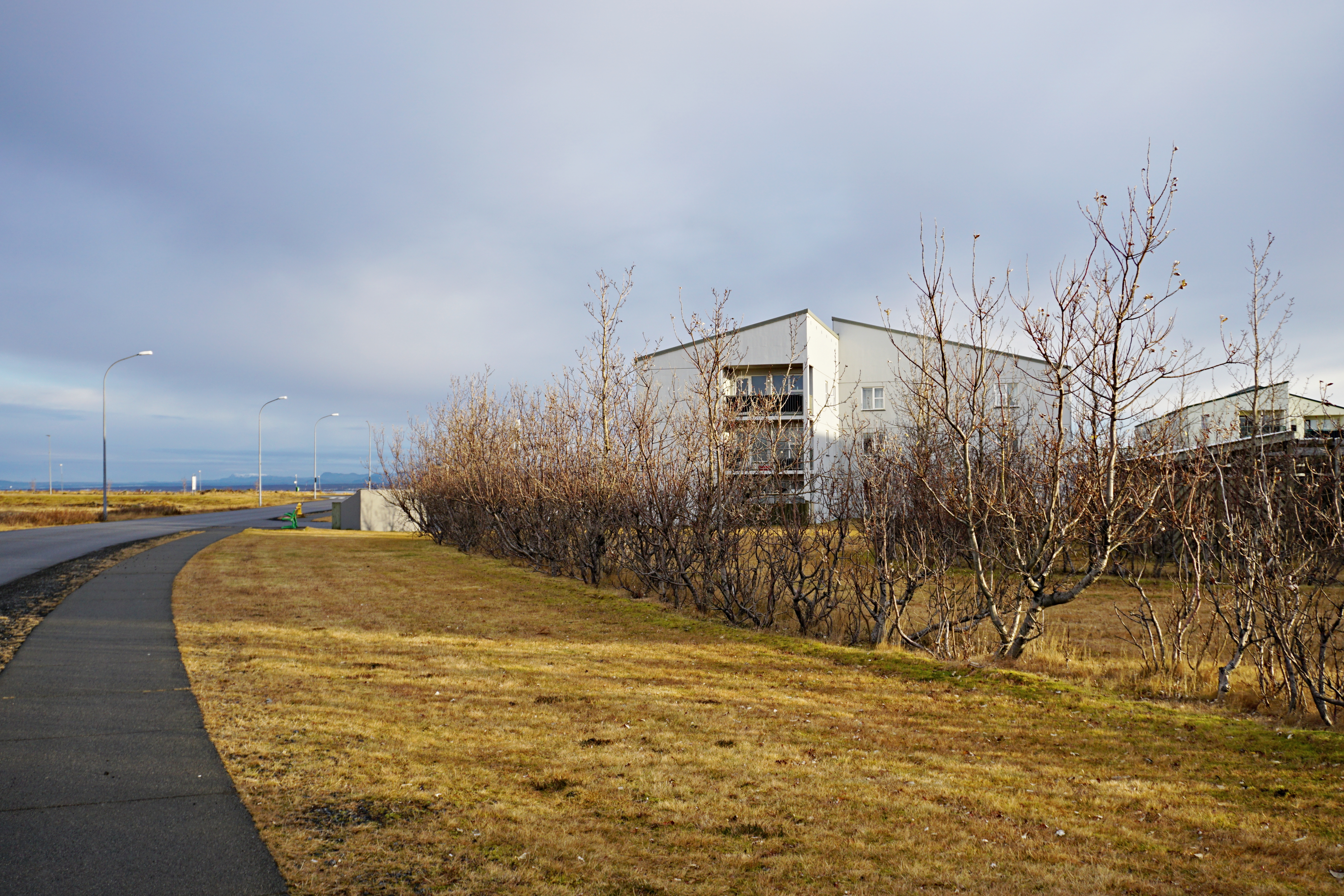
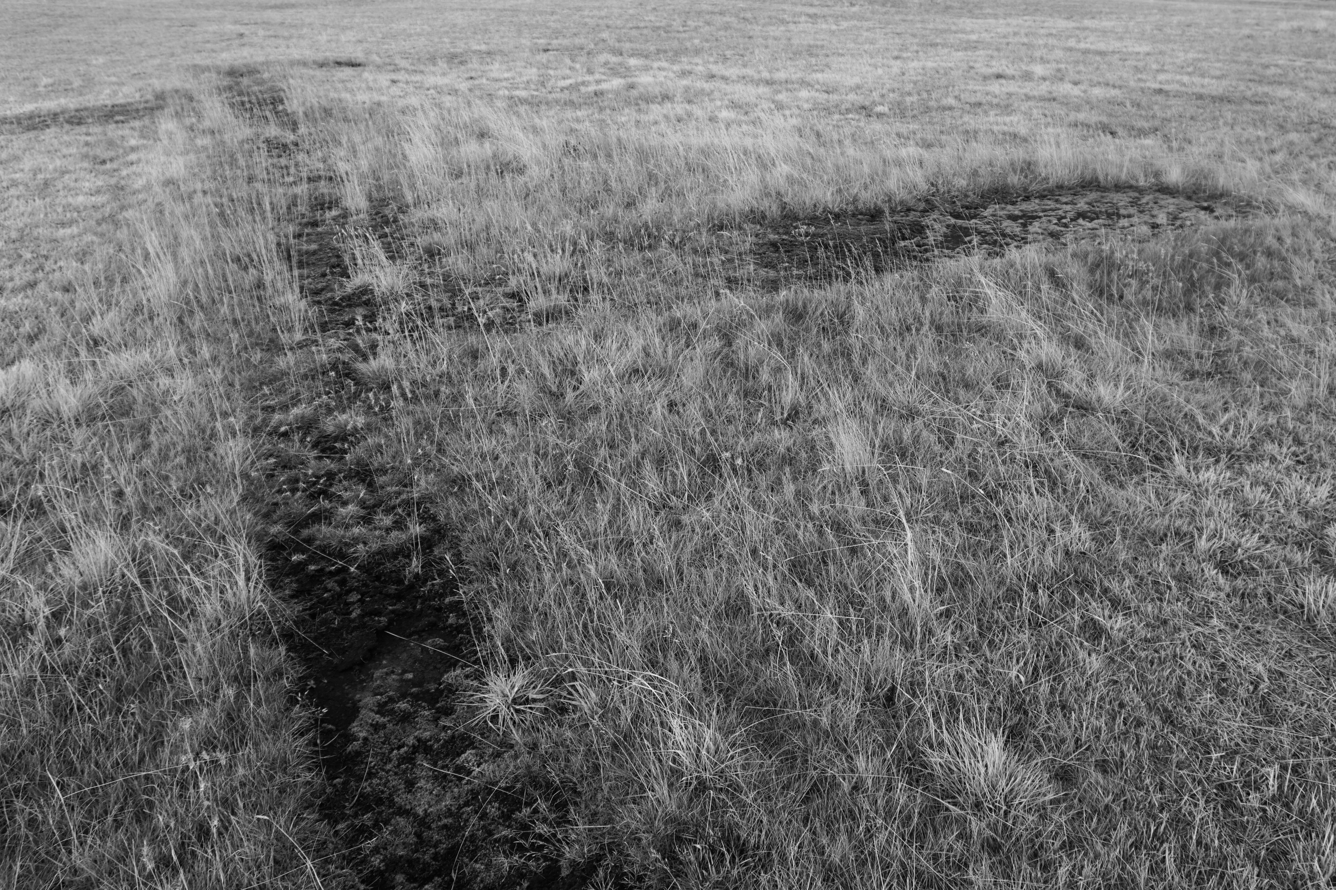
The vast majority of the Ásbrú is covered with rolled grass but there are places where lava and moss are present. Around 18 % of the area is a paved surface. Usually these are huge parking spaces.

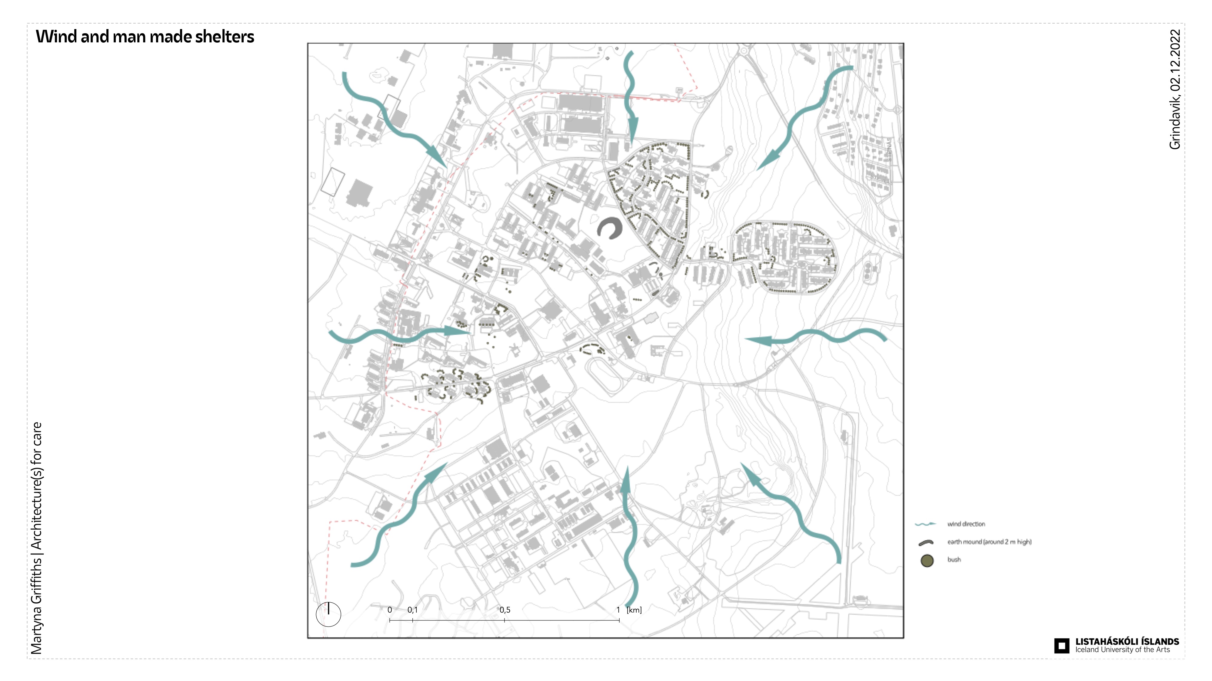
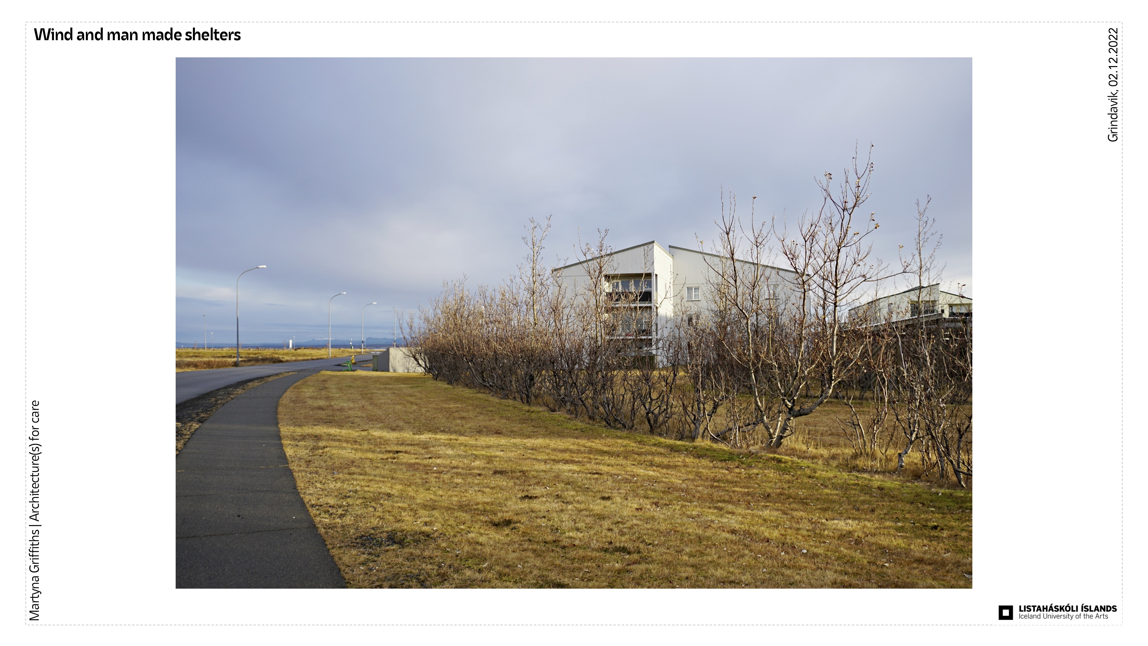
2. Shelter
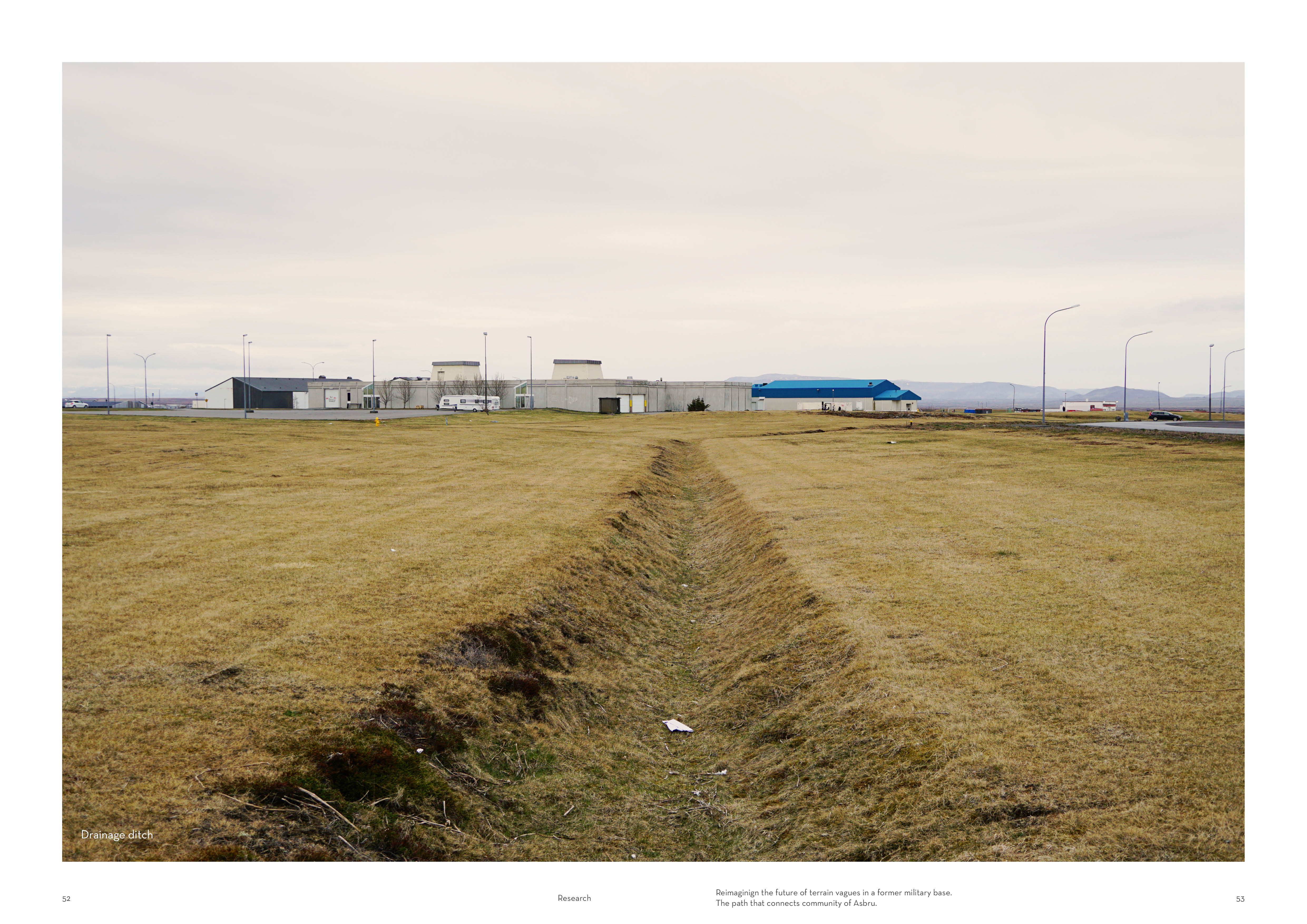
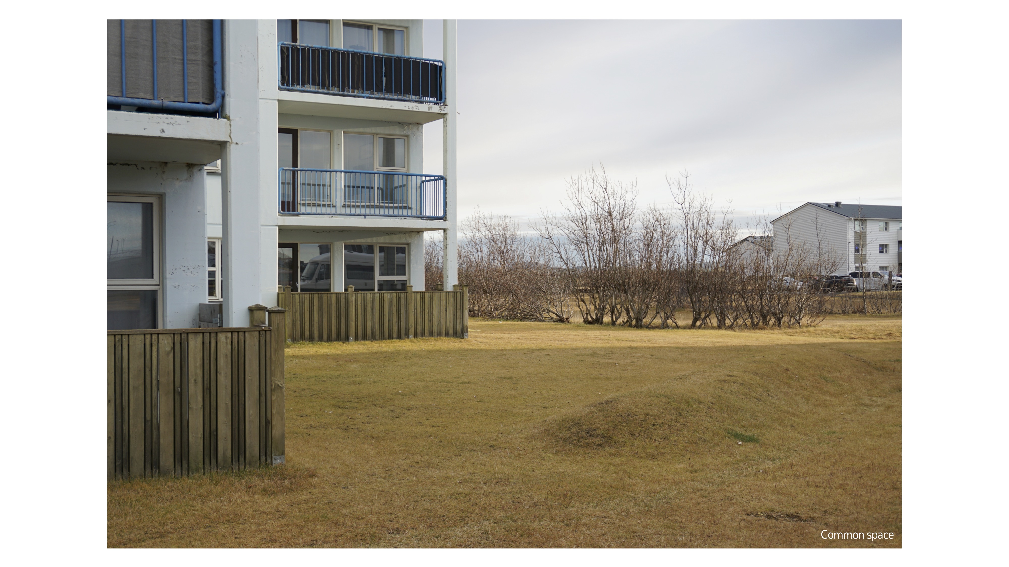
The location of the base on a slight hill and the surrounding open space and proximity to the ocean means that the winds in this area are very strong and blow from all directions. The area is partly sheltered from the wind by rows of shrubs or earth mounds.


3. Social
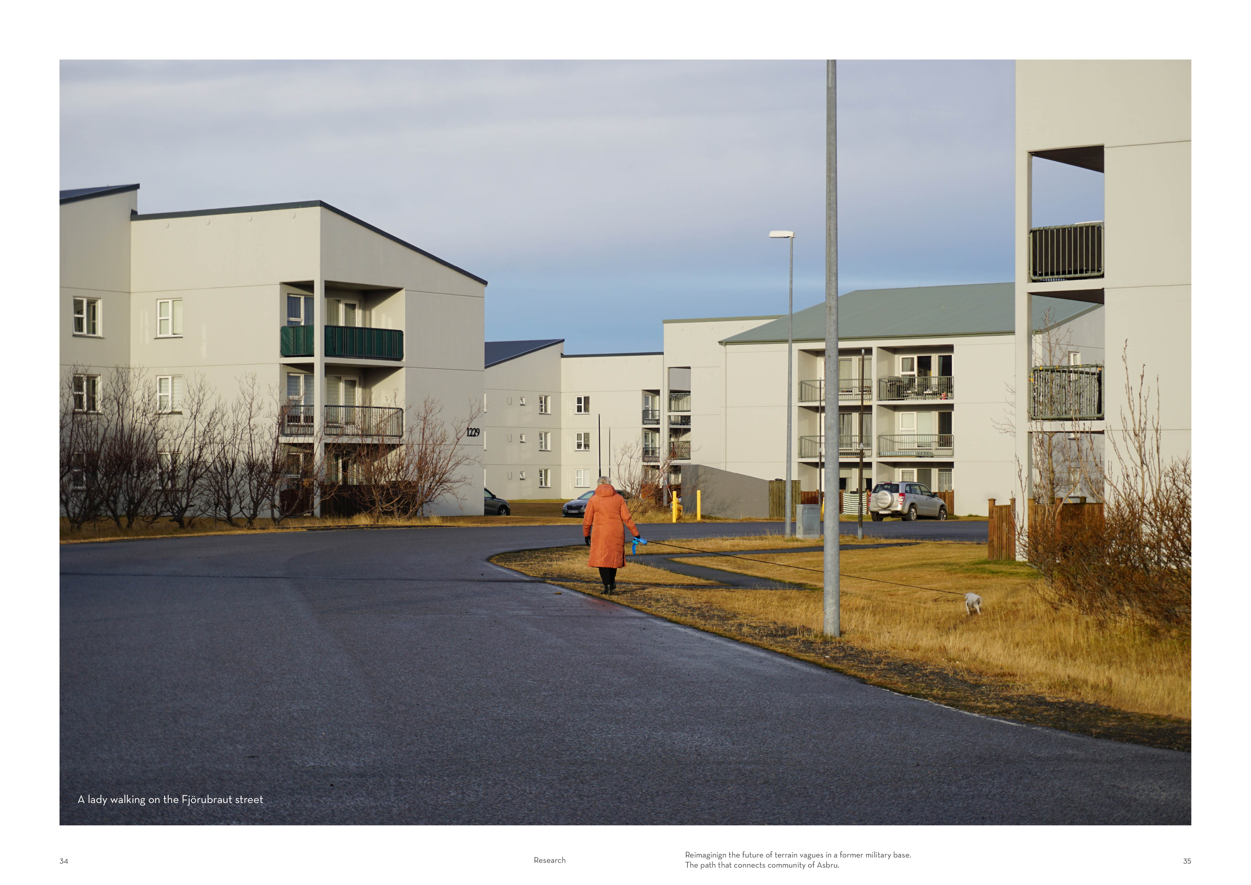
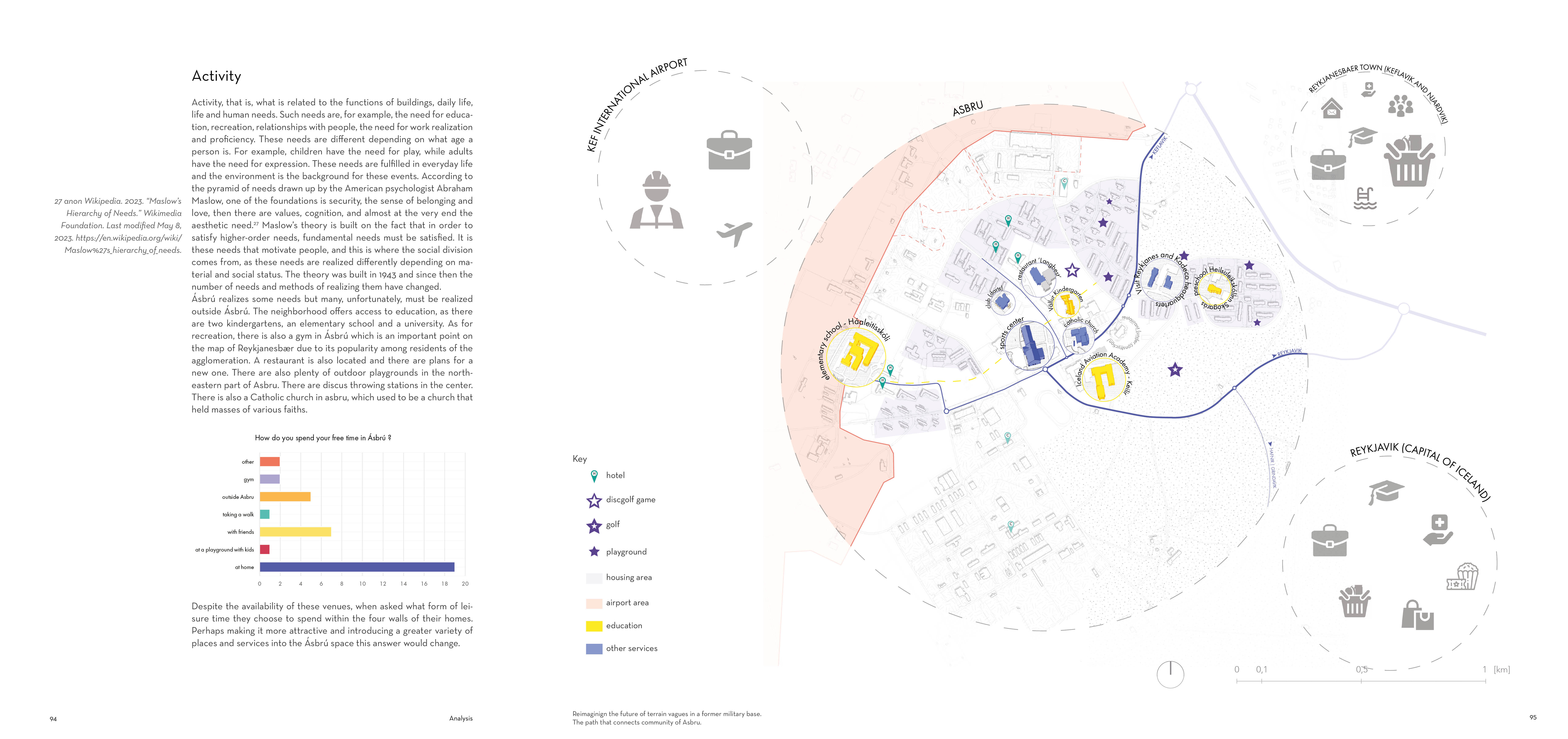
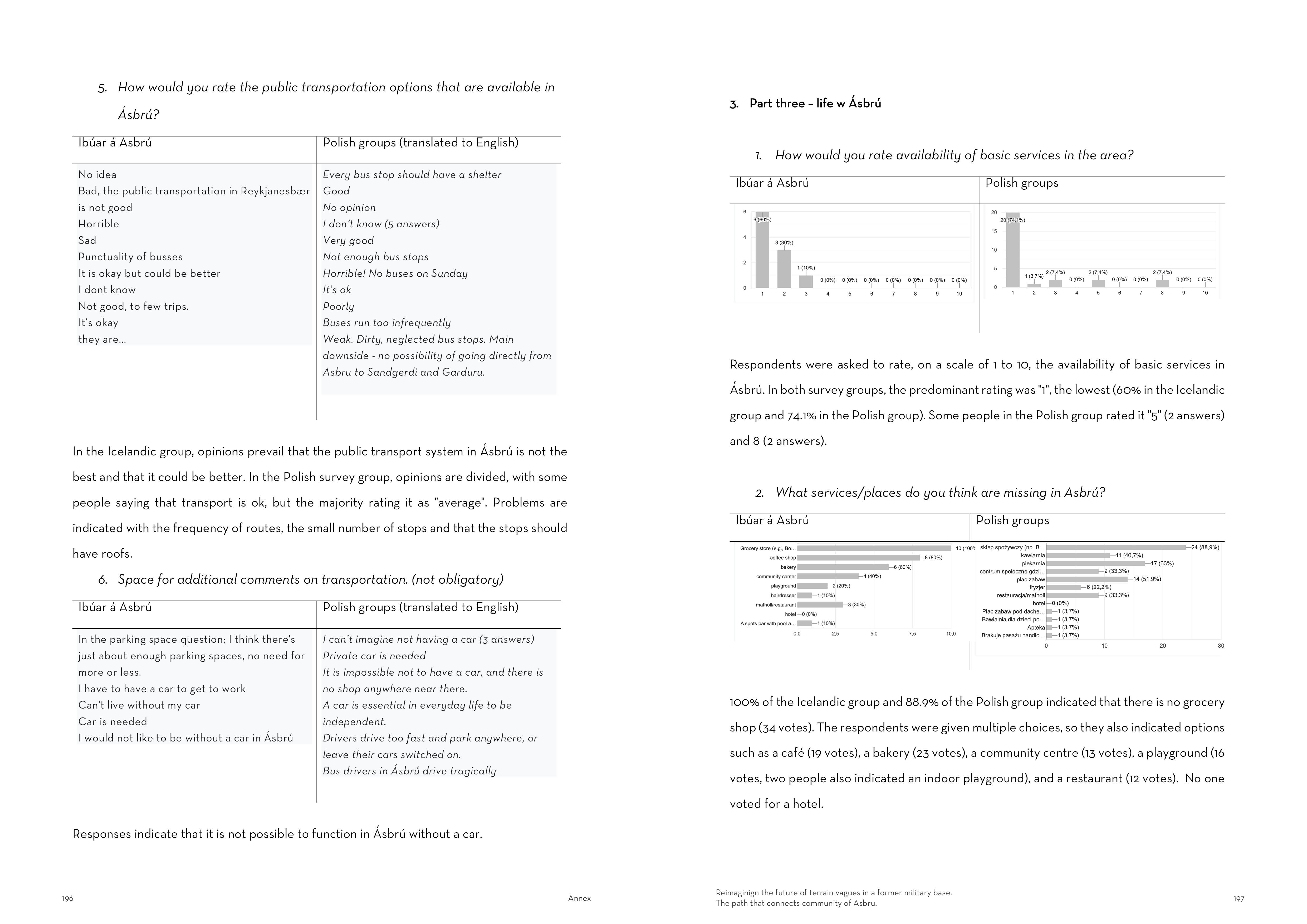
Ásbrú has no clearly defined center because it was strategically planned as a military base. Depending on the reflection of the space, one can say that the center is a restaurant, a playground or a school. Ásbrú has an academy, schools and two very good kindergartens. Tourists can find a wide selection of hotels tere. A number of car and wans rental companies are also located in Ásbrú. Two buildings are designated for refugees seeking asylum.

While researching the area I had the opportunity to talk to a Polish woman who has been living there for about a year. After asking her a few questions, she generally spoke positively about living here, but at the very end of the conversation she told me something that appeared to be important: she thanked me for talking to her because she can spend whole days here and talk only to her child.
"I'm glad I could talk to you, because I often spend whole days here talking only to my child"
Female, playground in Ásbrú, 9.11.2022
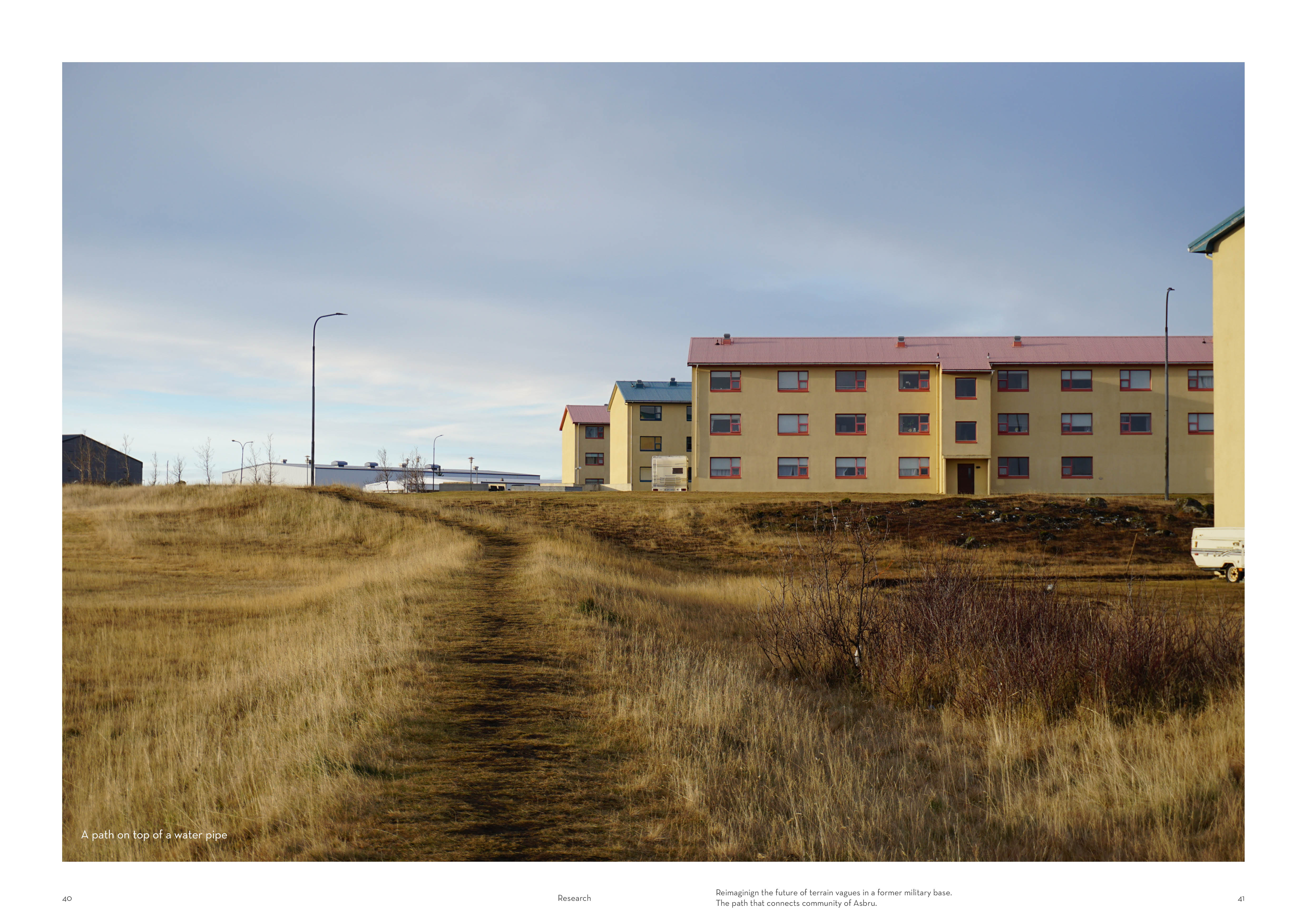
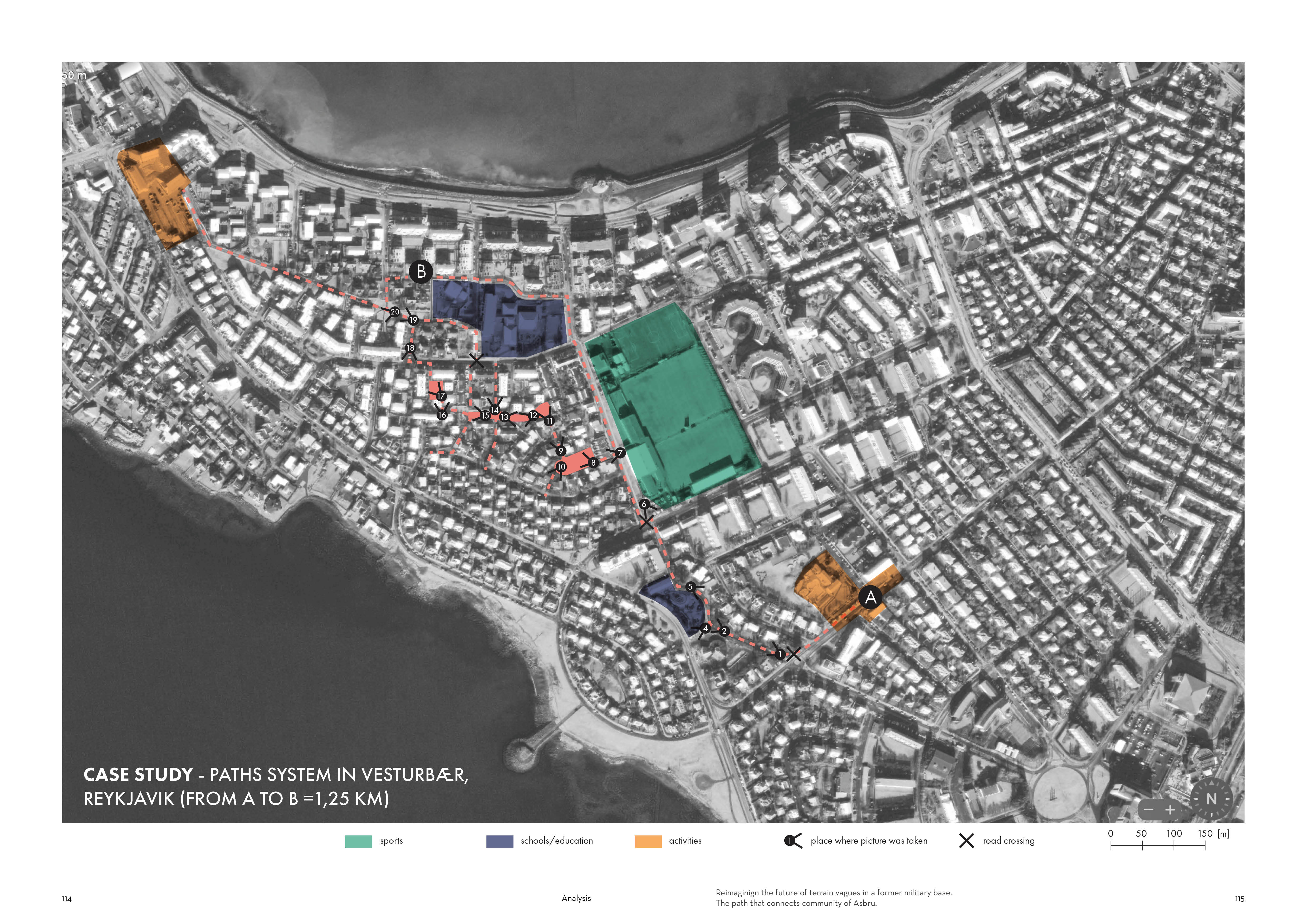
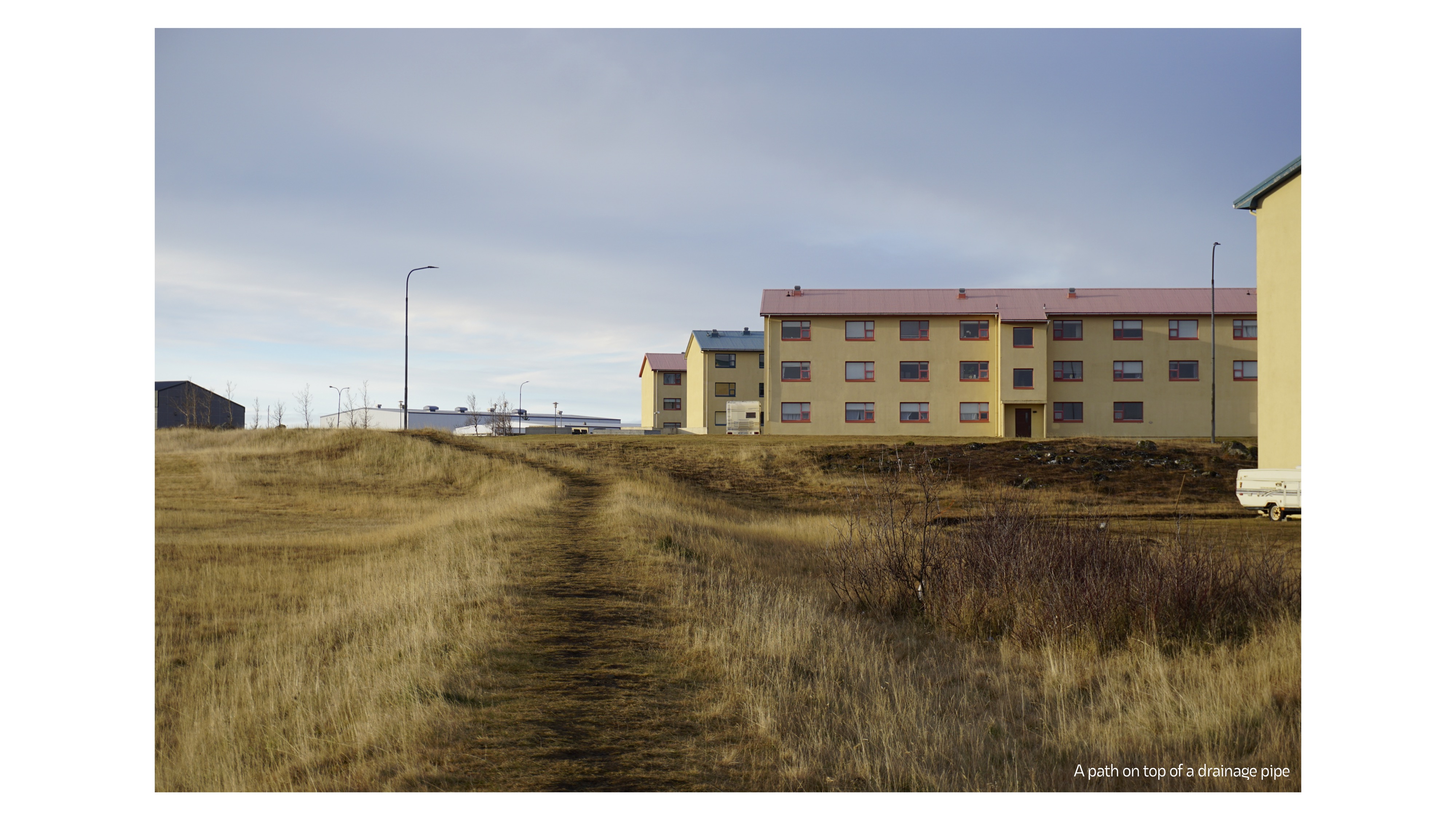
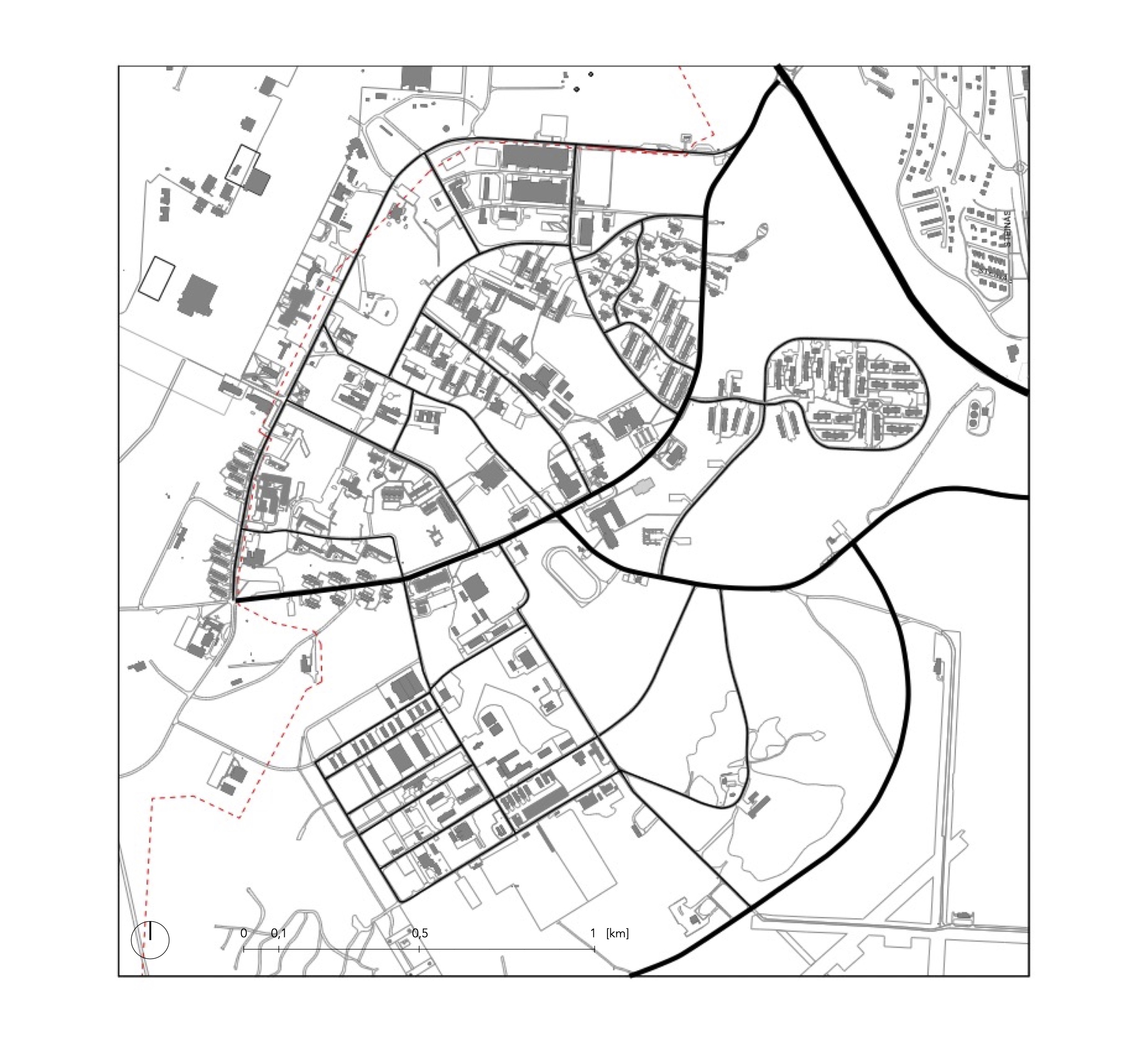
The layout of Ásbrú is dictated quite strongly by the layout of the streets, which separate huge blocks of buildings called megablocks. I was interested in how people get around on foot in this area, so I also mapped the walking paths and shortcuts. If we divide the quarters again with pedestrian paths we will see that these quarters are smaller.


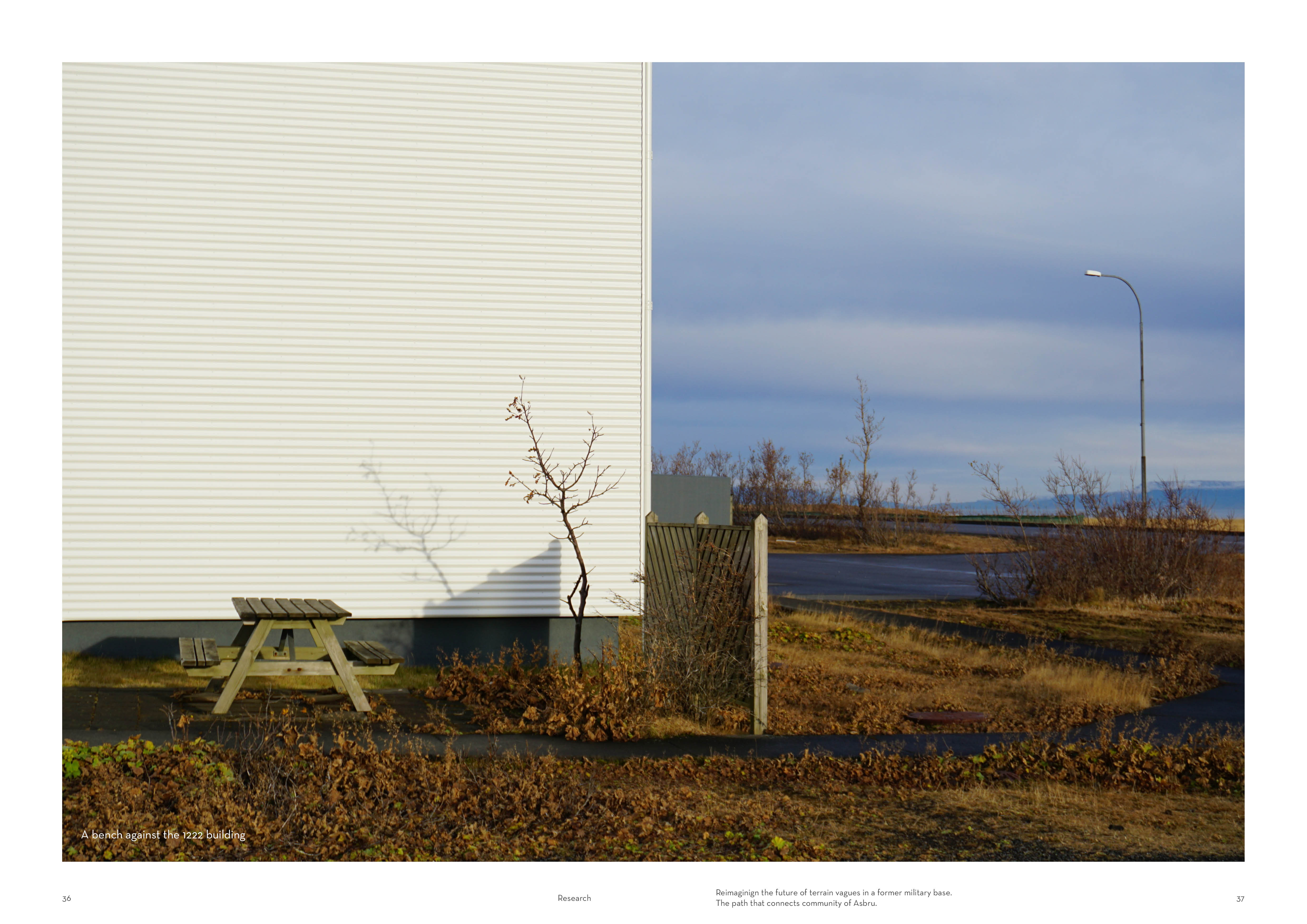
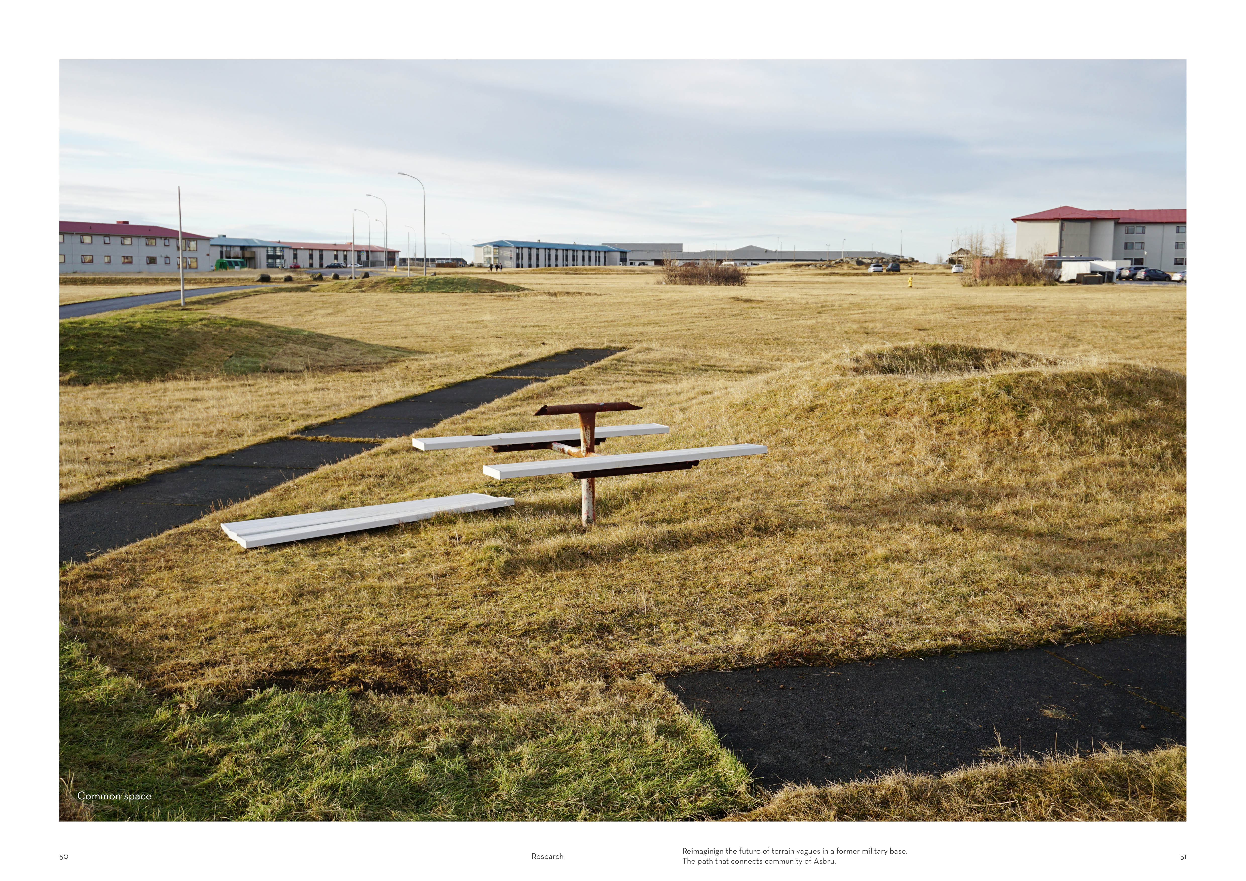
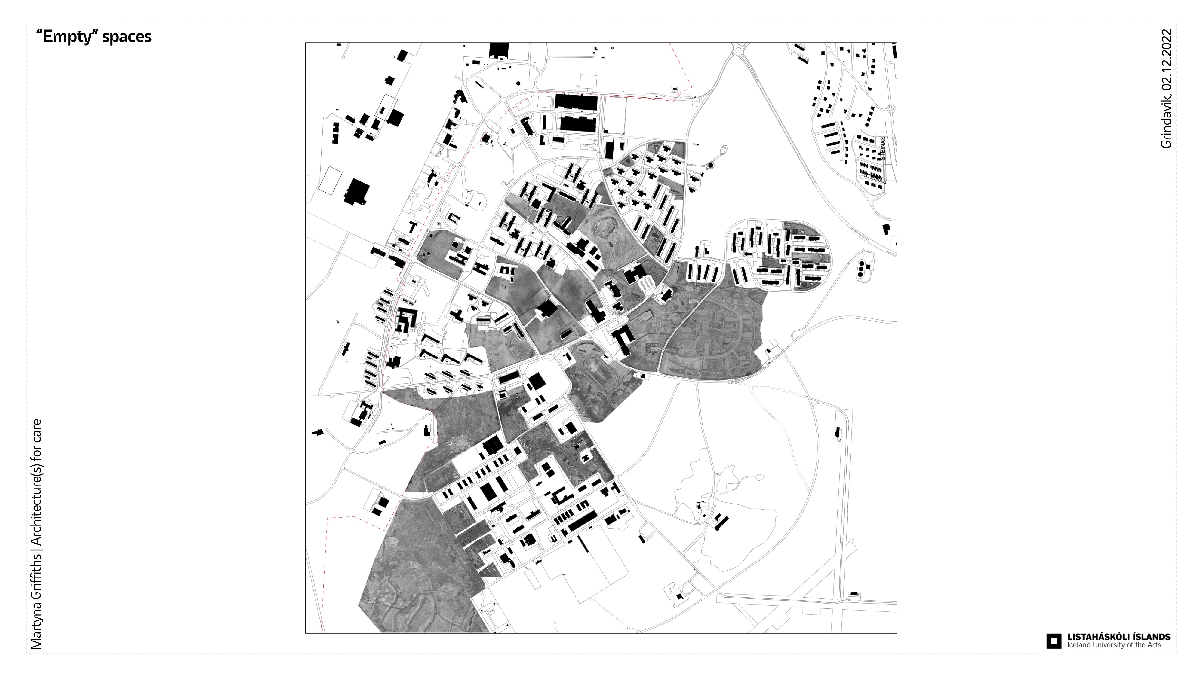
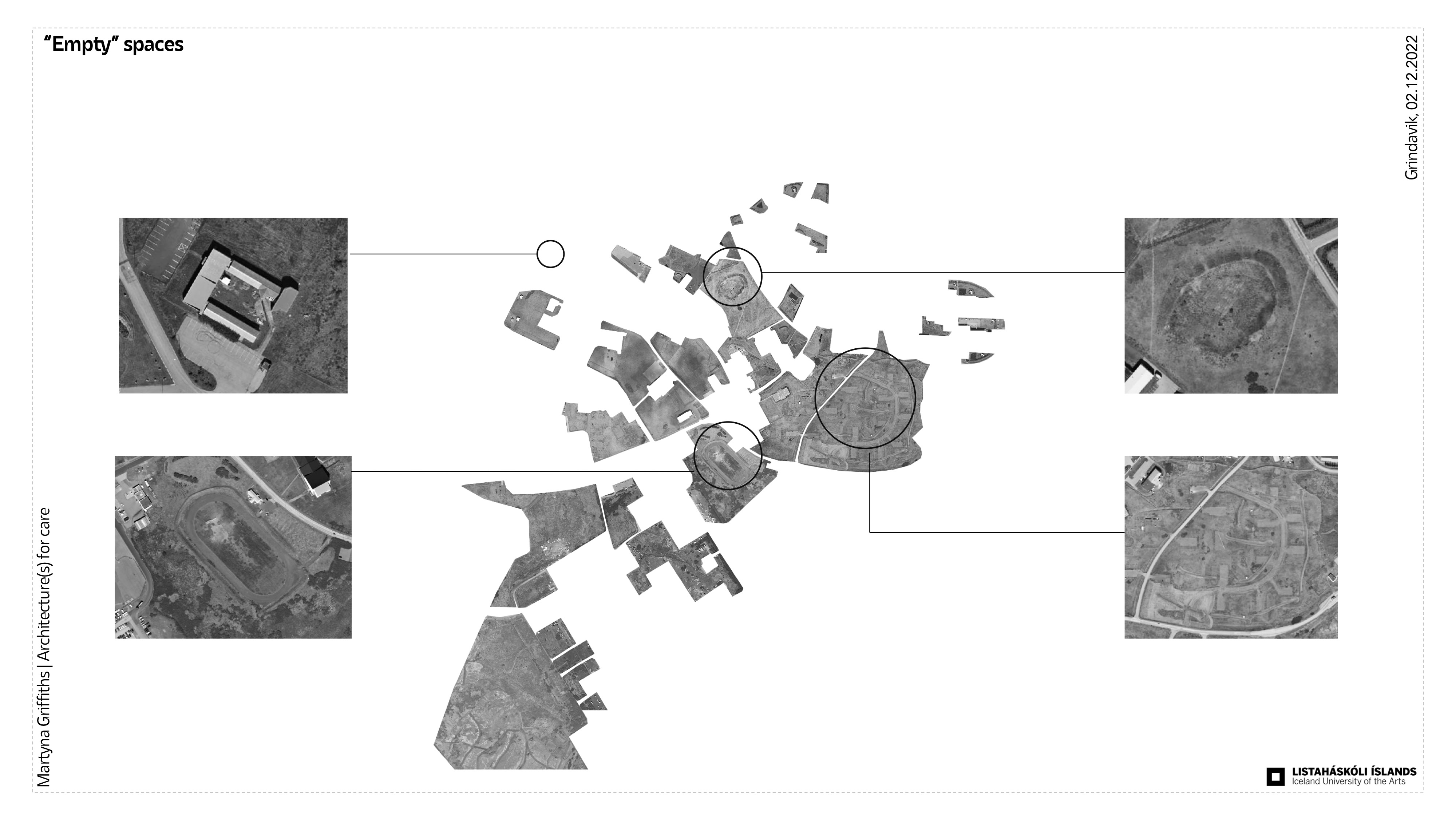
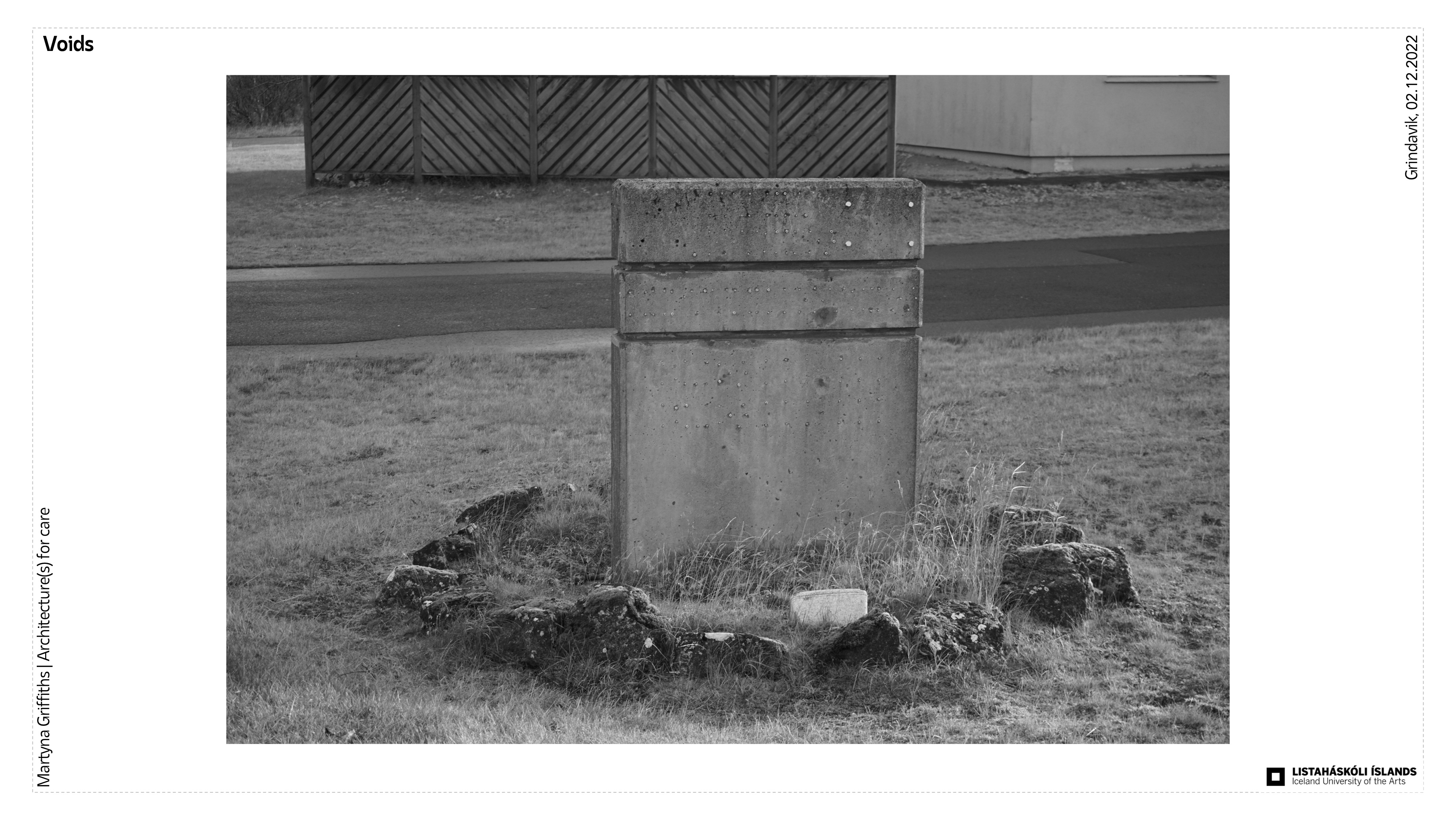
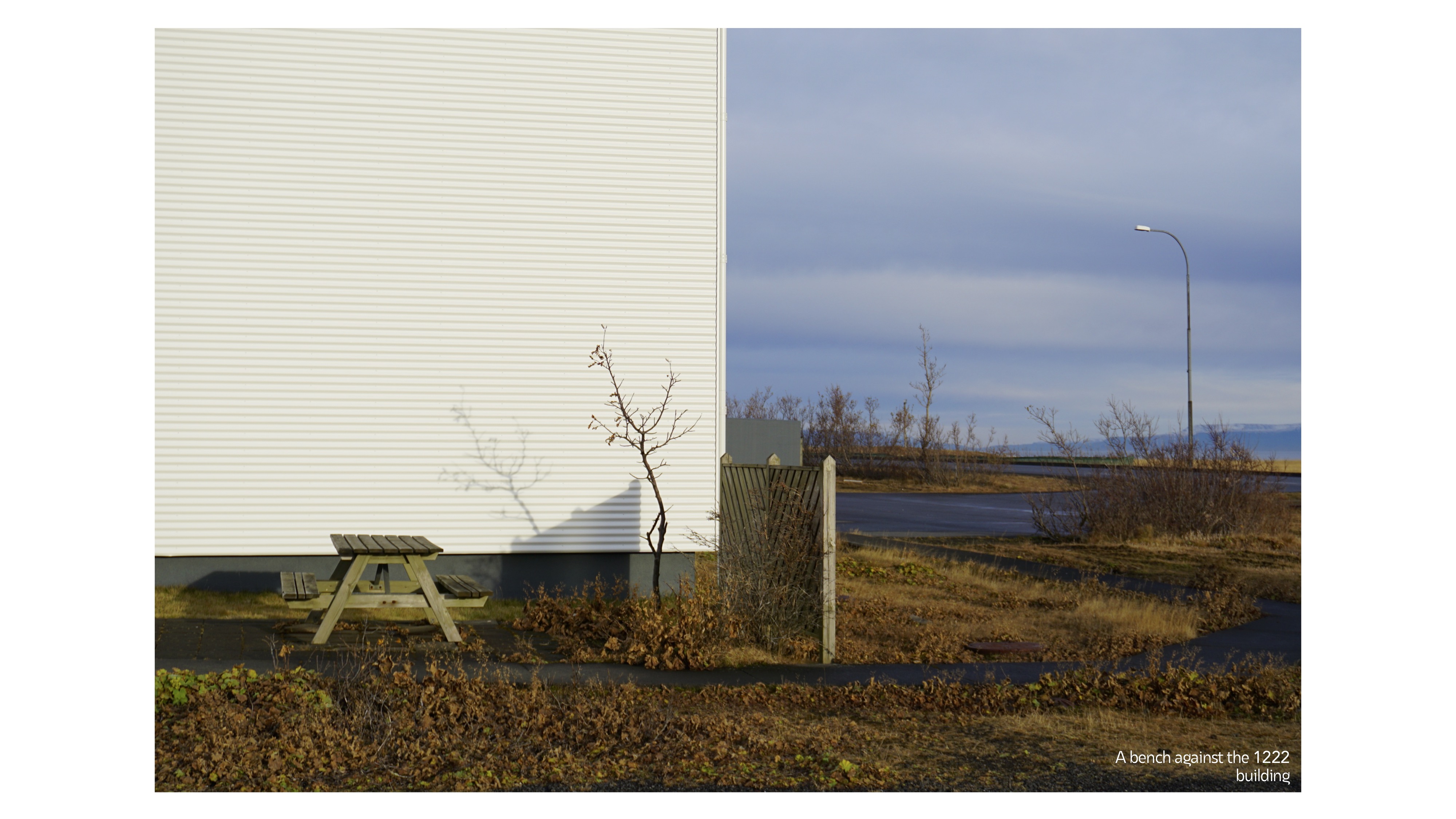
5. Empty spaces/voids
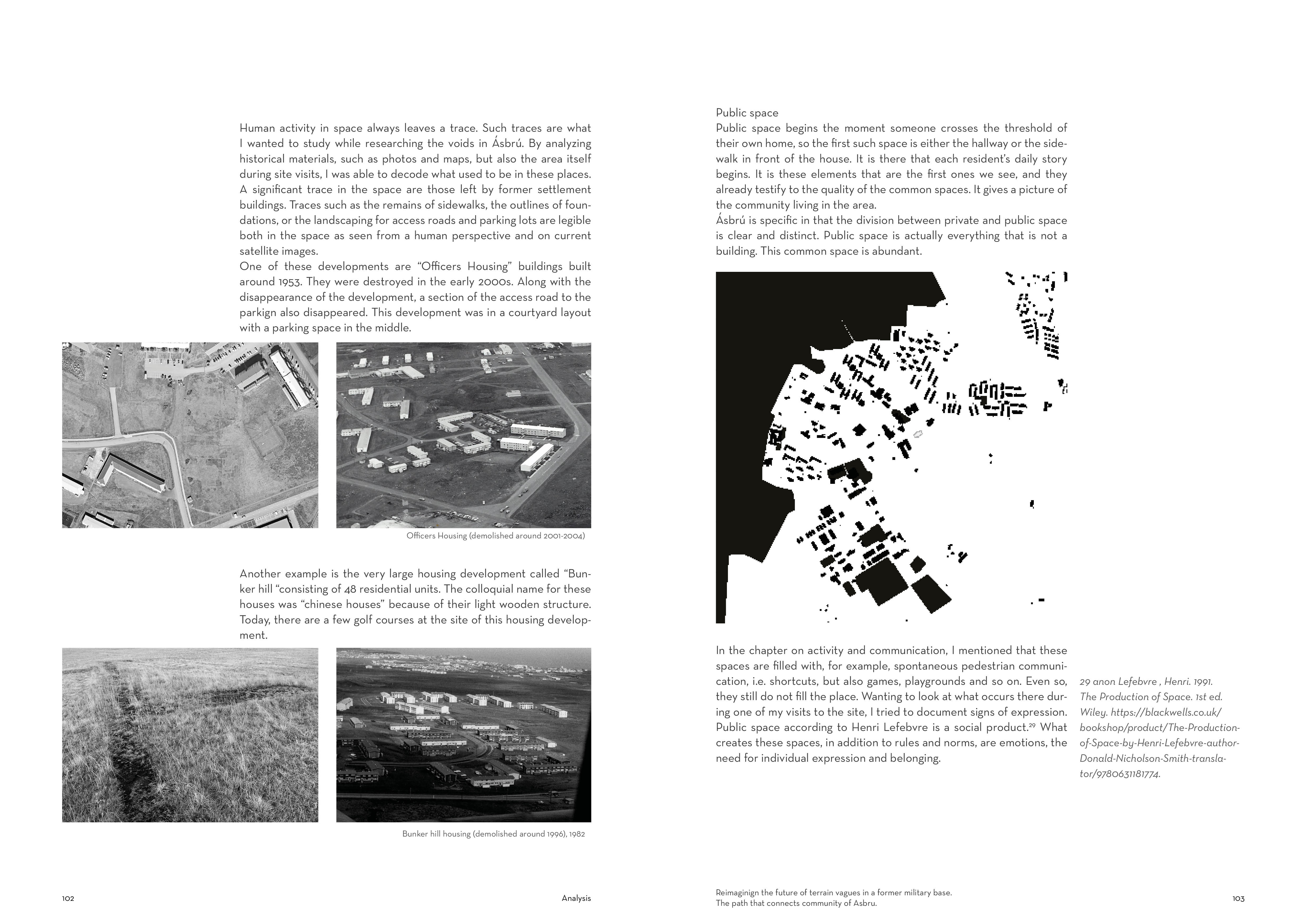
By analyzing the space, I wanted to illustrate the amount of empty unbuilt space that is in Ásbrú.
To illustrate what I'm saying here is a comparison of the same size section of Ásbrú and Keflavik (center). What you can see is a build-unbuild map, which also gives a lot of information, such as that at the time when the roads disappear from the layout, the layout of Ásbrú is very difficult to read, we do not know where the center is, we do not know where the streets run. White space shows the emptiness between objects.

Empty spaces are never empty.

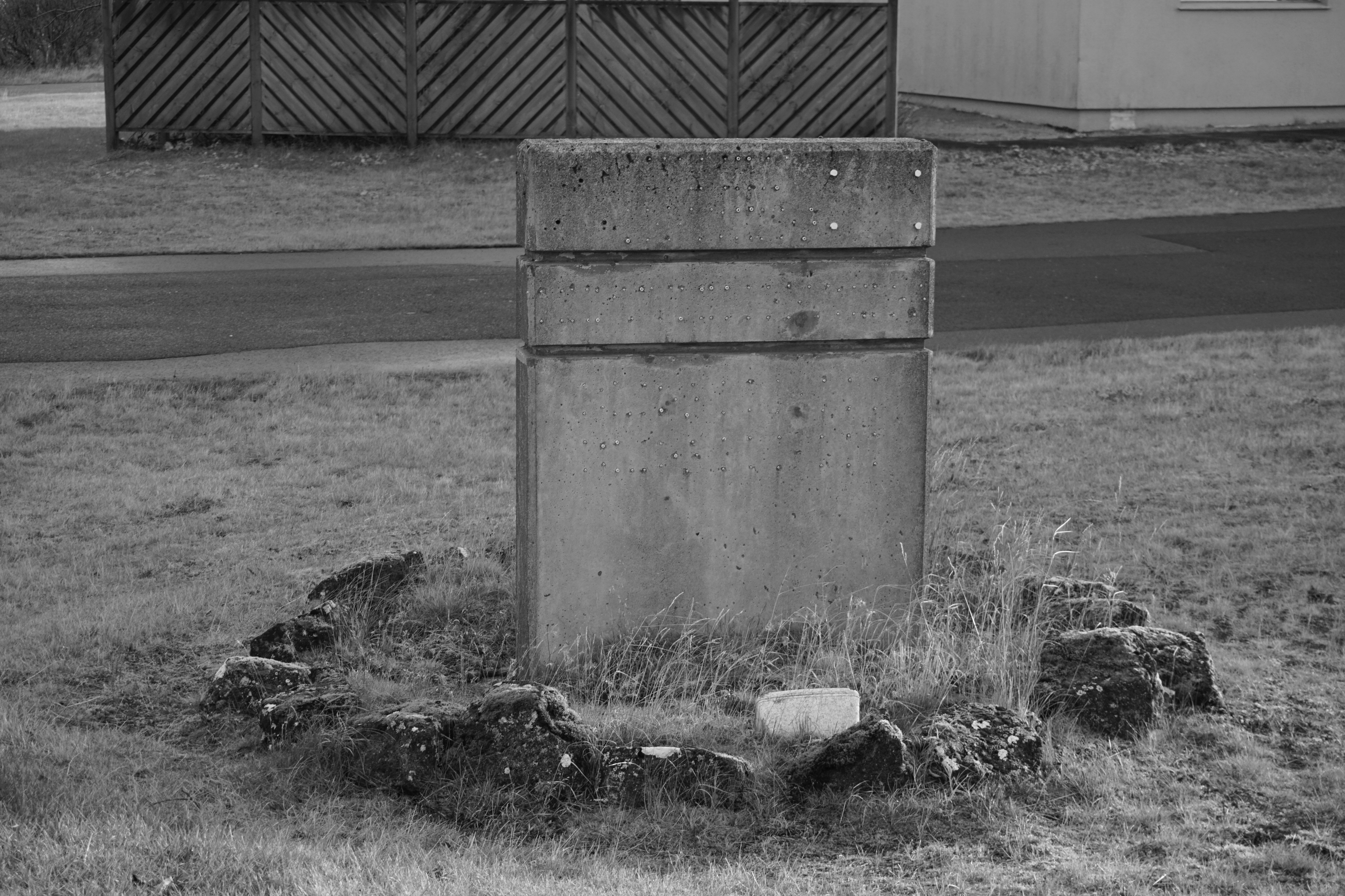
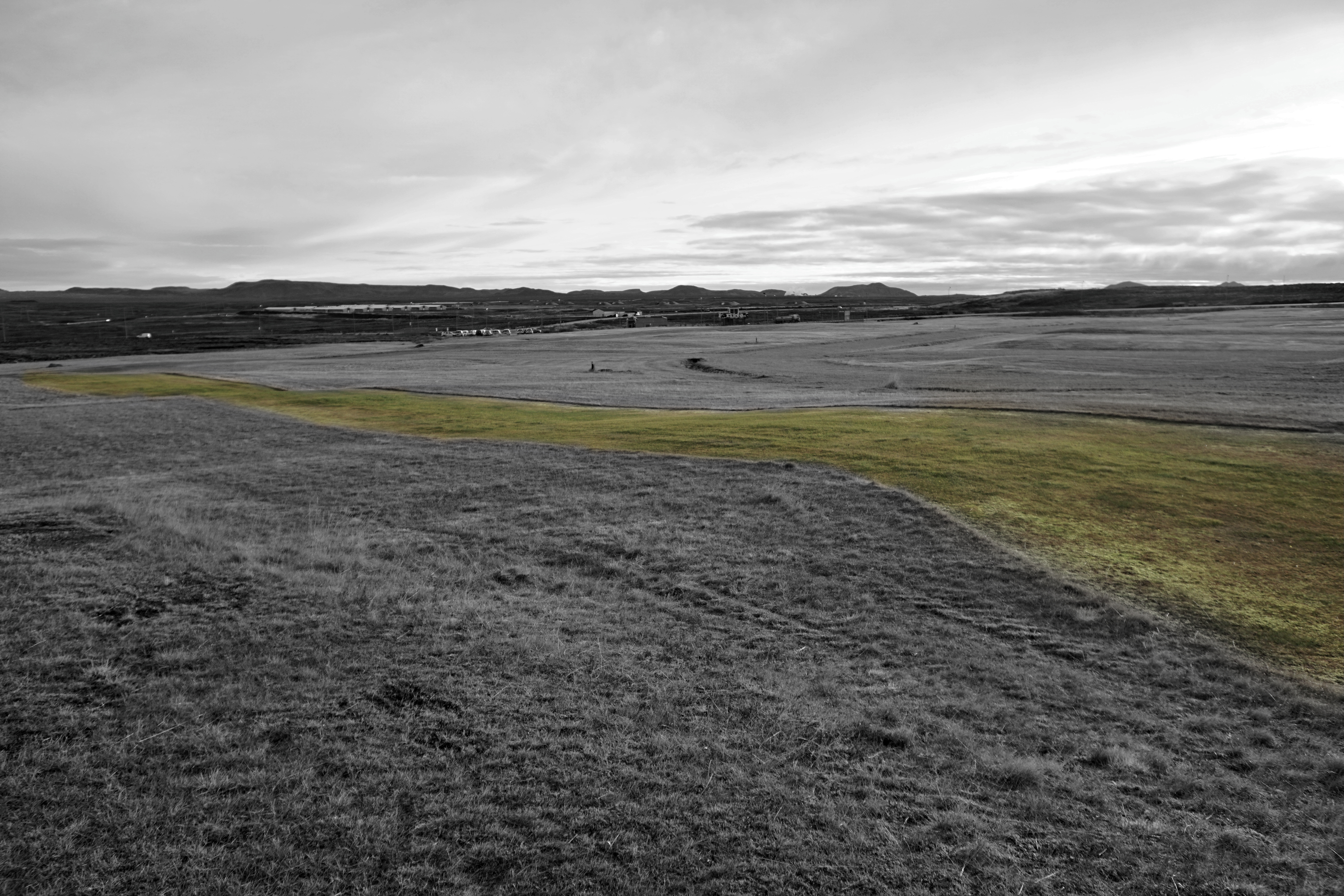
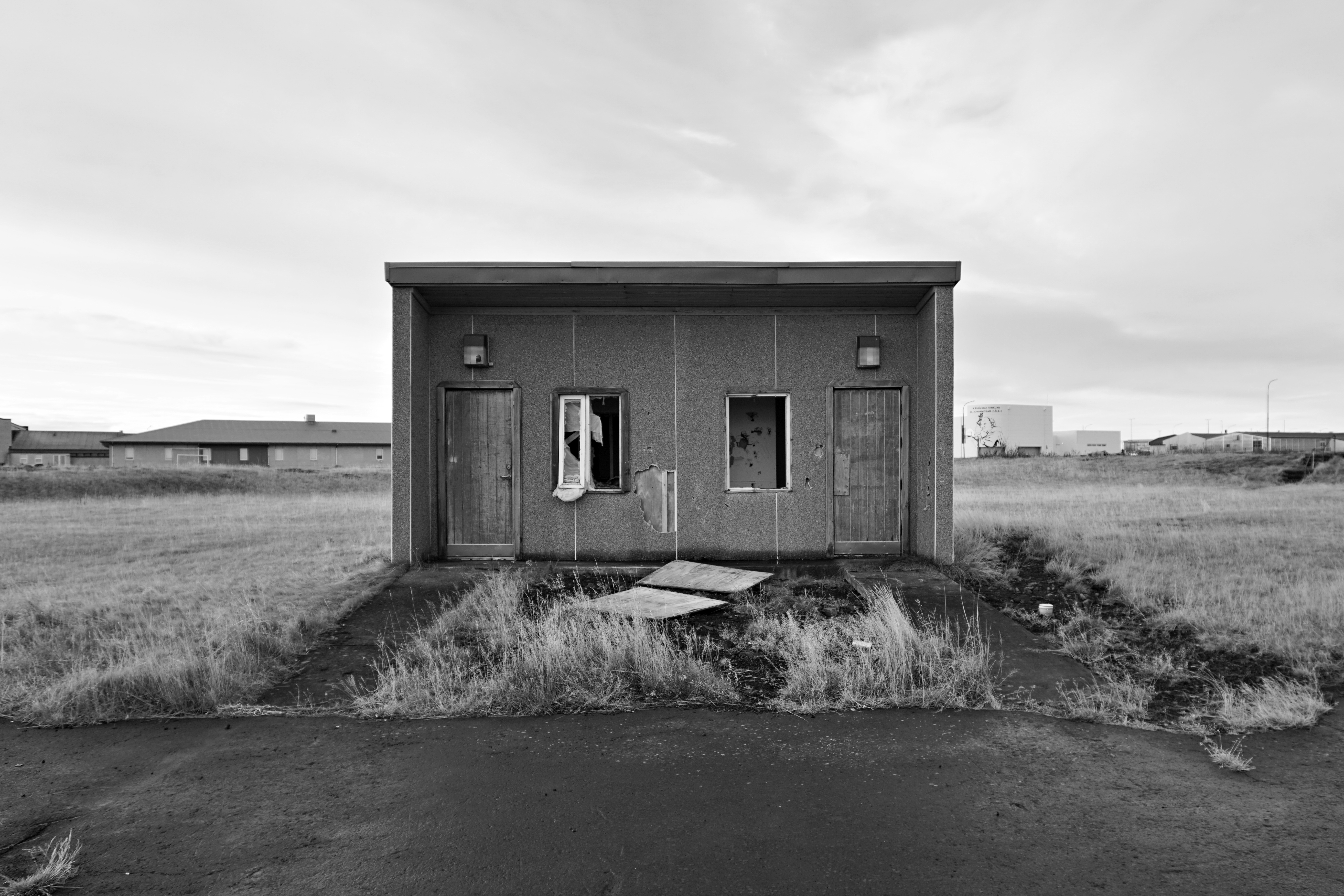
I highlighted 4 sites:
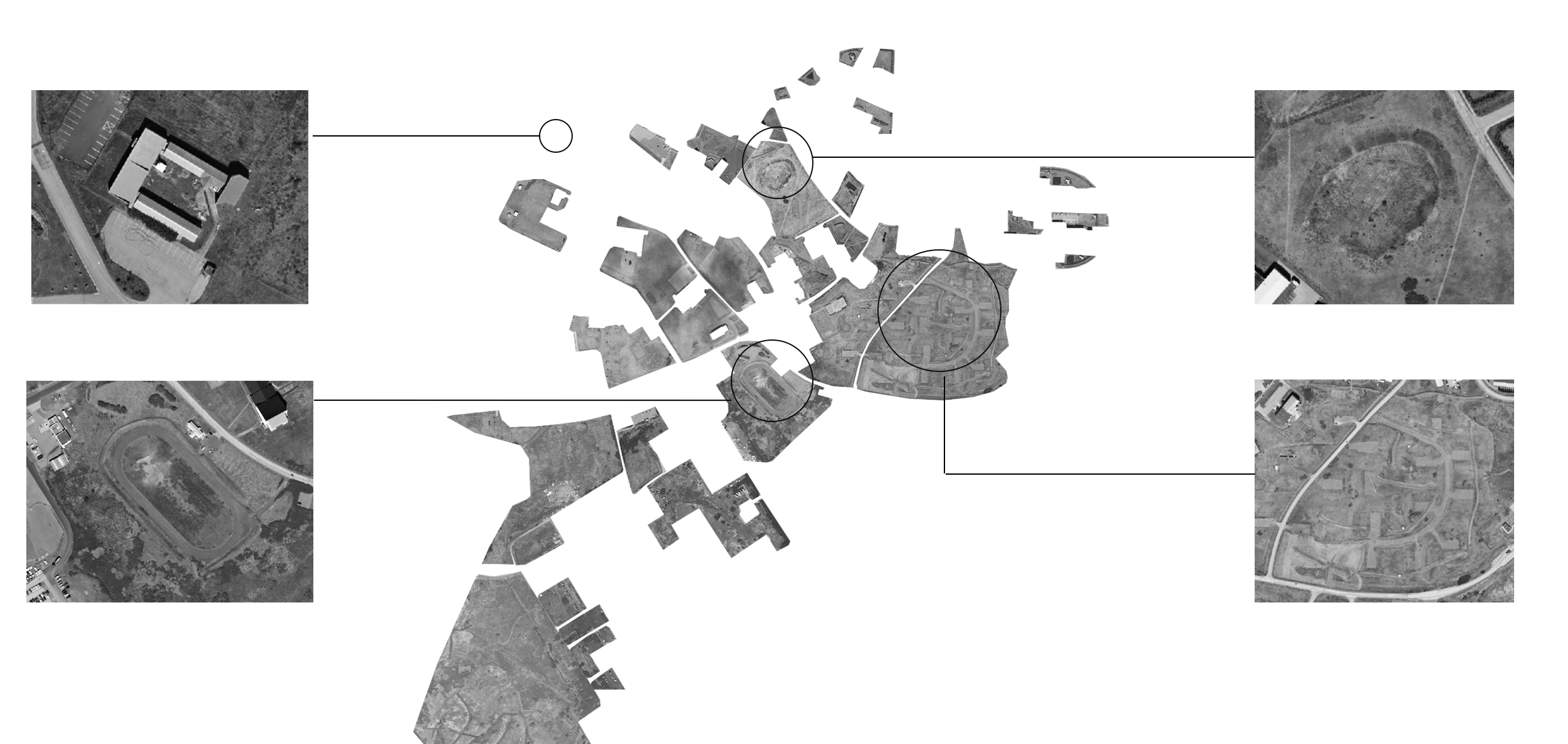
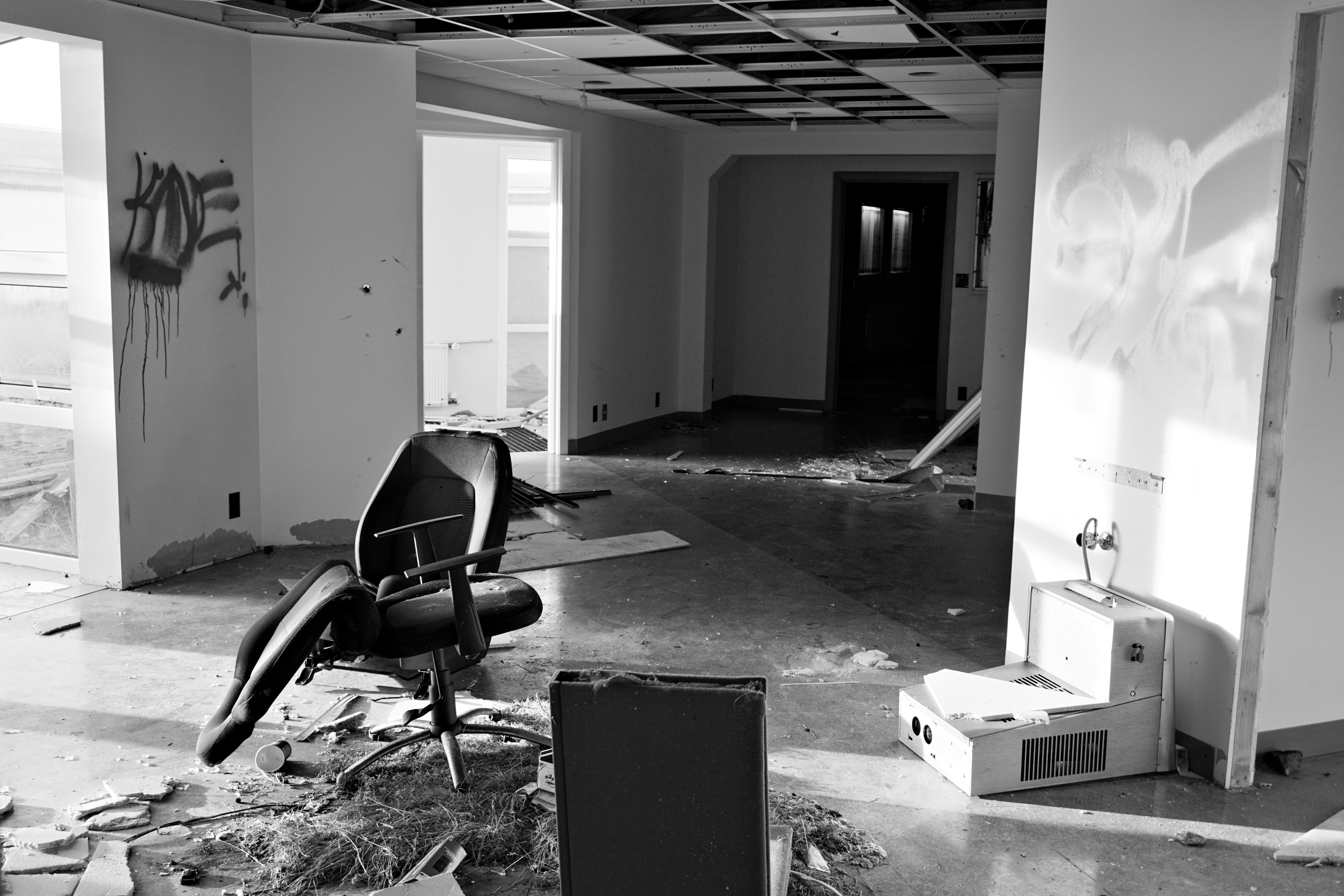
- Abandoned police station building,
- An inactive stadium
-The embankment in the central part of the asbru
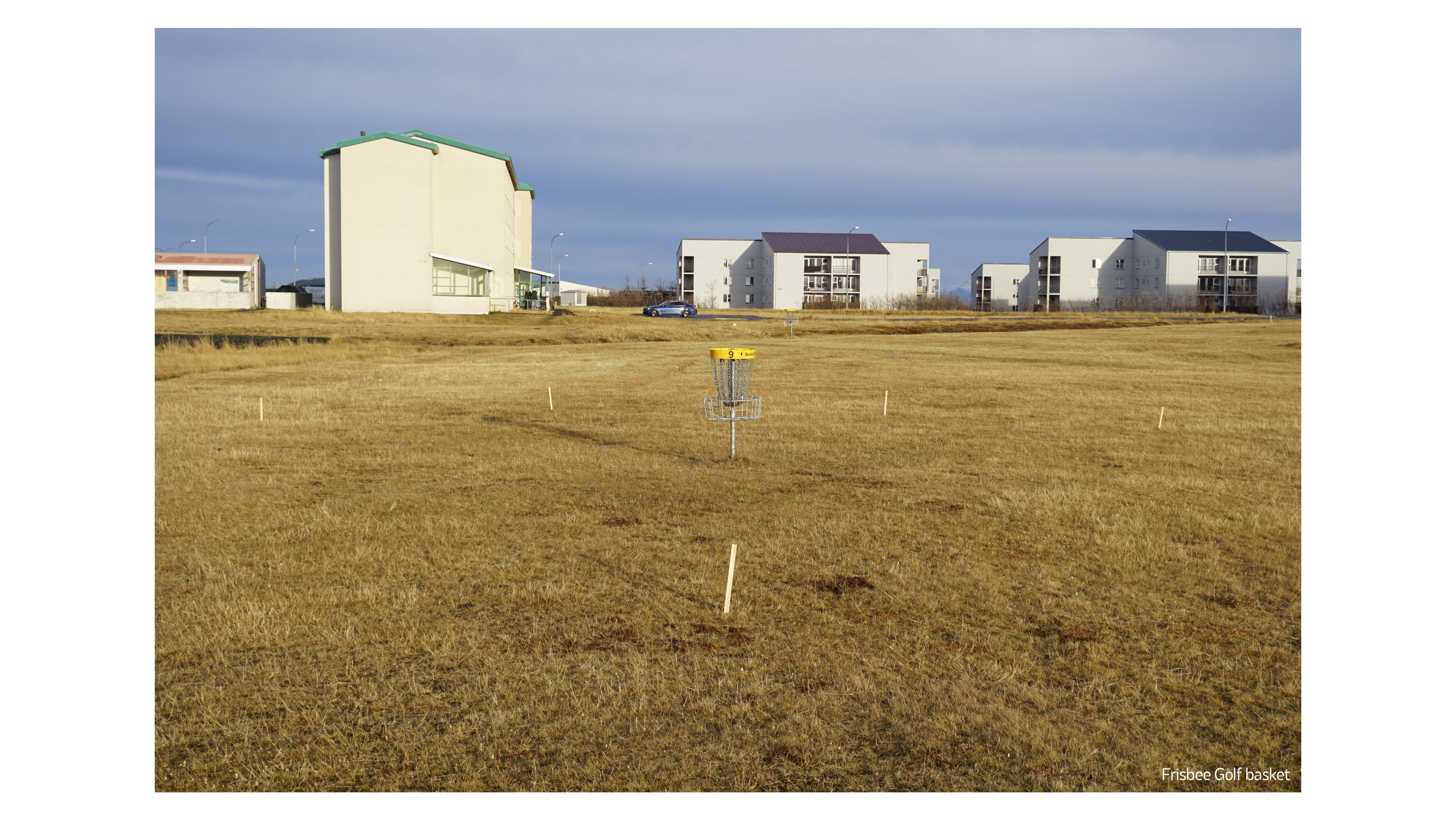
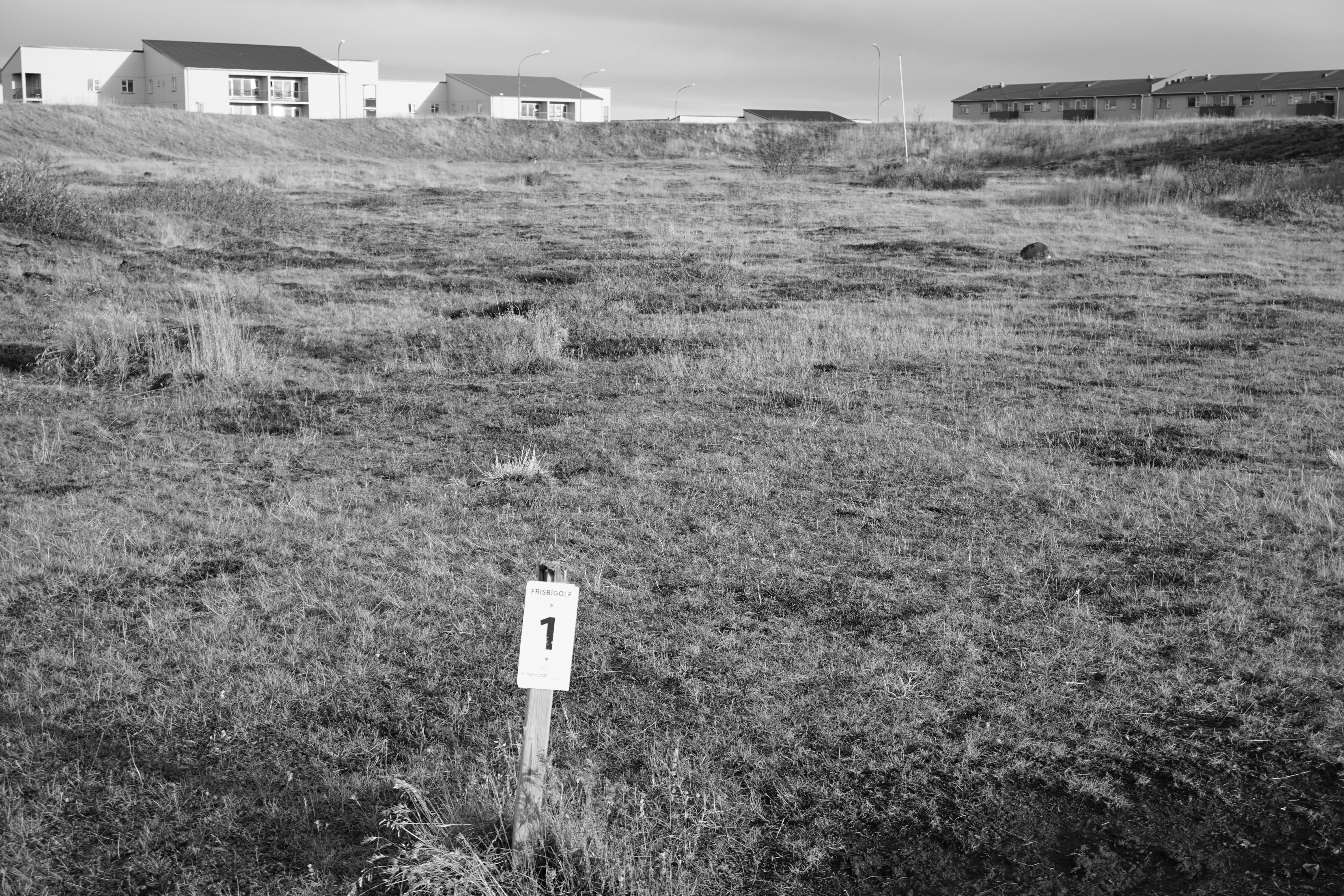
area of former "Chinese houses", which today is a place for golf fans

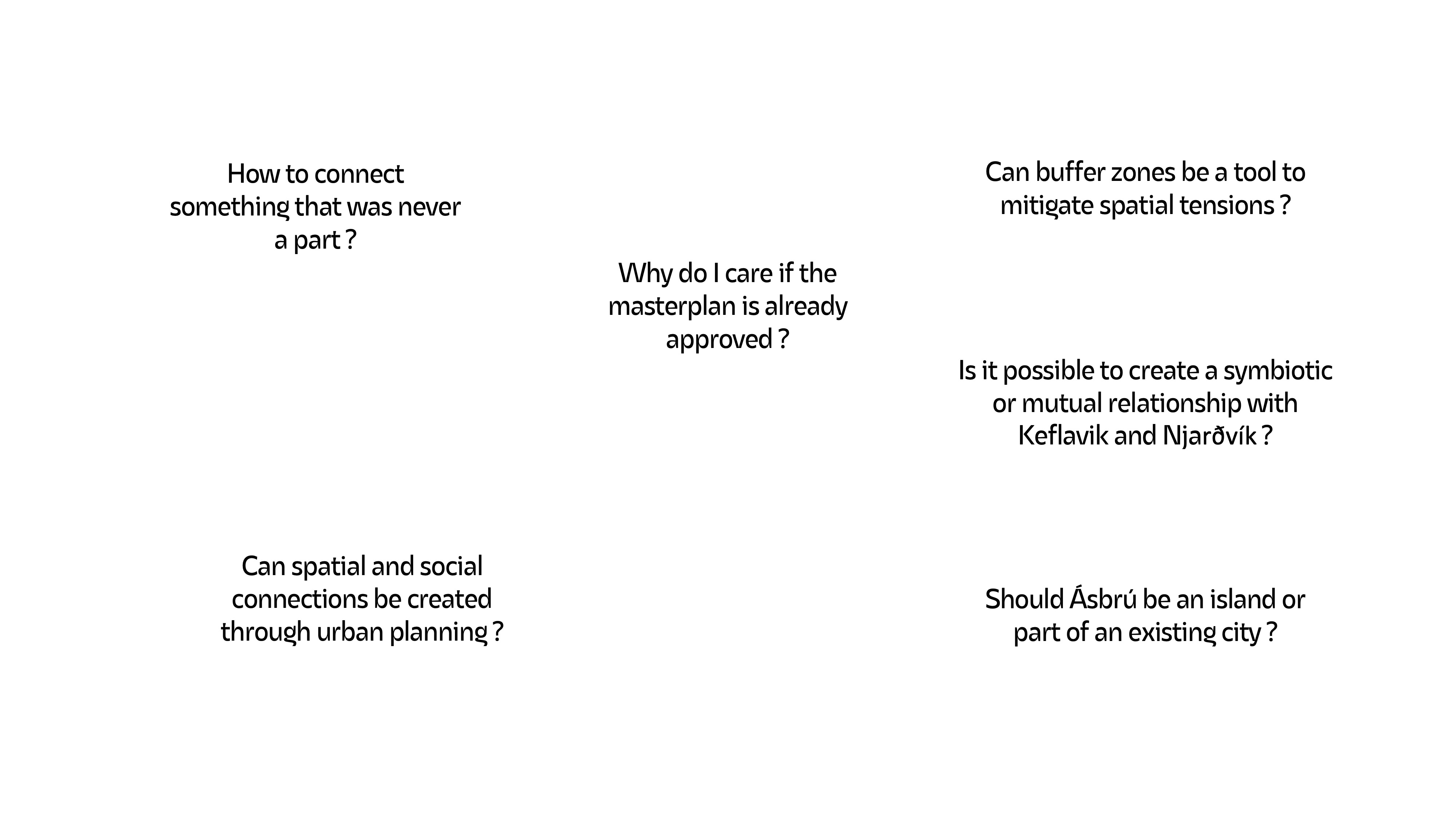
Problem posing
The main problem with Ásbrú is that it is hard to clearly define
what it is. Is it a neighbourhood, a part of a city, a remnant of a base or
perhaps a town in itself? To me it is currently an island on an island. It is
equally difficult to define clearly the boundaries of this place. In fact just before
the army left the base the barriers were clear – there was a fence. So even
though the fence doesn’t exist anymore, I can feel that a barrier is still
there.
Ásbrú is the fastest growing place in the municipality - in 3 years (2015-2018) the population of asbru more than doubled and now it is predicted that the district may grow by another 4,700 thousand people in 8 years from now (until the end of 2030) - according to a study conducted by kadeco.
Currently, 65% of asbru's population are foreigners, making Icelanders a minority here so it is a very sensitive urban fabric in terms of any transition.
The problem I see concerns both Ásbrú and the approach to urban planning. Planning for rapid population growth raises the question of how to create structures that are life-giving and community-creating
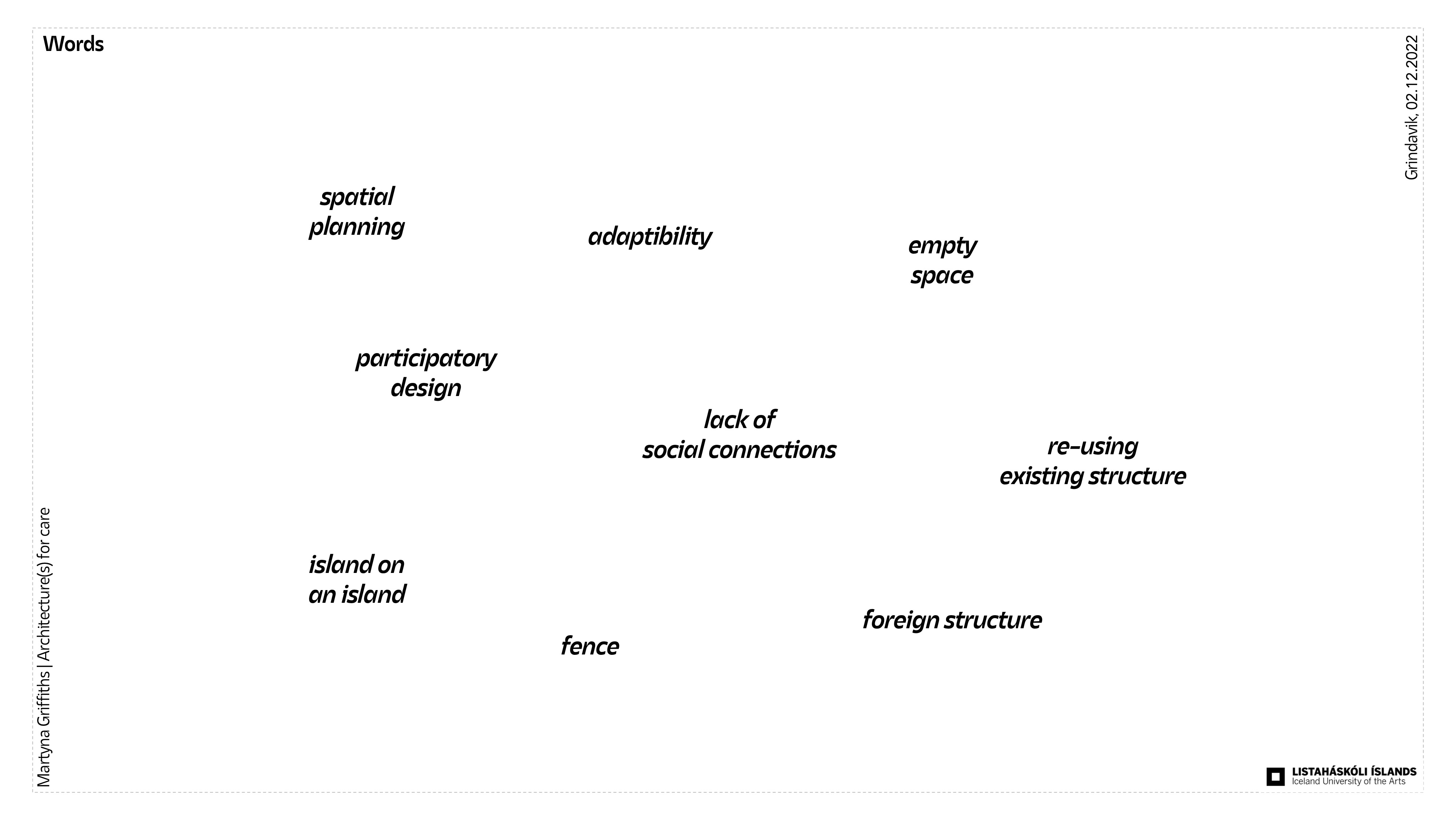
While gathering information, the following words kept popping up in my head... which, after thinking about it for a while, are connected to each other.


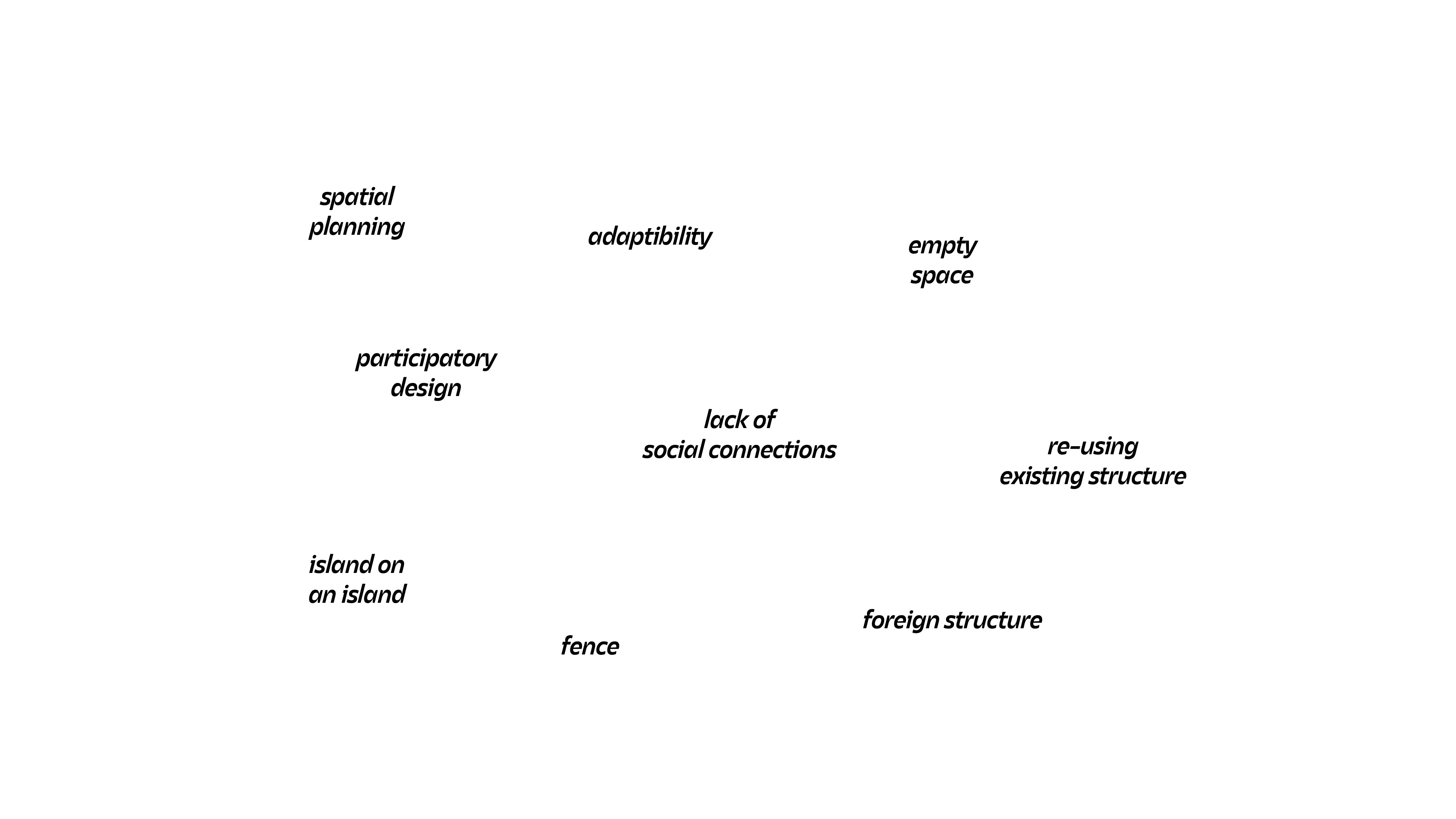

This helped me create questions that helped me form what might be the problem...


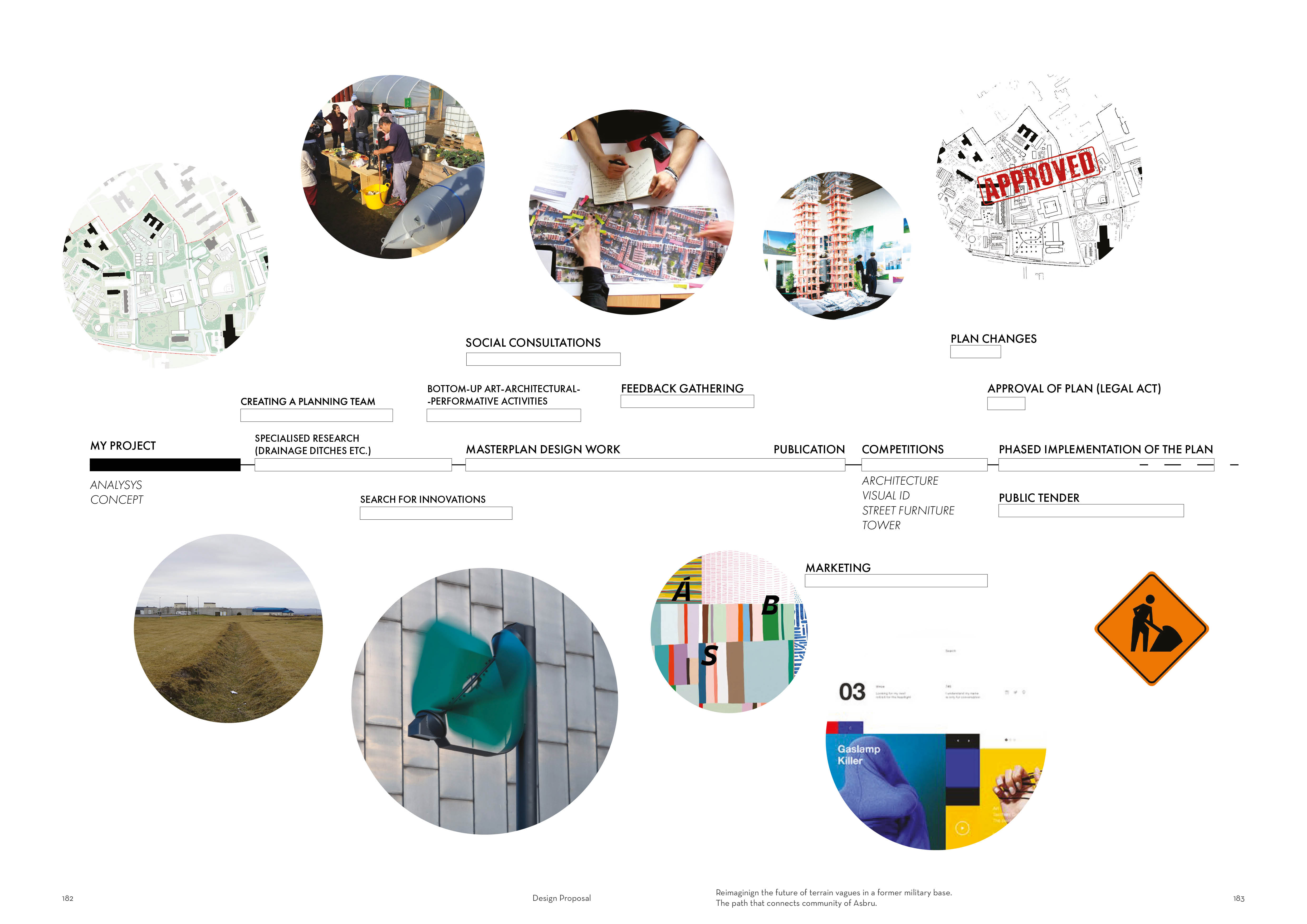
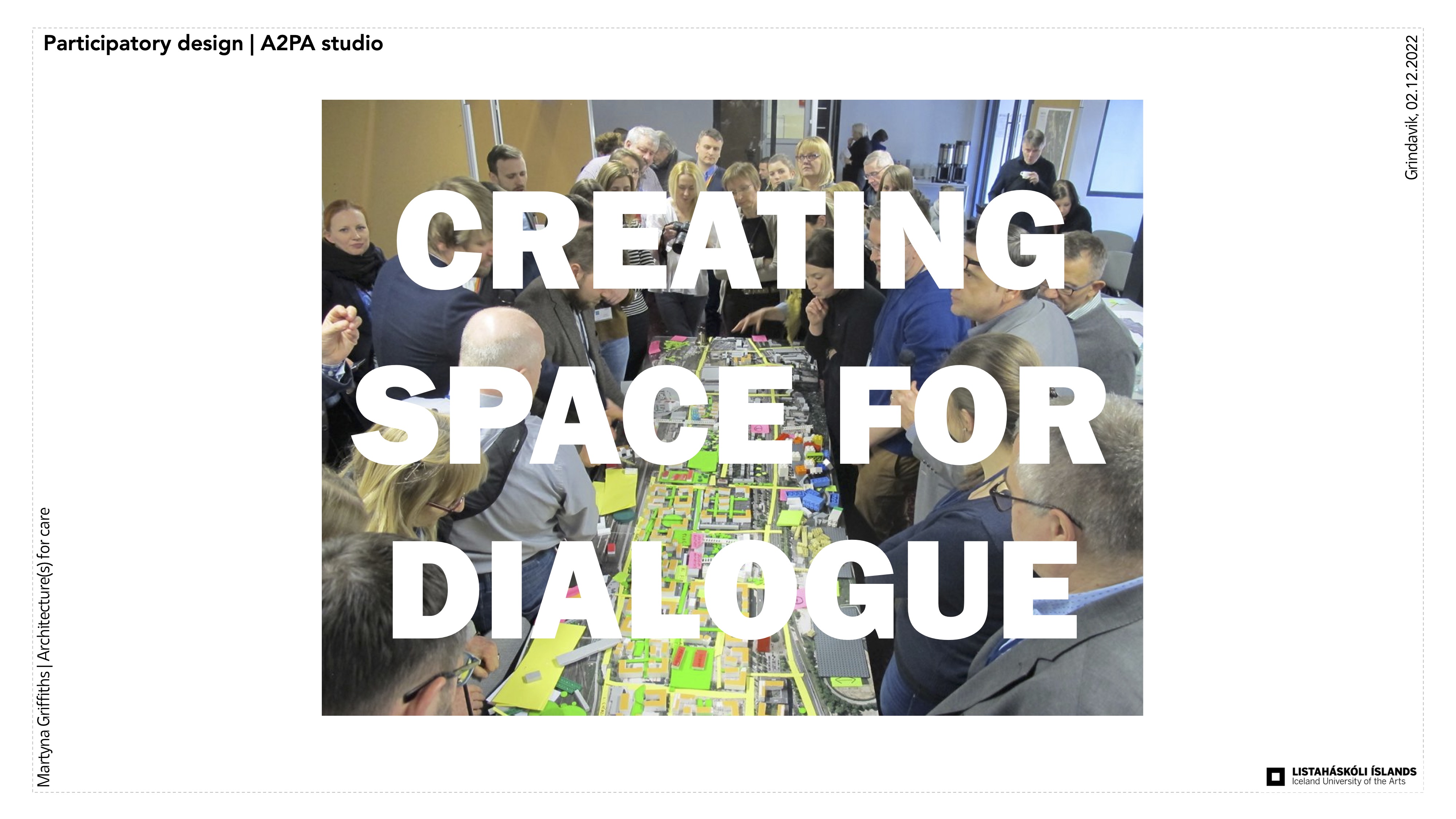
Methodology of design
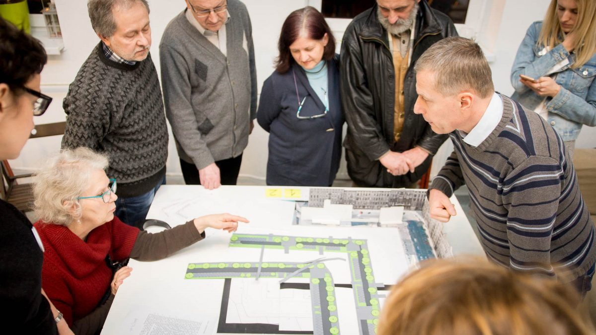
I believe that planning is
first and foremost about listening to needs, so in order to make the vision as
appropriate as possible I would like to support my project with a method called participatory design.

Quotes from the article:
”in this article I discuss participatory design as a research methodology, characterizing it as a way to understand knowledge by doing: the traditional, tracit, and often invisible (in the sense of Nordi and Engeström 1999; Muller 1999) ways that people perform their everyday activities and how those activities might be shaped productively.”
“participatory design is research”
“The developers of participatory design believed that politically and ethically, the two types of knowledge (participants’ tacit knowledge and researchers’ abstract, analytical knowledge) must be bridged, with each being valued by all involved in the research”
“When we think of knowledge, we often think of explicit forms of knowledge: things that are written down, defined, categorized, systematized, or quantified. But to understand knowledge-making in participatory design, we have to understand that much knowledge tends to be tacit. Tacit knowledge is implicit rather than explicit, holistic rather than bounded and systematized; it is what people know without being able to articulate”
A2PA is a polish studio that supprots their projects by using this method.
https://a2p2.pl/en/projects/
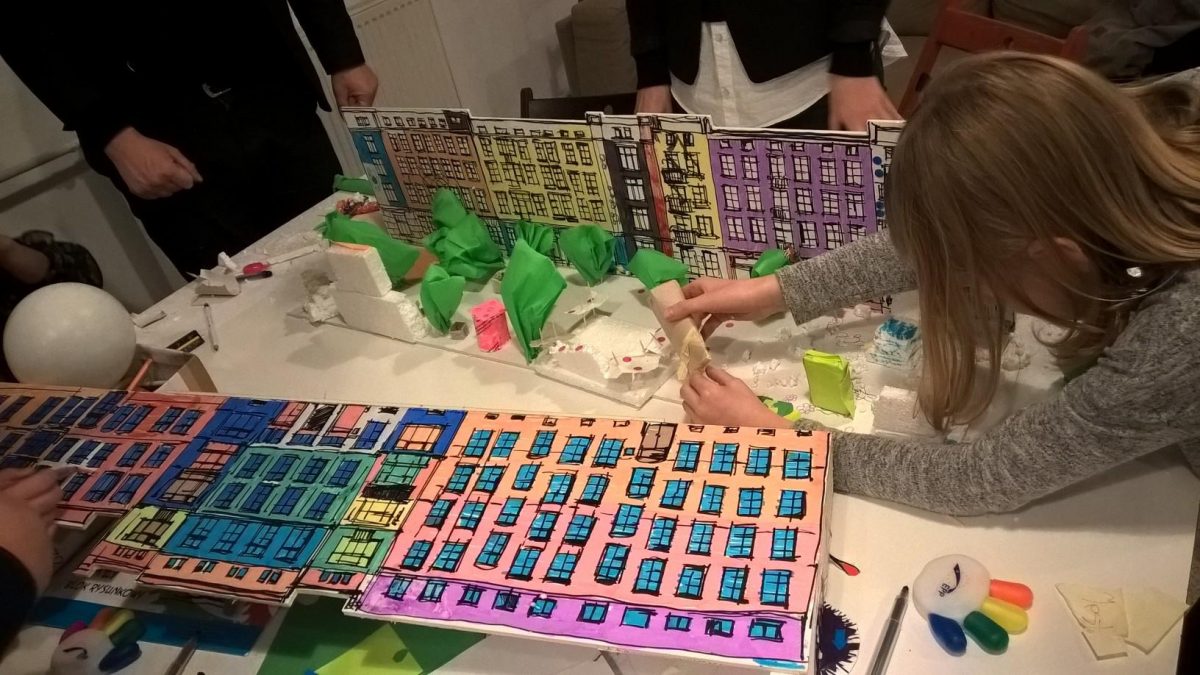
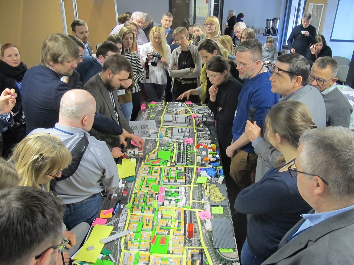
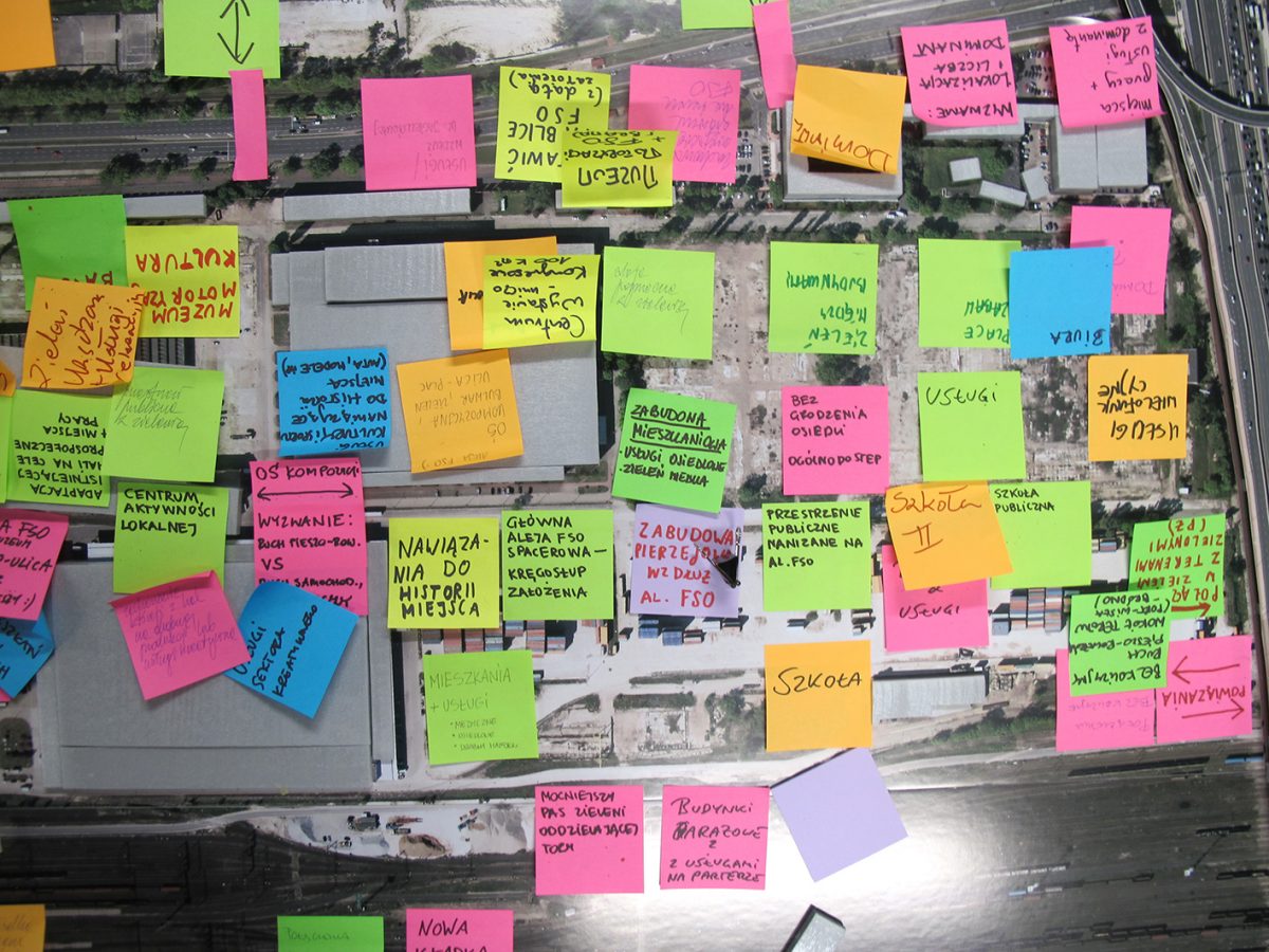
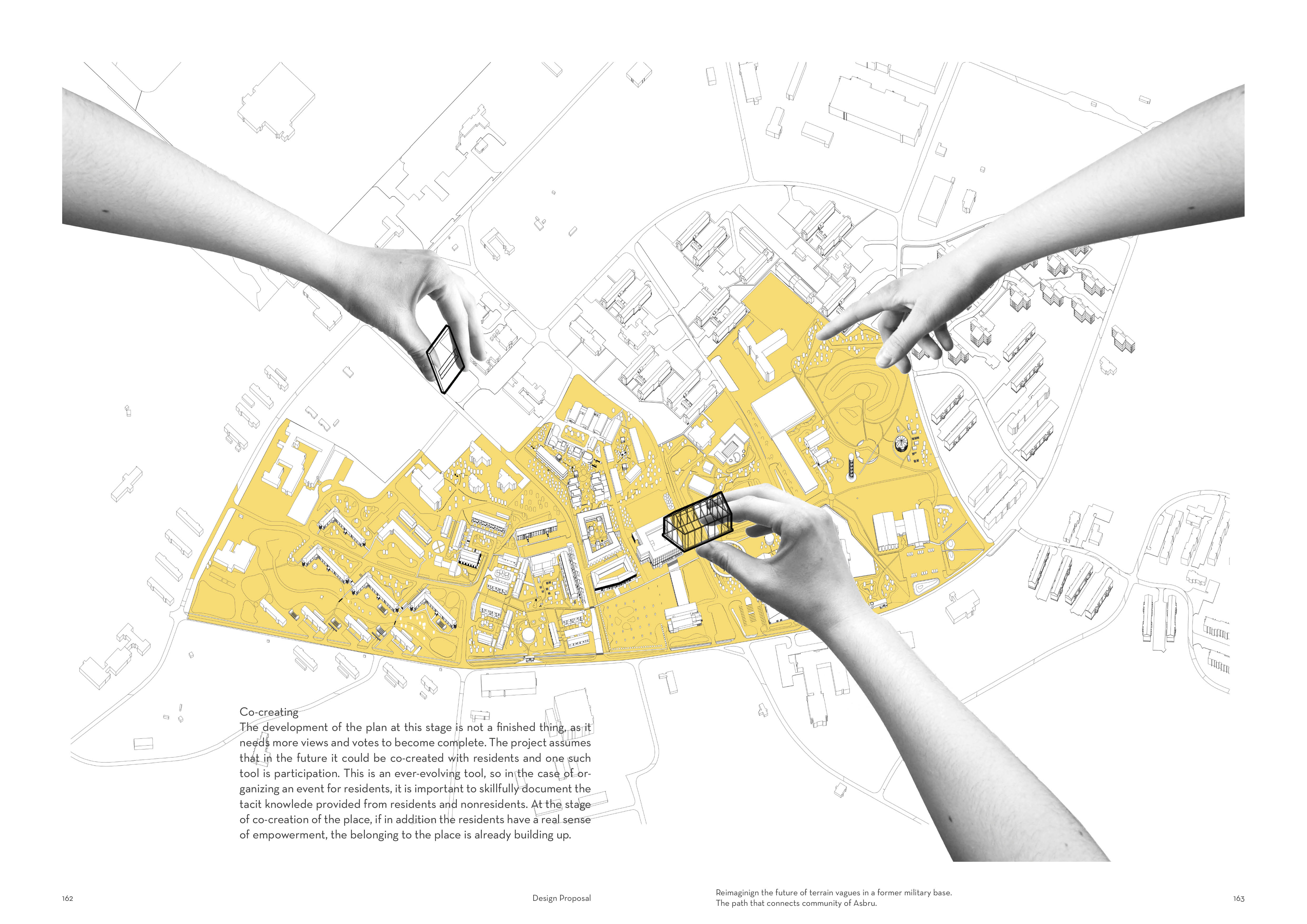
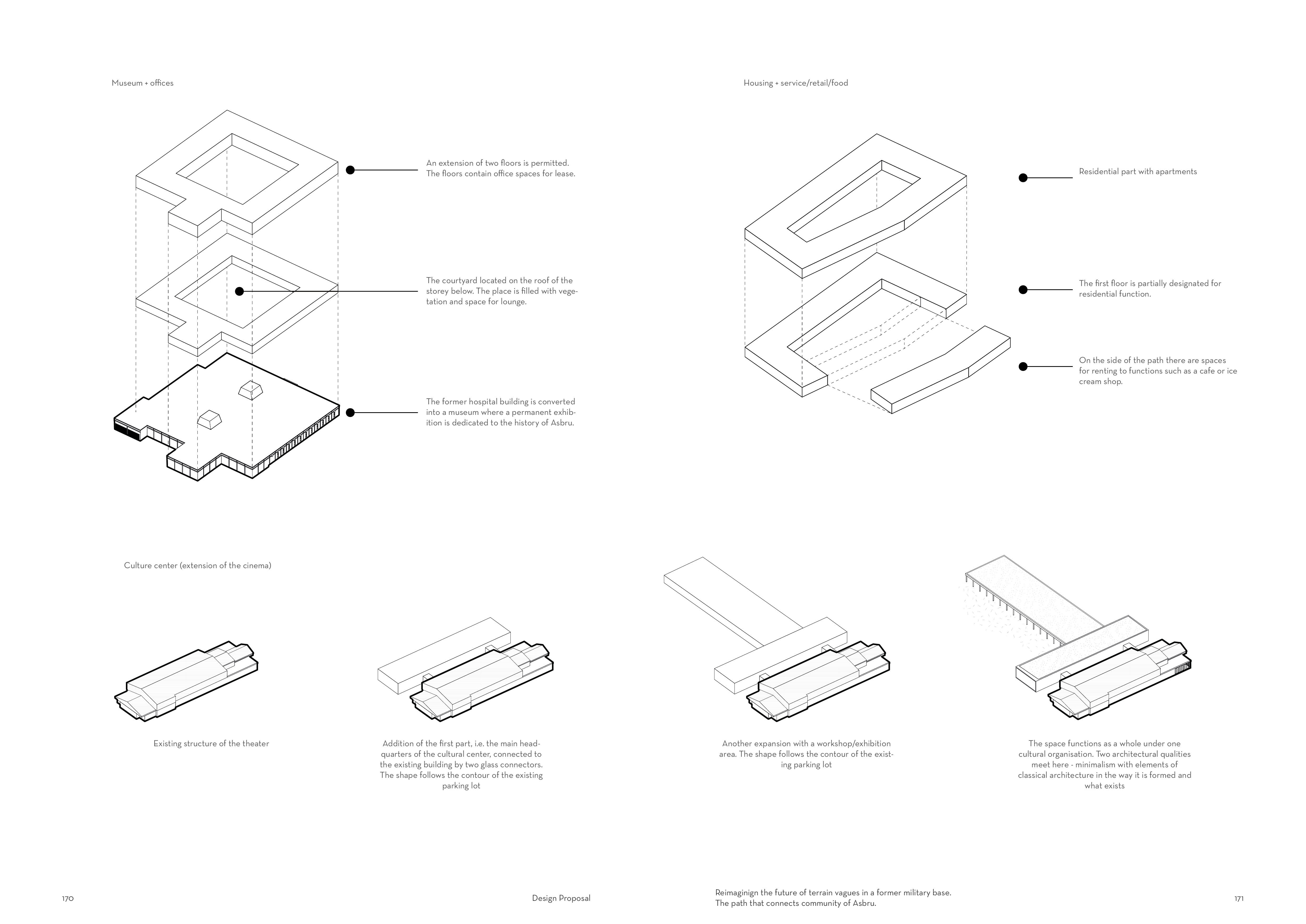
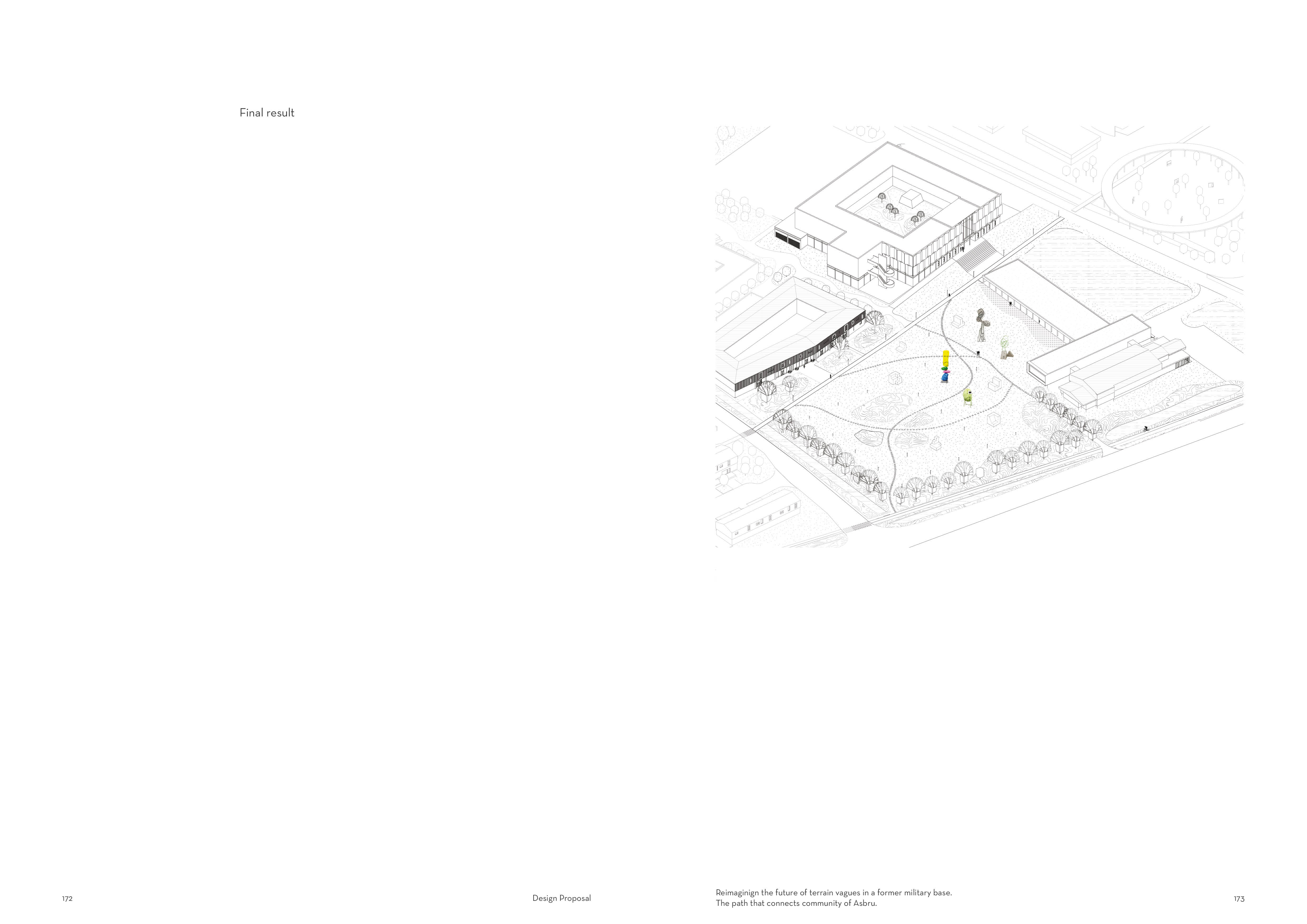
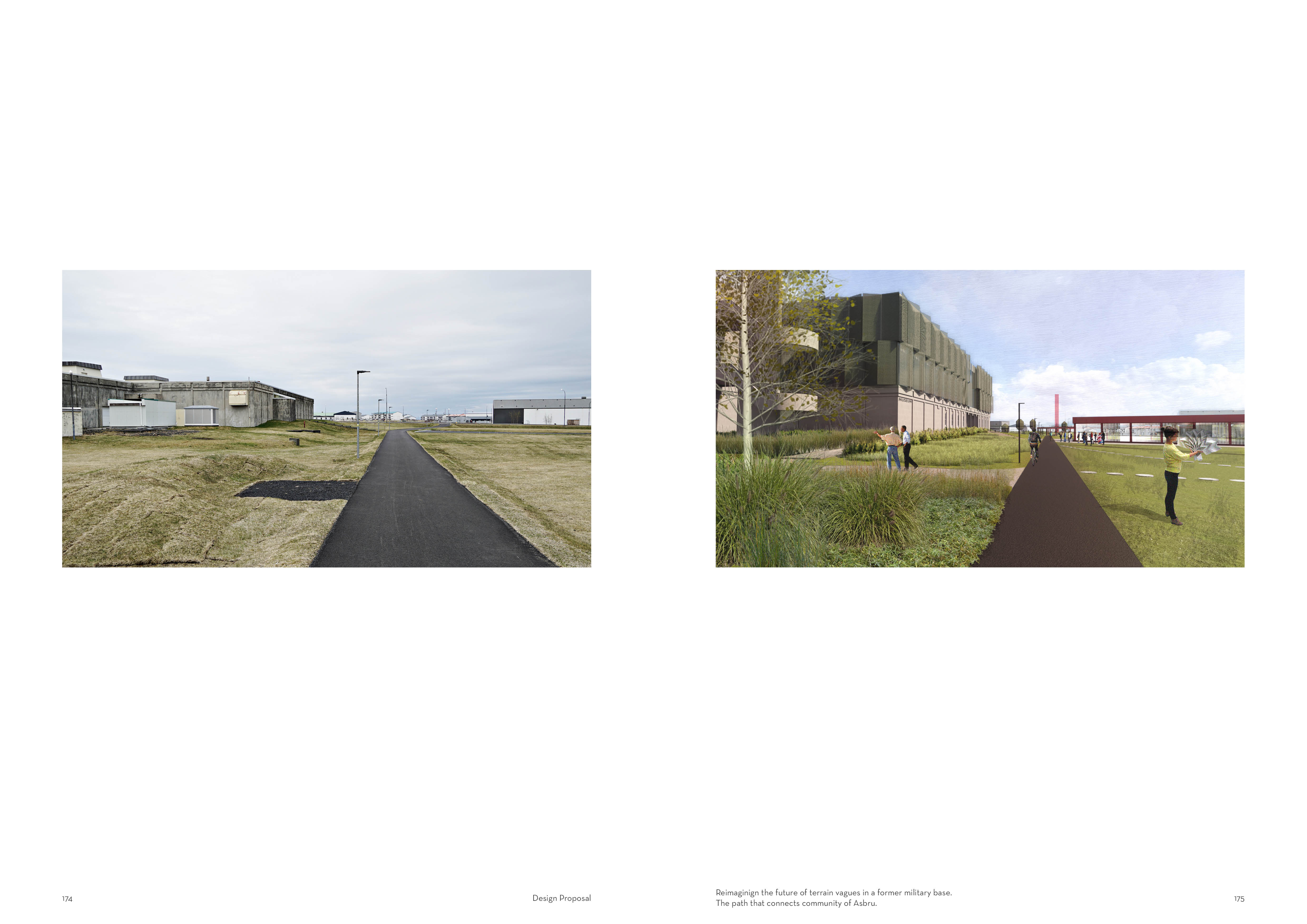
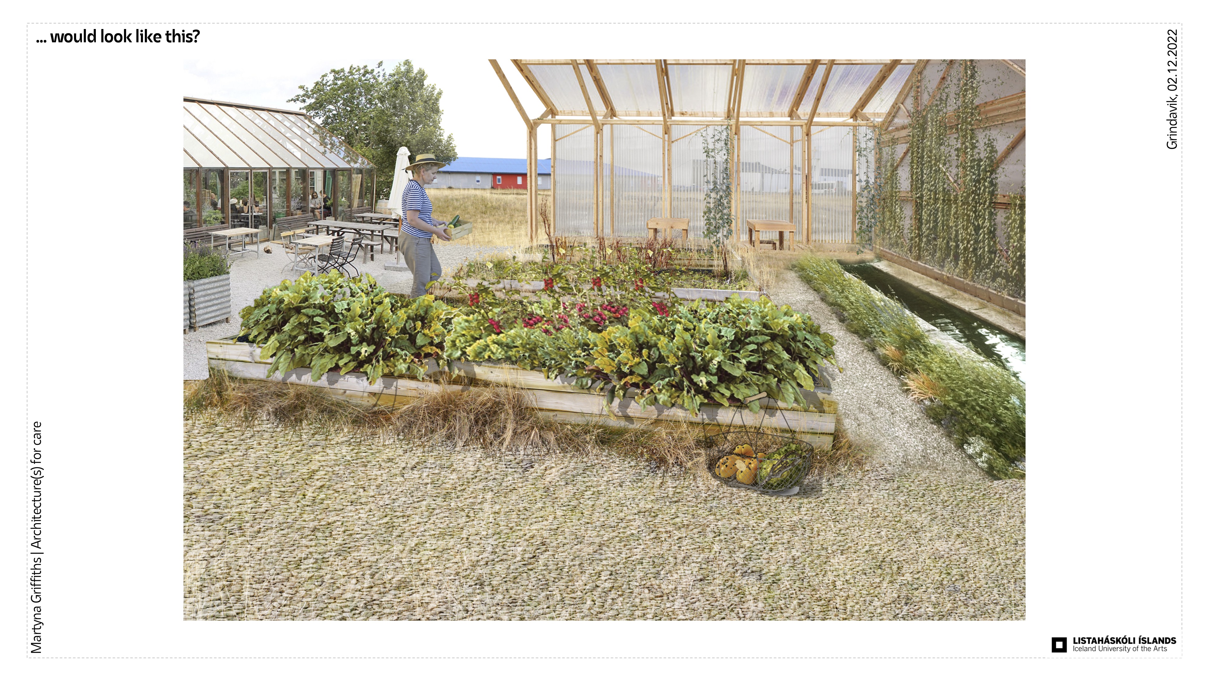
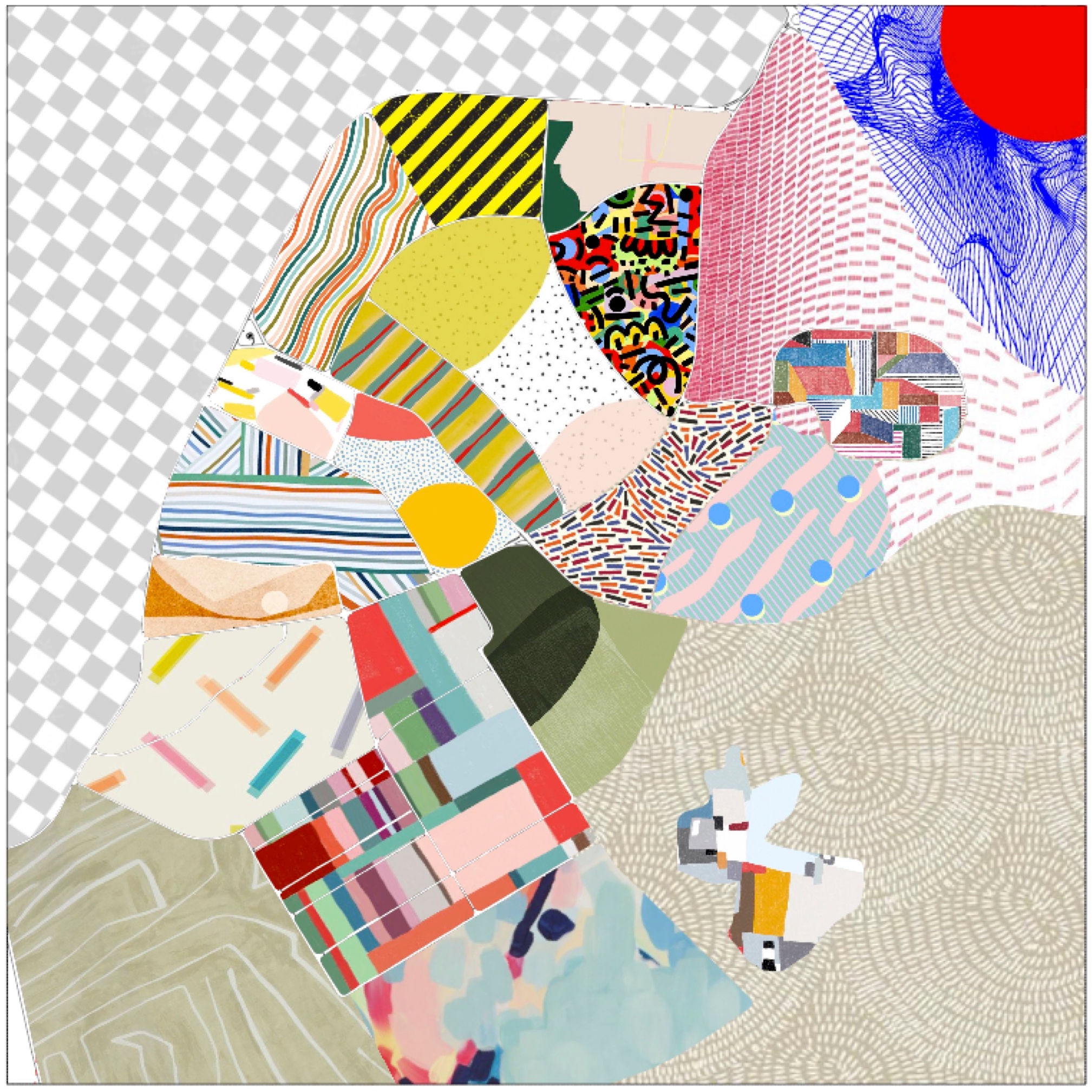
Let’s dream for a moment....
What if this place... would look like this?


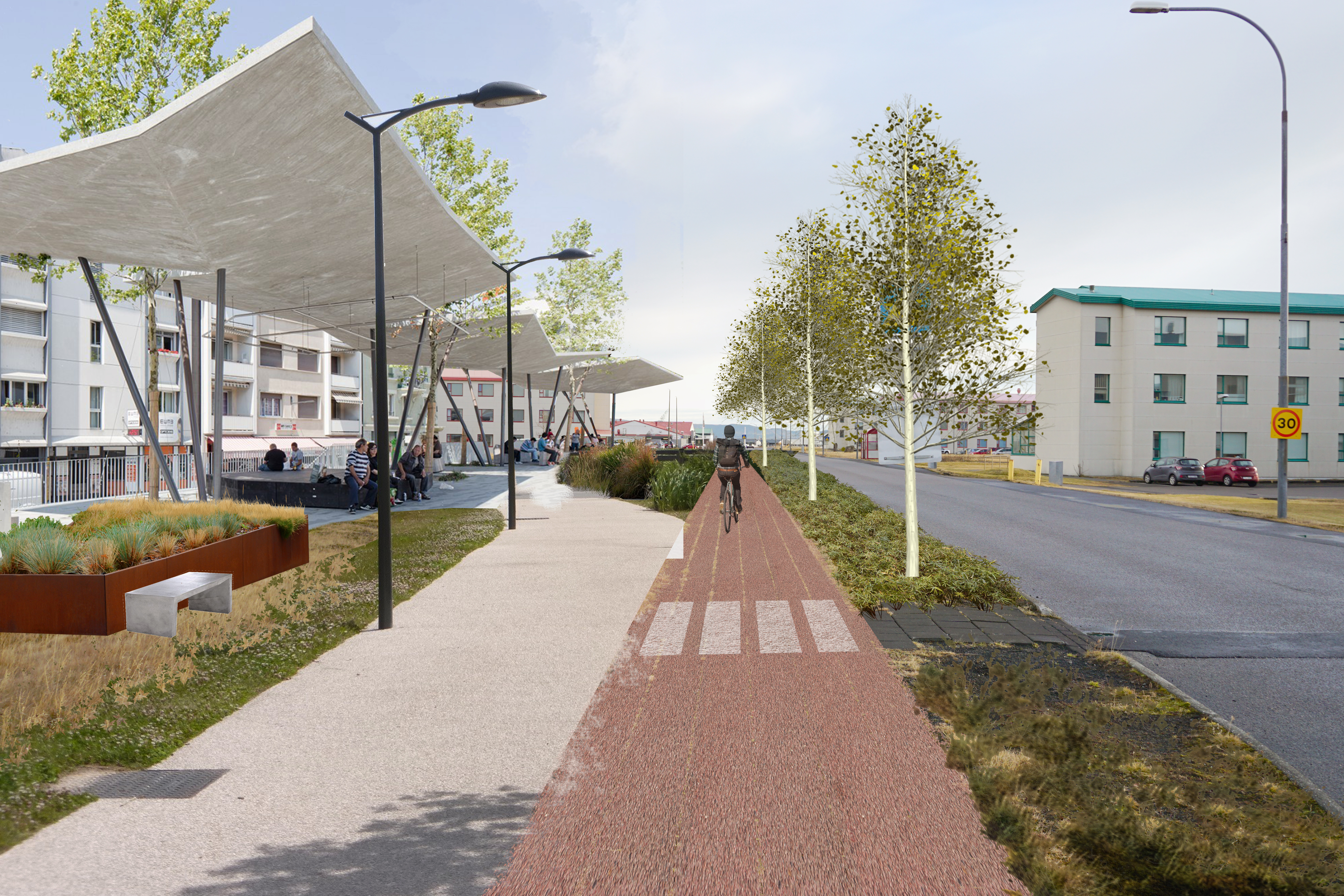
This might be the future for Ásbrú . And by listening and observing what is there already I want to create a coherent plan to develop this area by activating the voids.
-AQQ